
Washington, D.C.
Washington, D.C. | |
|---|---|
| District of Columbia | |
| Nickname(s): D.C., The District | |
| Motto(s): Justitia Omnibus (English: Justice for All) | |
| Anthem: "Washington" "Our Nation's Capital" (march)[1] | |
 Interactive map of Washington, D.C. | |
 Neighborhoods of Washington, D.C. | |
| Coordinates: 38°54′17″N 77°00′59″W / 38.90472°N 77.01639°W | |
| Country | United States |
| Residence Act | July 16, 1790 |
| Organized | February 27, 1801 |
| Consolidated | February 21, 1871 |
| Home Rule Act | December 24, 1973 |
| Named for | |
| Government | |
| • Type | Mayor–council |
| • Mayor | Muriel Bowser (D) |
| • D.C. Council |
|
| • U.S. House | Eleanor Holmes Norton (D), Delegate (At-large) |
| Area | |
| • Federal capital city and district | 68.35 sq mi (177.0 km2) |
| • Land | 61.126 sq mi (158.32 km2) |
| • Water | 7.224 sq mi (18.71 km2) |
| Highest elevation | 409 ft (125 m) |
| Lowest elevation | 0 ft (0 m) |
| Population | |
| • Federal capital city and district | 689,545 |
| • Estimate (2023)[4] | 678,972 |
| • Rank | 64th in North America 23rd in the United States |
| • Density | 11,280.71/sq mi (4,355.39/km2) |
| • Urban | 5,174,759 (US: 8th) |
| • Urban density | 3,997.5/sq mi (1,543.4/km2) |
| • Metro | 6,304,975 (US: 7th) |
| Demonym | Washingtonian[7][8] |
| GDP | |
| • Federal District | $144.0 billion (2022) |
| • DC-VA-MD-WV (MSA) | $660.6 billion (2022) |
| Time zone | UTC−5 (EST) |
| • Summer (DST) | UTC−4 (EDT) |
| ZIP Codes | 20001–20098, 20201–20599, 56901–56999 |
| Area code(s) | 202 and 771[11][12] |
| ISO 3166 code | US-DC |
| Airports | |
| Railroads | |
| Website | dc |


.jpg)

.jpg)


Washington, D.C., formally the District of Columbia and commonly known as Washington or D.C., is the capital city and federal district of the United States.[13] The city is on the Potomac River, across from Virginia, and shares land borders with Maryland to its north and east. It was named for George Washington, the first president of the United States.[14][15] The district is named for Columbia, the female personification of the nation.
The U.S. Constitution in 1789 called for the creation of a federal district under the exclusive jurisdiction of the U.S. Congress. As such, Washington, D.C., is not part of any state, and is not one itself. The Residence Act, adopted on July 16, 1790, approved the creation of the capital district along the Potomac River. The city was founded in 1791, and the 6th Congress held the first session in the unfinished Capitol Building in 1800 after the capital moved from Philadelphia. In 1801, the District of Columbia, formerly part of Maryland and Virginia and including the existing settlements of Georgetown and Alexandria, was officially recognized as the federal district; initially, the city was a separate settlement within the larger district.[16] In 1846, Congress returned the land originally ceded by Virginia, including the city of Alexandria. In 1871, it created a single municipality for the remaining portion of the district.[17] There have been several unsuccessful efforts to make the district into a state since the 1880s; a statehood bill passed the House of Representatives in 2021 but was not adopted by the U.S. Senate.[18]
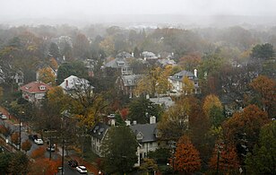
Designed in 1791 by Pierre Charles L'Enfant, the city is divided into quadrants, which are centered around the Capitol Building and include 131 neighborhoods. As of the 2020 census, the city had a population of 689,545.[3] Commuters from the city's Maryland and Virginia suburbs raise the city's daytime population to more than one million during the workweek.[19] The Washington metropolitan area, which includes parts of Maryland, Virginia, and West Virginia, is the country's seventh-largest metropolitan area, with a 2023 population of 6.3 million residents.[6] A locally elected mayor and 13-member council have governed the district since 1973, though Congress retains the power to overturn local laws. Washington, D.C., residents are, on the federal level, politically disenfranchised since the city's residents do not have voting representation in Congress; the city's residents elect a single non-voting congressional delegate to the U.S. House of Representatives. The city's voters choose three presidential electors in accordance with the Twenty-third Amendment.
Washington, D.C., anchors the southern end of the Northeast megalopolis. As the seat of the U.S. federal government and several international organizations, the city is an important world political capital.[20] The city hosts the buildings that house federal government headquarters, including the White House, the Capitol, the Supreme Court Building, and multiple federal departments and agencies. The city is home to many national monuments and museums, located most prominently on or around the National Mall, including the Jefferson Memorial, the Lincoln Memorial, and the Washington Monument. It hosts 177 foreign embassies and serves as the headquarters for the World Bank, the International Monetary Fund, the Organization of American States, and other international organizations. Many of the nation's largest industry associations, non-profit organizations, and think tanks are based in the city, including AARP, American Red Cross, Atlantic Council, Brookings Institution, National Geographic Society, The Heritage Foundation, Wilson Center, and others. The city is known as a lobbying hub, with K Street as the center of such activities.[21] The city had 20.7 million domestic visitors[22] and 1.2 million international visitors, ranking seventh among U.S. cities as of 2022.[23]
History
Various tribes of the Algonquian-speaking Piscataway people, also known as the Conoy, inhabited the lands around the Potomac River and present-day Washington, D.C., when Europeans first arrived and colonized the region in the early 17th century. The Nacotchtank, also called the Nacostines by Catholic missionaries, maintained settlements around the Anacostia River in present-day Washington, D.C. Conflicts with European colonists and neighboring tribes ultimately displaced the Piscataway people, some of whom established a new settlement in 1699 near Point of Rocks, Maryland.[24]
Founding

Several other cities served as the U.S. capital before 1800. Philadelphia served as the capital on five separate occasions during the American Revolution and its aftermath from May 1775 to July 1776, December 1776 to February 1777, March 1777 to September 1777, July 1778, July 1778 to March 1781, and March 1781 to June 1783. The Continental Congress was briefly based in five additional locations: York, Pennsylvania, in September 1777; Princeton, New Jersey, in 1783; Annapolis, Maryland, from November 1783 to August 1784; Trenton, New Jersey, from November to December 1784; and New York City from January 1785 to March 1789.[citation needed]
On October 6, 1783, after the capital was forced by the Pennsylvania Mutiny of 1783 to move to Princeton, Congress resolved to consider a new location for it.[25] The following day, Elbridge Gerry of Massachusetts moved "that buildings for the use of Congress be erected on the banks of the Delaware near Trenton, or of the Potomac, near Georgetown, provided a suitable district can be procured on one of the rivers as aforesaid, for a federal town".[26]
In Federalist No. 43, published January 23, 1788, James Madison argued that the new federal government would need authority over a national capital to provide for its own maintenance and safety.[27] The Pennsylvania Mutiny of 1783 emphasized the need for the national government not to rely on any state for its own security.[28]
Article One, Section Eight of the U.S. Constitution permits the establishment of a "District (not exceeding ten miles square) as may, by cession of particular states, and the acceptance of Congress, become the seat of the government of the United States".[29] However, the constitution does not specify a location for the capital. In the Compromise of 1790, Madison, Alexander Hamilton, and Thomas Jefferson agreed that the federal government would pay each state's remaining Revolutionary War debts in exchange for establishing the new national capital in the Southern United States.[30][a]
On July 9, 1790, Congress passed the Residence Act, which approved the creation of a national capital on the Potomac River. Under the Residence Act, the exact location was to be selected by President George Washington, who signed the bill into law on July 16, 1790. Formed from land donated by Maryland and Virginia, the initial shape of the federal district was a square measuring 10 miles (16 km) on each side and totaling 100 square miles (259 km2).[31][b]
Two pre-existing settlements were included in the territory, the port of Georgetown, founded in 1751,[32] and the port city of Alexandria, Virginia, founded in 1749.[33] In 1791 and 1792, a team led by Andrew Ellicott, including Ellicott's brothers Joseph and Benjamin and African American astronomer Benjamin Banneker, whose parents had been enslaved, surveyed the borders of the federal district and placed boundary stones at every mile point; many of these stones are still standing.[34][35] Both Maryland and Virginia were slave states, and slavery existed in the District from its founding. The building of Washington likely relied in significant part on slave labor, and slave receipts have been found for the White House, Capitol Building, and establishment of Georgetown University. The city became an important slave market and a center of the nation's internal slave trade.[36][37]
After its survey, the new federal city was constructed on the north bank of the Potomac River, to the east of Georgetown centered on Capitol Hill. On September 9, 1791, three commissioners overseeing the capital's construction named the city in honor of President Washington. The same day, the federal district was named Columbia, a feminine form of Columbus, which was a poetic name for the United States commonly used at that time.[38][39] Congress held its first session there on November 17, 1800.[40][41]
Congress passed the District of Columbia Organic Act of 1801, which officially organized the district and placed the entire territory under the exclusive control of the federal government. The area within the district was organized into two counties, the County of Washington to the east and north of the Potomac and the County of Alexandria to the west and south.[42] After the Act's passage, citizens in the district were no longer considered residents of Maryland or Virginia, which ended their representation in Congress.[43]
Burning during War of 1812

On August 24, 1814, during the War of 1812, British forces invaded and occupied the city after defeating an American force at Bladensburg. In retaliation for acts of destruction by American troops in the Canadas, the British set fire to government buildings in the city, gutting the United States Capitol, the Treasury Building, and the White House in what became known as the burning of Washington. However, a storm forced the British to evacuate the city after just 24 hours.[44] Most government buildings were repaired quickly, but the Capitol, which was largely under construction at the time, would not be completed in its current form until 1868.[45]
Retrocession and the Civil War

In the 1830s, the district's southern territory of Alexandria declined economically, due in part to its neglect by Congress.[46] Alexandria was a major market in the domestic slave trade and pro-slavery residents feared that abolitionists in Congress would end slavery in the district. Alexandria's citizens petitioned Virginia to retake the land it had donated to form the district, a process known as retrocession.[47]
The Virginia General Assembly voted in February 1846, to accept the return of Alexandria. On July 9, 1846, Congress went further, agreeing to return all territory that Virginia had ceded to the district during its formation. This left the district's area consisting only of the portion originally donated by Maryland.[46] Confirming the fears of pro-slavery Alexandrians, the Compromise of 1850 outlawed the slave trade in the district, although not slavery itself.[48]
The outbreak of the American Civil War in 1861 led to the expansion of the federal government and notable growth in the city's population, including a large influx of freed slaves.[49] President Abraham Lincoln signed the Compensated Emancipation Act in 1862, which ended slavery in the district, freeing about 3,100 slaves in the district nine months before the Emancipation Proclamation.[50] In 1868, Congress granted the district's African American male residents the right to vote in municipal elections.[49]
Growth and redevelopment
.jpg)
By 1870, the district's population had grown 75% in a decade to nearly 132,000 people,[51] yet the city still lacked paved roads and basic sanitation. Some members of Congress suggested moving the capital farther west, but President Ulysses S. Grant refused to consider the proposal.[52]
In the Organic Act of 1871, Congress repealed the individual charters of the cities of Washington and Georgetown, abolished Washington County, and created a new territorial government for the whole District of Columbia.[53] These steps made "the city of Washington...legally indistinguishable from the District of Columbia."[16]
In 1873, President Grant appointed Alexander Robey Shepherd as Governor of the District of Columbia. Shepherd authorized large projects that modernized the city but bankrupted its government. In 1874, Congress replaced the territorial government with an appointed three-member board of commissioners.[54]
In 1888, the city's first motorized streetcars began service. Their introduction generated growth in areas of the district beyond the City of Washington's original boundaries, leading to an expansion of the district over the next few decades.[55] Georgetown's street grid and other administrative details were formally merged with those of the City of Washington in 1895.[56] However, the city had poor housing and strained public works, leading it to become the first city in the nation to undergo urban renewal projects as part of the City Beautiful movement in the early 20th century.[57]
The City Beautiful movement built heavily upon the already-implemented L'Enfant Plan, with the new McMillan Plan leading urban development in the city throughout the movement. Much of the old Victorian Mall was replaced with modern Neoclassical and Beaux-Arts architecture; these designs are still prevalent in the city's governmental buildings today.
Increased federal spending under the New Deal in the 1930s led to the construction of new government buildings, memorials, and museums in the district,[58] though the chairman of the House Subcommittee on District Appropriations, Ross A. Collins of Mississippi, justified cuts to funds for welfare and education for local residents by saying that "my constituents wouldn't stand for spending money on niggers."[59]
World War II led to an expansion of federal employees in the city;[60] by 1950, the district's population reached its peak of 802,178 residents.[51]
Civil rights and home rule era

The Twenty-third Amendment to the United States Constitution was ratified in 1961, granting the district three votes in the Electoral College for the election of president and vice president, but still not affording the city's residents representation in Congress.[61]
After the assassination of civil rights leader Martin Luther King Jr. on April 4, 1968, riots broke out in the city, primarily in the U Street, 14th Street, 7th Street, and H Street corridors, which were predominantly black residential and commercial areas. The riots raged for three days until more than 13,600 federal troops and Washington, D.C., Army National Guardsmen stopped the violence. Many stores and other buildings were burned, and rebuilding from the riots was not completed until the late 1990s.[62]
In 1973, Congress enacted the District of Columbia Home Rule Act providing for an elected mayor and 13-member council for the district.[63] In 1975, Walter Washington became the district's first elected and first black mayor.[64]
Since the 1980s, the D.C. statehood movement has grown in prominence. In 2016, a referendum on D.C. statehood resulted in an 85% support among Washington, D.C., voters for it to become the nation's 51st state. In March 2017, the city's congressional delegate Eleanor Holmes Norton introduced a bill for statehood. Reintroduced in 2019 and 2021 as the Washington, D.C., Admission Act, the U.S. House of Representatives passed it in April 2021. After not progressing in the Senate, the statehood bill was introduced again in January 2023.[65]
Geography

Washington, D.C., is located in the Mid-Atlantic region of the U.S. East Coast. The city has a total area of 68.34 square miles (177 km2), of which 61.05 square miles (158.1 km2) is land and 7.29 square miles (18.9 km2) (10.67%) is water.[66] The district is bordered by Montgomery County, Maryland, to the northwest; Prince George's County, Maryland, to the east; Arlington County, Virginia, to the west; and Alexandria, Virginia, to the south. Washington is 38 miles (61 km) from Baltimore, 124 miles (200 km) from Philadelphia, 227 miles (365 km) from New York City, 242 miles (389 km) from Pittsburgh, 384 miles (618 km) from Charlotte, and 439 miles (707 km) from Boston.[citation needed]
The south bank of the Potomac River forms the district's border with Virginia and has two major tributaries, the Anacostia River and Rock Creek.[67] Tiber Creek, a natural watercourse that once passed through the National Mall, was fully enclosed underground during the 1870s.[68] The creek also formed a portion of the now-filled Washington City Canal, which allowed passage through the city to the Anacostia River from 1815 until the 1850s.[69] The Chesapeake and Ohio Canal starts in Georgetown and was used during the 19th century to bypass the Little Falls of the Potomac River, located at the northwest edge of the city at the Atlantic Seaboard fall line.[70]
The highest natural elevation in the district is 409 feet (125 m) above sea level at Fort Reno Park in upper northwest Washington, D.C.[71] The lowest point is sea level at the Potomac River.[72] The geographic center of Washington is near the intersection of 4th and L streets NW.[73][74][75]
The district has 7,464 acres (30.21 km2) of parkland, about 19% of the city's total area, the second-highest among high-density U.S. cities after Philadelphia.[76] The city's sizable parkland was a factor in the city being ranked as third in the nation for park access and quality in the 2018 ParkScore ranking of the park systems of the nation's 100 most populous cities, according to Trust for Public Land, a non-profit organization.[77]
The National Park Service manages most of the 9,122 acres (36.92 km2) of city land owned by the U.S. government.[78] Rock Creek Park is a 1,754-acre (7.10 km2) urban forest in Northwest Washington, which extends 9.3 miles (15.0 km) through a stream valley that bisects the city. Established in 1890, it is the country's fourth-oldest national park and is home to a variety of plant and animal species, including raccoon, deer, owls, and coyotes.[79] Other National Park Service properties include the Chesapeake and Ohio Canal National Historical Park, the National Mall and Memorial Parks, Theodore Roosevelt Island, Columbia Island, Fort Dupont Park, Meridian Hill Park, Kenilworth Park and Aquatic Gardens, and Anacostia Park.[80] The District of Columbia Department of Parks and Recreation maintains the city's 900 acres (3.6 km2) of athletic fields and playgrounds, 40 swimming pools, and 68 recreation centers.[81] The U.S. Department of Agriculture operates the 446-acre (1.80 km2) United States National Arboretum in Northeast Washington, D.C.[82]
Climate

Washington's climate is humid subtropical (Köppen: Cfa), or oceanic (Trewartha: Do bordering Cf downtown).[83][84] Winters are cool to cold with some snow of varying intensity, while summers are hot and humid. The district is in plant hardiness zone 8a near downtown, and zone 7b elsewhere in the city.[85][86]
Summers are hot and humid with a July daily average of 79.8 °F (26.6 °C) and average daily relative humidity around 66%, which can cause moderate personal discomfort. Heat indices regularly approach 100 °F (38 °C) at the height of summer.[87] The combination of heat and humidity in the summer brings very frequent thunderstorms, some of which occasionally produce tornadoes in the area.[88]
Blizzards affect Washington once every four to six years on average. The most violent storms, known as nor'easters, often impact large regions of the East Coast.[89] From January 27 to 28, 1922, the city officially received 28 inches (71 cm) of snowfall, the largest snowstorm since official measurements began in 1885.[90] According to notes kept at the time, the city received between 30 and 36 inches (76 and 91 cm) from a snowstorm in January 1772.[91]
Hurricanes or their remnants occasionally impact the area in late summer and early fall. However, they usually are weak by the time they reach Washington, partly due to the city's inland location.[92] Flooding of the Potomac River, however, caused by a combination of high tide, storm surge, and runoff, has been known to cause extensive property damage in the Georgetown neighborhood of the city.[93] Precipitation occurs throughout the year.[94]
The highest recorded temperature was 106 °F (41 °C) on August 6, 1918, and on July 20, 1930.[95] The lowest recorded temperature was −15 °F (−26 °C) on February 11, 1899, right before the Great Blizzard of 1899.[89] During a typical year, the city averages about 37 days at or above 90 °F (32 °C) and 64 nights at or below the freezing mark (32 °F or 0 °C).[96] On average, the first day with a minimum at or below freezing is November 18 and the last day is March 27.[97][98]
| Month | Jan | Feb | Mar | Apr | May | Jun | Jul | Aug | Sep | Oct | Nov | Dec | Year |
|---|---|---|---|---|---|---|---|---|---|---|---|---|---|
| Record high °F (°C) | 80 (27) |
84 (29) |
93 (34) |
95 (35) |
99 (37) |
104 (40) |
106 (41) |
106 (41) |
104 (40) |
98 (37) |
86 (30) |
79 (26) |
106 (41) |
| Mean maximum °F (°C) | 66.7 (19.3) |
68.1 (20.1) |
77.3 (25.2) |
86.4 (30.2) |
91.0 (32.8) |
95.7 (35.4) |
98.1 (36.7) |
96.5 (35.8) |
91.9 (33.3) |
84.5 (29.2) |
74.8 (23.8) |
67.1 (19.5) |
99.1 (37.3) |
| Mean daily maximum °F (°C) | 44.8 (7.1) |
48.3 (9.1) |
56.5 (13.6) |
68.0 (20.0) |
76.5 (24.7) |
85.1 (29.5) |
89.6 (32.0) |
87.8 (31.0) |
80.7 (27.1) |
69.4 (20.8) |
58.2 (14.6) |
48.8 (9.3) |
67.8 (19.9) |
| Daily mean °F (°C) | 37.5 (3.1) |
40.0 (4.4) |
47.6 (8.7) |
58.2 (14.6) |
67.2 (19.6) |
76.3 (24.6) |
81.0 (27.2) |
79.4 (26.3) |
72.4 (22.4) |
60.8 (16.0) |
49.9 (9.9) |
41.7 (5.4) |
59.3 (15.2) |
| Mean daily minimum °F (°C) | 30.1 (−1.1) |
31.8 (−0.1) |
38.6 (3.7) |
48.4 (9.1) |
58.0 (14.4) |
67.5 (19.7) |
72.4 (22.4) |
71.0 (21.7) |
64.1 (17.8) |
52.2 (11.2) |
41.6 (5.3) |
34.5 (1.4) |
50.9 (10.5) |
| Mean minimum °F (°C) | 14.3 (−9.8) |
16.9 (−8.4) |
23.4 (−4.8) |
34.9 (1.6) |
45.5 (7.5) |
55.7 (13.2) |
63.8 (17.7) |
62.1 (16.7) |
51.3 (10.7) |
38.7 (3.7) |
28.8 (−1.8) |
21.3 (−5.9) |
12.3 (−10.9) |
| Record low °F (°C) | −14 (−26) |
−15 (−26) |
4 (−16) |
15 (−9) |
33 (1) |
43 (6) |
52 (11) |
49 (9) |
36 (2) |
26 (−3) |
11 (−12) |
−13 (−25) |
−15 (−26) |
| Average precipitation inches (mm) | 2.86 (73) |
2.62 (67) |
3.50 (89) |
3.21 (82) |
3.94 (100) |
4.20 (107) |
4.33 (110) |
3.25 (83) |
3.93 (100) |
3.66 (93) |
2.91 (74) |
3.41 (87) |
41.82 (1,062) |
| Average snowfall inches (cm) | 4.9 (12) |
5.0 (13) |
2.0 (5.1) |
0.0 (0.0) |
0.0 (0.0) |
0.0 (0.0) |
0.0 (0.0) |
0.0 (0.0) |
0.0 (0.0) |
0.0 (0.0) |
0.1 (0.25) |
1.7 (4.3) |
13.7 (35) |
| Average precipitation days (≥ 0.01 in) | 9.7 | 9.3 | 11.0 | 10.8 | 11.6 | 10.6 | 10.5 | 8.7 | 8.7 | 8.3 | 8.4 | 10.1 | 117.7 |
| Average snowy days (≥ 0.1 in) | 2.8 | 2.7 | 1.1 | 0.0 | 0.0 | 0.0 | 0.0 | 0.0 | 0.0 | 0.0 | 0.1 | 1.3 | 8.0 |
| Average relative humidity (%) | 62.1 | 60.5 | 58.6 | 58.0 | 64.5 | 65.8 | 66.9 | 69.3 | 69.7 | 67.4 | 64.7 | 64.1 | 64.3 |
| Average dew point °F (°C) | 21.7 (−5.7) |
23.5 (−4.7) |
31.3 (−0.4) |
39.7 (4.3) |
52.3 (11.3) |
61.5 (16.4) |
66.0 (18.9) |
65.8 (18.8) |
59.5 (15.3) |
47.5 (8.6) |
37.0 (2.8) |
27.1 (−2.7) |
44.4 (6.9) |
| Mean monthly sunshine hours | 144.6 | 151.8 | 204.0 | 228.2 | 260.5 | 283.2 | 280.5 | 263.1 | 225.0 | 203.6 | 150.2 | 133.0 | 2,527.7 |
| Percent possible sunshine | 48 | 50 | 55 | 57 | 59 | 64 | 62 | 62 | 60 | 59 | 50 | 45 | 57 |
| Average ultraviolet index | 2 | 3 | 5 | 7 | 8 | 9 | 9 | 8 | 7 | 4 | 3 | 2 | 6 |
| Source 1: NOAA (relative humidity, dew point and sun 1961−1990)[96][100][94][101] | |||||||||||||
| Source 2: Weather Atlas (UV)[102] | |||||||||||||
Graphs are unavailable due to technical issues. There is more info on Phabricator and on MediaWiki.org. |
See or edit raw graph data.
Cityscape
.jpg)

Washington, D.C., was a planned city, and many of the city's street grids were developed in that initial plan. In 1791, President George Washington commissioned Pierre Charles L'Enfant, a French-born military engineer and artist, to design the new capital. He enlisted the help of Isaac Roberdeau, Étienne Sulpice Hallet and Scottish surveyor Alexander Ralston to help lay out the city plan.[103] The L'Enfant Plan featured broad streets and avenues radiating out from rectangles, providing room for open space and landscaping.[104]
L'Enfant was also provided a roll of maps by Thomas Jefferson depicting Frankfurt, Amsterdam, Strasbourg, Paris, Orleans, Bordeaux, Lyon, Marseille, Turin, and Milan.[105] L'Enfant's design also envisioned a garden-lined grand avenue about 1 mile (1.6 km) long and 400 feet (120 m) wide in an area that is now the National Mall inpsired by the grounds at Versailles and Tuileries Gardens.[106] In March 1792, President Washington dismissed L'Enfant due to conflicts with the three commissioners appointed to supervise the capital's construction. Andrew Ellicott, who worked with L'Enfant in surveying the city, was then tasked with completing its design. Though Ellicott revised the original L'Enfant plans, including changing some street patterns, L'Enfant is still credited with the city's overall design.[107]
By the early 20th century, however, L'Enfant's vision of a grand national capital was marred by slums and randomly placed buildings in the city, including a railroad station on the National Mall. Congress formed a special committee charged with beautifying Washington's ceremonial core.[57] What became known as the McMillan Plan was finalized in 1901 and included relandscaping the Capitol grounds and the National Mall, clearing slums, and establishing a new citywide park system. The plan is thought to have largely preserved L'Enfant's intended design for the city.[104]
.jpg)
By law, the city's skyline is low and sprawling. The federal Height of Buildings Act of 1910 prohibits buildings with height exceeding the width of the adjacent street plus 20 feet (6.1 m).[108] Despite popular belief, no law has ever limited buildings to the height of the United States Capitol or the 555-foot (169 m) Washington Monument,[75] which remains the district's tallest structure. City leaders have cited the height restriction as a primary reason that the district has limited affordable housing and its metro area has suburban sprawl and traffic problems.[108] Washington, D.C., still has a relatively high homelessness rate, despite its high living standard compared to many American cities.[109]
Washington, D.C., is divided into four quadrants of unequal area: Northwest (NW), Northeast (NE), Southeast (SE), and Southwest (SW). The axes bounding the quadrants radiate from the U.S. Capitol.[110] All road names include the quadrant abbreviation to indicate their location. House numbers generally correspond with the number of blocks away from the Capitol. Most streets are set out in a grid pattern with east–west streets named with letters (e.g., C Street SW), north–south streets with numbers (e.g., 4th Street NW), and diagonal avenues, many of which are named after states.[110]
- Selection of neighborhoods in Washington, D.C.
-

-
-

-

-
-

-

-


_(cropped).jpg)

.jpg)
.jpg)

The City of Washington was bordered on the north by Boundary Street (renamed Florida Avenue in 1890); Rock Creek to the west, and the Anacostia River to the east.[55][104] Washington, D.C.'s street grid was extended, where possible, throughout the district starting in 1888.[111] Georgetown's streets were renamed in 1895.[56] Some streets are particularly noteworthy, including Pennsylvania Avenue, which connects the White House to the Capitol; and K Street, which houses the offices of many lobbying groups.[112] Constitution Avenue and Independence Avenue, located on the north and south sides of the National Mall, respectively, are home to many of Washington's iconic museums, including many Smithsonian Institution buildings and the National Archives Building. Washington hosts 177 foreign embassies; these maintain nearly 300 buildings and more than 1,600 residential properties, many of which are on a section of Massachusetts Avenue informally known as Embassy Row.[113]
Architecture
The architecture of Washington, D.C., varies greatly and is generally popular among tourists and locals. In 2007, six of the top ten buildings in the American Institute of Architects' ranking of America's Favorite Architecture were in the city:[114] the White House, Washington National Cathedral, the Jefferson Memorial, the United States Capitol, the Lincoln Memorial, and the Vietnam Veterans Memorial. The neoclassical, Georgian, Gothic, and Modern styles are reflected among these six structures and many other prominent edifices in the city.[citation needed]

Many of the government buildings, monuments, and museums along the National Mall and surrounding areas are heavily inspired by classical Roman and Greek architecture. The designs of the White House, the U.S. Capitol, Supreme Court Building, Washington Monument, National Gallery of Art, Lincoln Memorial, and Jefferson Memorial are all heavily drawn from these classical architectural movements and feature large pediments, domes, columns in classical order, and heavy stone walls. Notable exceptions to the city's classical-style architecture include buildings constructed in the French Second Empire style, including the Eisenhower Executive Office Building, and the modernist Watergate complex.[115] The Thomas Jefferson Building, the main Library of Congress building, and the historic Willard Hotel are built in Beaux-Arts style, popular throughout the world in the late nineteenth and early twentieth centuries.[116][117] Meridian Hill Park contains a cascading waterfall with Italian Renaissance-style architecture.[118]

Modern, Postmodern, contemporary, and other non-classical architectural styles are also seen in the city. The National Museum of African American History and Culture deeply contrasts the stone-based neoclassical buildings on the National Mall with a design that combines modern engineering with heavy inspiration from African art.[119] The interior of the Washington Metro stations and the Hirshhorn Museum and Sculpture Garden are designed with strong influence from the 20th-century Brutalism movement.[120] The Smithsonian Institution Building is built of Seneca red sandstone in the Norman Revival style.[121] The Old Post Office building, located on Pennsylvania Avenue and completed in 1899, was the first building in the city to have a steel frame structure and the first to use electrical wiring in its design.[122]
Notable contemporary residential buildings, restaurants, shops, and office buildings in the city include the Wharf on the Southwest Waterfront, Navy Yard along the Anacostia River, and CityCenterDC in Downtown. The Wharf has seen the construction of several high-rise office and residential buildings overlooking the Potomac River. Additionally, restaurants, bars, and shops have been opened at street level. Many of these buildings have a modern glass exterior and heavy curvature.[123][124] CityCenterDC is home to Palmer Alley, a pedestrian-only walkway, and houses several apartment buildings, restaurants, and luxury-brand storefronts with streamlined glass and metal facades.[125]

Outside Downtown D.C., architectural styles are more varied. Historic buildings are designed primarily in the Queen Anne, Châteauesque, Richardsonian Romanesque, Georgian Revival, Beaux-Arts, and a variety of Victorian styles.[126] Rowhouses are prominent in areas developed after the Civil War and typically follow Federal and late Victorian designs.[127] Georgetown's Old Stone House, built in 1765, is the oldest-standing building in the city.[128] Founded in 1789, Georgetown University features a mix of Romanesque and Gothic Revival architecture.[115] The Ronald Reagan Building is the largest building in the district with a total area of about 3.1 million square feet (288,000 m2).[129] Washington Union Station is designed in a combination of architectural styles. Its Great Hall has elaborate gold leaf designs along the ceilings and the hall includes several decorative classical-style statues.[130]
Demographics
| Census | Pop. | Note | %± |
|---|---|---|---|
| 1800 | 8,144 | — | |
| 1810 | 15,471 | 90.0% | |
| 1820 | 23,336 | 50.8% | |
| 1830 | 30,261 | 29.7% | |
| 1840 | 33,745 | 11.5% | |
| 1850 | 51,687 | 53.2% | |
| 1860 | 75,080 | 45.3% | |
| 1870 | 131,700 | 75.4% | |
| 1880 | 177,624 | 34.9% | |
| 1890 | 230,392 | 29.7% | |
| 1900 | 278,718 | 21.0% | |
| 1910 | 331,069 | 18.8% | |
| 1920 | 437,571 | 32.2% | |
| 1930 | 486,869 | 11.3% | |
| 1940 | 663,091 | 36.2% | |
| 1950 | 802,178 | 21.0% | |
| 1960 | 763,956 | −4.8% | |
| 1970 | 756,510 | −1.0% | |
| 1980 | 638,333 | −15.6% | |
| 1990 | 606,900 | −4.9% | |
| 2000 | 572,059 | −5.7% | |
| 2010 | 601,723 | 5.2% | |
| 2020 | 689,545 | 14.6% | |
| Source:[131] [e][51][132] Note:[f] 2010–2020[3] | |||
| Demographic profile | 2020[134] | 2010[135] | 1990[136] | 1970[136] | 1940[136] |
|---|---|---|---|---|---|
| White | 39.6% | 38.5% | 29.6% | 27.7% | 71.5% |
| —Non-Hispanic whites | 38.0% | 34.8% | 27.4% | 26.5%[g] | 71.4% |
| Black or African American | 41.4% | 50.7% | 65.8% | 71.1% | 28.2% |
| Hispanic or Latino (of any race) | 11.3% | 9.1% | 5.4% | 2.1%[g] | 0.1% |
| Asian | 4.8% | 3.5% | 1.8% | 0.6% | 0.2% |
The U.S. Census Bureau estimates that the district's population was 705,749 as of July 2019, up more than 100,000 people since the 2010 United States Census. When measured decade-over-decade, this shows growth since 2000, following a half-century of population decline.[137] But year-over-year, the July 2019 census count shows a decline of 16,000 people over the preceding 12 months.[138][unreliable source?] Washington was the 24th-most populous place in the United States as of 2010[update].[139] According to data from 2010, commuters from the suburbs boost the district's daytime population past one million.[140] If the district were a state, it would rank 49th in population, ahead of Vermont and Wyoming.[141]
.png)
The Washington metropolitan area, which includes the district and surrounding suburbs, is the sixth-largest metropolitan area in the U.S., with an estimated six million residents as of 2016.[142] When the Washington area is included with Baltimore and its suburbs, it forms the vast Washington–Baltimore combined statistical area. With a population exceeding 9.8 million residents in 2020, it is the third-largest combined statistical area in the country.[143]
According to HUD's 2022 Annual Homeless Assessment Report, there were an estimated 4,410 homeless people in Washington, D.C.[144][145]
According to 2017 Census Bureau data, the population of Washington, D.C., was 47.1% Black or African American, 45.1% White (36.8% non-Hispanic White), 4.3% Asian, 0.6% American Indian or Alaska Native, and 0.1% Native Hawaiian or Other Pacific Islander. Individuals from two or more races made up 2.7% of the population. Hispanics of any race made up 11.0% of the district's population.[141]

Washington, D.C. has had a relatively large African American population since the city's foundation.[146] African American residents composed about 30% of the district's total population between 1800 and 1940.[51] The black population reached a peak of 70% by 1970, and has since declined as African Americans moved to the surrounding suburbs. Partly as a result of gentrification, there was a 31.4% increase in the non-Hispanic white population and an 11.5% decrease in the black population between 2000 and 2010.[147] According to a study by the National Community Reinvestment Coalition, D.C. has experienced more "intense" gentrification than any other American city, with 40% of neighborhoods gentrified.[148]
About 17% of Washington, D.C. residents were age 18 or younger as of 2010, lower than the U.S. average of 24%. However, at 34 years old, the district had the lowest median age compared to the 50 states as of 2010.[149] As of 2010[update], there were an estimated 81,734 immigrants living in Washington, D.C.[150] Major sources of immigration include El Salvador, Ethiopia, Mexico, Guatemala, and China, with a concentration of Salvadorans in the Mount Pleasant neighborhood.[151]
As of 2010, there were 4,822 same-sex couples in the city, about 2% of total households, according to Williams Institute.[152] Legislation authorizing same-sex marriage passed in 2009, and the district began issuing marriage licenses to same-sex couples in March 2010.[153]


As of 2007, about one-third of Washington, D.C., residents were functionally illiterate, more than the national rate of about one in five. The city's relatively high illiteracy rate is attributed in part to immigrants who are not proficient in English.[154] As of 2011[update], 85% of D.C. residents age 5 and older spoke English at home as a primary language.[155] Half of residents had at least a four-year college degree in 2006.[150] In 2017, the median household income in D.C. was $77,649;[156] also in 2017, D.C. residents had a personal income per capita of $50,832 (higher than any of the 50 states).[156][157] However, 19% of residents were below the poverty level in 2005, higher than any state except Mississippi. In 2019, the poverty rate stood at 14.7%.[158][h][160]
As of 2010[update], more than 90% of Washington, D.C., residents had health insurance coverage, the second-highest rate in the nation. This is due in part to city programs that help provide insurance to low-income individuals who do not qualify for other types of coverage.[161] A 2009 report found that at least three percent of Washington, D.C., residents have HIV or AIDS, which the Centers for Disease Control and Prevention (CDC) characterizes as a "generalized and severe" epidemic.[162]
Of the district's population, 17% are Baptist, 13% are Catholic, 6% are evangelical Protestant, 4% are Methodist, 3% are Episcopalian or Anglican, 3% are Jewish, 2% are Eastern Orthodox, 1% are Pentecostal, 1% are Buddhist, 1% are Adventist, 1% are Lutheran, 1% are Muslim, 1% are Presbyterian, 1% are Mormon, and 1% are Hindu.[163][i] The city is populated with many religious buildings, including the Washington National Cathedral, the Basilica of the National Shrine of the Immaculate Conception, which comprises the largest Catholic church building in the United States, and the Islamic Center of Washington, which was the largest mosque in the Western Hemisphere when opened in 1957. St. John's Episcopal Church, located off Lafayette Square, has held services for every U.S. president since James Madison. The Sixth & I Historic Synagogue, built in 1908, is a synagogue located in the Chinatown section of the city. The Washington D.C. Temple is a large Mormon temple located just outside the city in Kensington, Maryland. Viewable from the Capital Beltway, the temple is the tallest Mormon temple in existence and the third-largest by square footage.[164][165]
Economy
_(cropped).jpg)
As of 2023, the Washington metropolitan area, including District of Columbia as well as parts of Virginia, Maryland, and West Virginia, was one of the nation's largest metropolitan economies. Its growing and diversified economy has an increasing percentage of professional and business service jobs in addition to more traditional jobs rooted in tourism, entertainment, and government.[166][obsolete source]
Between 2009 and 2016, gross domestic product per capita in Washington, D.C., consistently ranked at the very top among U.S. states.[167] In 2016, at $160,472, its GDP per capita was almost three times greater than that of Massachusetts, which was ranked second in the nation (see List of U.S. states and territories by GDP).[167] As of 2022[update], the metropolitan statistical area's unemployment rate was 3.1%, ranking 171 out of the 389 metropolitan areas as defined by the U.S. Bureau of Economic Analysis.[168] The District of Columbia itself had an unemployment rate of 4.6% during the same time period.[169] In 2019, Washington, D.C., had the highest median household income in the U.S. at $92,266.[170]
According to the District's comprehensive annual financial reports, the top employers by number of employees in 2022 included Georgetown University, Children's National Medical Center, Washington Hospital Center, George Washington University, American University, Georgetown University Hospital, Booz Allen & Hamilton, Insperity PEO Services, Universal Protection Service, Howard University, Medstar Medical Group, George Washington University Hospital, Catholic University of America, and Sibley Memorial Hospital.[171]
Federal government

As of July 2022, 25% of people employed in Washington, D.C., were employed by the federal government.[172] The vast majority of these government employees serve in various executive branch departments, agencies, and institutions. A small percentage serve as temporary staff for presidents, Congress members, or in the federal judiciary.[citation needed]
Many of the region's residents are employed by companies and organizations that do work for the federal government, seek to influence federal policy, or are otherwise related to its work, including law firms, defense contractors, civilian contractors, nonprofit organizations, lobbying firms, trade unions, industry trade groups, and professional associations, many of which have their headquarters in or near the city for proximity to the federal government. The largest U.S. government agencies located in or near the city are: the United States Department of Defense headquartered in the Pentagon in Arlington, Virginia, the United States Postal Service, the United States Department of Veterans Affairs, the United States Department of Homeland Security, and the United States Department of Justice.[173]
Diplomacy and global finance

As the national capital, Washington, D.C. hosts about 185 foreign missions, including embassies, ambassador's residences, and international cultural centers.[174] Many are concentrated along a stretch of Massachusetts Avenue known informally as Embassy Row.[175] D.C. is consequently one of the most culturally diverse cities in the world; it hosts a number of internationally themed festivals and events, often in collaboration with foreign missions or delegations.[176][177]
In 2008, the foreign diplomatic corps employed about 10,000 people and contributed an estimated $400 million annually to the local economy.[178] The city government maintains an Office of International Affairs to liaise with the diplomatic community and foreign delegations.[179]
The Federal Reserve, the central bank of the United States, is located on Constitution Avenue. Commonly called The Fed, its policies are made by the members of the Federal Reserve Board of Governors. Through monetary policy, the Board adjusts various interest rates in the U.S., which affects the U.S. economy and economies of countries across the world. Because of the power of the U.S. dollar, the actions of the Board are monitored closely by political, economic, and diplomatic leaders around the world.[citation needed]
Research and non-profit organizations

Washington, D.C., is a leading center for national and international research organizations, especially think tanks engaged in public policy.[180] As of 2020, 8% of the country's think tanks are headquartered in the city, including many of the largest and most widely cited;[181] these include the Carnegie Endowment for International Peace, Center for Strategic and International Studies, Peterson Institute for International Economics, The Heritage Foundation, and Urban Institute.[182]
D.C. is home to many non-profit organizations that engage with issues of domestic and global importance by conducting advanced research, running programs, or public advocacy. Among these organizations are the UN Foundation, Human Rights Campaign, Amnesty International, and the National Endowment for Democracy.[183] Major medical research institutions include the MedStar Washington Hospital Center and the Children's National Medical Center.[184]
The city is the country's primary location for international development firms, many of which contract with the D.C.-based United States Agency for International Development (USAID), the U.S. federal government's aid agency. The American Red Cross, a humanitarian agency focused on emergency relief, is also headquartered in the city.[185]
Private sector

According to statistics compiled in 2011, four of the largest 500 companies in the country were headquartered in Washington, D.C.[186] In the 2023 Global Financial Centres Index, Washington was ranked as having the 8th most competitive financial center in the world, and fourth most competitive in the United States (after New York City, San Francisco, and Los Angeles).[187] Among the largest companies headquartered in the Washington, D.C., area are Fannie Mae, Amtrak, Lockheed Martin, Marriot International, Hilton Worldwide, Danaher Corporation, FTI Consulting, and Hogan Lovells.[188]
Due to building height restrictions in Washington, D.C., taller buildings are able to be built in suburban Maryland and Virginia. Capital One Bank, which is one of the largest banks in the country, is headquartered in nearby Tysons, Virginia, a large and growing financial center located in Fairfax County, Virginia. The headquarters building for Capital One Bank, known as Capital One Tower, is the tallest occupied building in the Washington region. In 2018, Amazon announced it would build a second headquarters building, known as HQ2, in the Crystal City neighborhood of Arlington County, Virginia, which is located just across the Potomac River from Washington, D.C.[189] In addition to Capital One, some of the largest companies headquartered in Northern Virginia include Hilton, Navy Federal Credit Union, Mars, Freddie Mac, Northrop Grumman, and General Dynamics.[190]
The Washington, D.C., economy also benefits from being home to many prominent news and media organizations. Among these are The Washington Post, The Washington Times, Politico, and The Hill. Television and radio media organizations either headquartered in or near the city or with large offices in the region, include CNN, PBS, C-SPAN, CBS, NBC, Discovery, and NPR, and others. The Gannett Company, which owns USA Today and other media outlets, is headquartered in Tysons, Virginia.[191][192]
Tourism

Tourism is the city's second-largest industry, after the federal government. In 2012, some 18.9 million visitors contributed an estimated $4.8 billion to the local economy.[193] In 2019, the city saw 24.6 million tourists, including 1.8 million from foreign countries, who collectively spent $8.15 billion during their stay.[194] Tourism helps many of the region's other industries, such as lodging, food and beverage, entertainment, shopping, and transportation;[194] it also supports the city's world-class museums and cultural centers, most notably the Smithsonian Institution.[citation needed]
The city and wider Washington region has a diverse array of attractions for tourists, such as monuments, memorials, museums, sports events, and trails. Within the city, the National Mall serves as the center of the tourism industry. It is there that many of the city's museums and monuments are located. Adjacent to the mall sits the Tidal Basin, where several additional memorials and monuments lie, including the popular Jefferson Memorial. Washington Union Station is a popular tourist spot with its multitude of restaurants and shops.[citation needed]
Among the most visited tourist destinations is Arlington National Cemetery in nearby Arlington County, Virginia.[195] This is a military cemetery that serves as a burial ground for former military combatants. It is also the location of President John F. Kennedy's tomb, marked by an eternal flame.[196] President William Howard Taft is also buried in Arlington.[197] The Tomb of the Unknown Soldier is located in the cemetery and is guarded 24/7 by a tomb guard. The changing of the guard is a popular tourist attraction and occurs once every hour from October through March and every half-hour during the rest of the year.[198]
Culture
| Slogan | Federal City |
|---|---|
| Living insignia | |
| Bird | Wood Thrush |
| Crustacean | Hay's Spring amphipod |
| Fish | American shad |
| Flower | American Beauty rose |
| Mammal | Little brown bat |
| Tree | Scarlet Oak |
| Inanimate insignia | |
| Beverage | Rickey[199] |
| Dance | Hand dancing |
| Dinosaur | Capitalsaurus |
| Food | Cherry |
| Rock | Potomac bluestone |
| Route marker | |
| |
| State quarter | |
 Released in 2009 | |

Arts

Washington, D.C., is a national center for the arts, home to several concert halls and theaters. The John F. Kennedy Center for the Performing Arts is home to the National Symphony Orchestra, the Washington National Opera, and the Washington Ballet. The Kennedy Center Honors are awarded each year to those in the performing arts who have contributed greatly to the cultural life of the United States. This ceremony is often attended by the sitting U.S. president and other dignitaries and celebrities.[200] The Kennedy Center also awards the annual Mark Twain Prize for American Humor.[201]
The historic Ford's Theatre, site of the assassination of President Abraham Lincoln on April 14, 1865, continues to function as a theatre and as a museum.[202]
The Marine Barracks near Capitol Hill houses the United States Marine Band; founded in 1798, it is the country's oldest professional musical organization.[203] American march composer and Washington-native John Philip Sousa led the Marine Band from 1880 until 1892.[204] Founded in 1925, the United States Navy Band has its headquarters at the Washington Navy Yard and performs at official events and public concerts around the city.[205]
Founded in 1950, Arena Stage achieved national attention and spurred growth in the city's independent theater movement that now includes organizations such as the Shakespeare Theatre Company, Woolly Mammoth Theatre Company, and the Studio Theatre.[206] Arena Stage reopened after a renovation and expansion in the city's emerging Southwest waterfront area in 2010.[207] The GALA Hispanic Theatre, now housed in the historic Tivoli Theatre in Columbia Heights, was founded in 1976 and is a National Center for the Latino Performing Arts.[208]
Other performing arts spaces in the city include the Andrew W. Mellon Auditorium in Federal Triangle, the Atlas Performing Arts Center on H Street, the Carter Barron Amphitheater in Rock Creek Park, Constitution Hall in Downtown, the National Theatre in Downtown, the Keegan Theatre in Dupont Circle, the Lisner Auditorium in Foggy Bottom, the Sylvan Theater on the National Mall, and the Warner Theatre in Penn Quarter.[citation needed]
The U Street Corridor in Northwest D.C., once known as "Washington's Black Broadway", is home to institutions like Howard Theatre and Lincoln Theatre, which hosted music legends such as Washington-native Duke Ellington, John Coltrane, and Miles Davis.[209] Just east of U Street is Shaw, which also served as a major cultural center during the jazz age. Intersecting with U Street is Fourteenth Street, which was an extension of the U Street cultural corridor during the 1920s through the 1960s. The collection of Fourteenth Street, U Street, and Shaw was the location of the Black Renaissance in D.C., which was part of the larger Harlem Renaissance. Today, the area starting at Fourteenth Street downtown going north through U Street and east to Shaw boasts a high concentration of bars, restaurants, and theaters, and is among the city's most notable cultural and artistic areas.[citation needed]
The Washington D.C. Area Film Critics Association (WAFCA), a group of more than 65 film critics, holds an annual awards ceremony.[210]
Music
.jpg)
Columbia Records, a major music record label in the US, was founded in Washington, D.C. in 1889.[211][212]
The city grew into being one of America's most important music cities in the early jazz age. Duke Ellington, among the most prominent jazz composers and musicians of his time, was born and raised in Washington, and began his music career in the city. The center of the city's jazz scene during those years was U street and Shaw. Among the city's major jazz locations were the Lincoln Theatre and the Howard Theatre.[213]
Washington has its own native music genre called go-go; a post-funk, percussion-driven flavor of rhythm and blues that was popularized in the late 1970s by D.C. band leader Chuck Brown.[214]
The district is an important center for indie culture and music in the United States. The DC-based label Dischord Records, formed by Ian MacKaye, frontman of Fugazi, was one of the most crucial independent labels in the genesis of 1980s punk and eventually indie rock in the 1990s.[215] Modern alternative and indie music venues like The Black Cat and the 9:30 Club bring popular acts to the U Street area.[216] The hardcore punk scene in the city, known as D.C. hardcore, is an important genre of D.C.'s contemporary music scene. Starting in the 1970s and flourishing in the Adams Morgan neighborhood, it is considered to be one of the most influential punk music movements in the country.[217]
Cuisine

Washington, D.C., is rich in fine and casual dining; some consider it among the country's best cities for dining.[218] The city has a diverse range of restaurants, including a wide variety of international cuisines.[219] The city's Chinatown, for example, has more than a dozen Chinese-style restaurants. The city also has many Middle Eastern, European, African, Asian, and Latin American cuisine options. D.C. is known as one of the best cities in the world for Ethiopian cuisine, due largely to Ethiopian immigrants who arrived in the 20th century.[220] A part of the Shaw neighborhood in central D.C. is known as "Little Ethiopia" and has a high concentration of Ethiopian restaurants and shops.[221] The diversity of cuisine is also reflected in the city's many food trucks, which are particularly heavily concentrated along the National Mall, which has few other dining options.[222]
Among the most famous Washington, D.C.-born foods is the half-smoke, a half-beef, half-pork sausage placed in a hotdog-style bun and topped with onion, chili, and cheese.[223] The city is also the birthplace of mumbo sauce, a condiment similar to barbecue sauce but sweeter in flavor, often used on meat and french fries.[224][225] Washington, D.C. is known for popularizing the jumbo slice pizza, a large New York-style pizza[226][227][228] with roots in the Adams Morgan neighborhood.[229]
.jpg)
Among the city's signature restaurants is Ben's Chili Bowl, located on U Street since its founding in 1958. The restaurant rose to prominence as a peaceful escape during the violent 1968 race riots in the city. Famous for its chili dogs and half-smokes, it has been visited by numerous presidents and celebrities over the years.[230] The Georgetown Cupcake bakery became famous through its appearance on the reality T.V. show DC Cupcakes. Another culinary hotspot is Union Market in Northeast D.C., a former farmer's market and wholesale that now houses a large, gourmet food hall.[231]
D.C.'s fine dining restaurants have received more Michelin stars, as of 2023, than any other U.S. city except New York City and San Francisco. Several celebrity chefs have opened restaurants in the city, including José Andrés,[232] Kwame Onwuachi,[233] Gordon Ramsay,[234][235] and previously Michel Richard.[236]
Museums

Washington, D.C. is home to many of the country's most visited museums and some of the most visited museums in the world. In 2022, the National Museum of Natural History and the National Gallery of Art were the two most visited museums in the country. Overall, Washington had eight of the 28 most visited museums in the U.S. in 2022. That year, the National Museum of Natural History was the fifth-most-visited museum in the world; the National Gallery of Art was the eleventh.[237]
Smithsonian museums
.jpg)
The Smithsonian Institution is an educational foundation chartered by Congress in 1846 that maintains most of the nation's official museums and galleries in Washington, D.C. It is the world's largest research and museum complex.[238] The U.S. government partially funds the Smithsonian, and its collections are open to the public free of charge.[239] The Smithsonian's locations had a combined total of 30 million visits in 2013. The most visited museum is the National Museum of Natural History on the National Mall.[240] Other Smithsonian Institution museums and galleries on the Mall include the National Air and Space Museum; the National Museum of African Art; the National Museum of American History; the National Museum of the American Indian; the Sackler and Freer galleries, which focus on Asian art and culture; the Hirshhorn Museum and Sculpture Garden; the Arts and Industries Building; the S. Dillon Ripley Center; and the Smithsonian Institution Building, which serves as the institution's headquarters.[241]
The Smithsonian American Art Museum and the National Portrait Gallery are housed in the Old Patent Office Building near Washington's Chinatown.[242] Renwick Gallery is part of the Smithsonian American Art Museum and is located in a separate building near the White House. Other Smithsonian museums and galleries include Anacostia Community Museum in Southeast Washington, the National Postal Museum near Washington Union Station, and the National Zoo in Woodley Park.[241]
Other museums

The National Gallery of Art is on the National Mall near the Capitol and features American and European artworks. The U.S. government owns the gallery and its collections. However, they are not a part of the Smithsonian Institution.[243] The National Building Museum, which occupies the former Pension Building near Judiciary Square, was chartered by Congress and hosts exhibits on architecture, urban planning, and design.[244] The Botanic Garden is a botanical garden and museum operated by the U.S. Congress that is open to the public.[245]
There are several private art museums in Washington, D.C., that house major collections and exhibits open to the public, such as the National Museum of Women in the Arts and The Phillips Collection in Dupont Circle, the first museum of modern art in the United States.[246] Other private museums in Washington include the O Street Museum, the International Spy Museum, the National Geographic Society Museum, and the Museum of the Bible. The United States Holocaust Memorial Museum near the National Mall maintains exhibits, documentation, and artifacts related to the Holocaust.[247]
Landmarks
National Mall and Tidal Basin


The National Mall is a park near Downtown Washington that stretches nearly two miles from the Lincoln Memorial to the United States Capitol. The mall often hosts political protests, concerts, festivals, and presidential inaugurations. The Capitol grounds host the National Memorial Day Concert, held each Memorial Day, and A Capitol Fourth, a concert held each Independence Day. Both concerts are broadcast across the country on PBS. In the evening on the Fourth of July, the park hosts a large fireworks show.[248]
The Washington Monument and the Jefferson Pier are near the center of the mall, south of the White House. Directly northwest of the Washington Monument is Constitution Gardens, which includes a garden, park, pond, and a memorial to the signers of the United States Declaration of Independence.[249] Just north of Constitution Gardens is the Lockkeeper's House, which is the second-oldest building on the mall after the White House. The house is operated by the National Park Service (NPS) and is open to the public. Also on the mall is the National World War II Memorial at the east end of the Lincoln Memorial Reflecting Pool; the Korean War Veterans Memorial; and the Vietnam Veterans Memorial.[250]
South of the mall is the Tidal Basin, a human-made reservoir surrounded by pedestrian paths lined by Japanese cherry trees. Every spring, millions of cherry blossoms bloom, attracting visitors from across the world as part of the annual National Cherry Blossom Festival.[251] The Franklin Delano Roosevelt Memorial, George Mason Memorial, Jefferson Memorial, Martin Luther King Jr. Memorial, and the District of Columbia War Memorial are around the Tidal Basin.[250]
Other landmarks
.jpg)
Numerous historic landmarks are located outside the National Mall. Among these are the Old Post Office,[252] the Treasury Building,[253] Old Patent Office Building,[254] the National Cathedral,[255] the Basilica of the National Shrine of the Immaculate Conception,[256] the National World War I Memorial,[257] the Frederick Douglass National Historic Site,[258] Lincoln's Cottage,[259] the Dwight D. Eisenhower Memorial, and the United States Navy Memorial.[260] The Octagon House, which was the building that President James Madison and his administration moved into following the burning of the White House during the War of 1812, is now a historic museum and popular tourist destination.[261]
The National Archives is headquartered in a building just north of the National Mall and houses thousands of documents important to American history, including the Declaration of Independence, the Constitution, and the Bill of Rights.[262] Located in three buildings on Capitol Hill, the Library of Congress is the largest library complex in the world with a collection of more than 147 million books, manuscripts, and other materials.[263] The United States Supreme Court is located immediately north of the Library of Congress. The United States Supreme Court Building was completed in 1935; before then, the court held sessions in the Old Senate Chamber of the Capitol.[264]
Chinatown, located just north of the National Mall, houses Capital One Arena, which serves as the home arena to the Washington Capitals of the National Hockey League and the Washington Wizards of the National Basketball Association, and serves as the city's primary indoor entertainment arena. Chinatown includes several Chinese restaurants and shops. The Friendship Archway is one of the largest Chinese ceremonial archways outside of China and bears the Chinese characters for "Chinatown" below its roof.[265]
The Southwest Waterfront along the Potomac River has been redeveloped in recent years and now serves as a popular cultural center. The Wharf, as it is called, contains the city's historic Maine Avenue Fish Market. This is the oldest fish market currently in operation in the entire United States.[266] The Wharf also has many hotels, residential buildings, restaurants, shops, parks, piers, docks and marinas, and live music venues.[123][124]
Several other landmarks are located in neighboring Northern Virginia. Among these are Arlington National Cemetery, including the Tomb of the Unknown Soldier, The Pentagon, the 9/11 Pentagon Memorial, the United States Air Force Memorial, Old Town Alexandria, and Mount Vernon, the former home of George Washington.[267] National Harbor in Prince George's County, Maryland, and its Capital Wheel, a ferris wheel providing riders with views of the D.C. area, are also notable landmarks. The National Spelling Bee is held annually since 2011 at the Gaylord National Resort & Convention Center in National Harbor, Maryland.[268]
As a result of its central role in United States history, the District of Columbia has many sites listed on the National Register of Historic Places.[citation needed]
Parks
.jpg)
.jpg)
There are many parks, gardens, squares, and circles throughout Washington. The city has 683 parks and greenspaces, comprising almost a quarter of its land area.[269] Consequently, 99% of residents live within a 10-minute walk of a park.[270] According to the nonprofit Trust for Public Land, Washington ranked first among the 100 largest U.S. cities for its public parks, based on indicators such as accessibility, the share of land reserved for parks, and the amount invested in green spaces.[270]
Rock Creek Park, located in Northwest D.C., is the largest park in the city and is administered by the National Park Service.[271] Located on the northern side of the White House, Lafayette Square is a historic public square. Named after the Marquis de Lafayette, a Frenchman who served as a commander during the American Revolutionary War, the square has been the site of many protests, marches, and speeches. The houses bordering Lafayette Square have served as the home to many notable figures, such as First Lady Dolley Madison and Abraham Lincoln's Secretary of State William H. Seward, who was stabbed by an intruder in his Lafayette Square house on the evening of President Lincoln's assassination.[272] Located next to the square and on Pennsylvania Avenue across from the White House is the Blair House, which serves as the primary state guest house for the U.S. president.[273]
There are several river islands in Washington, D.C., including Theodore Roosevelt Island in the Potomac River, which hosts the Theodore Roosevelt National Memorial and a number of trails.[274] Columbia Island, also in the Potomac, is home to the Lyndon Baines Johnson Memorial Grove, the Navy – Merchant Marine Memorial, and a marina. Kingman Island, in the Anacostia River, is home to Langston Golf Course and a public park with trails.[275]
Other parks, gardens, and squares include Dumbarton Oaks, Meridian Hill Park, the Yards, Anacostia Park, Lincoln Park, Kenilworth Park and Aquatic Gardens, Franklin Square, McPherson Square, Farragut Square, and Chesapeake and Ohio Canal National Historical Park.[276] There are a large number of traffic circles and circle parks in Washington, D.C., including Dupont Circle, Logan Circle, Scott Circle, Sheridan Circle, Thomas Circle, Washington Circle, and others.[citation needed]
The United States National Arboretum is a dense arboretum in Northeast D.C. filled with gardens and trails. Its most notable landmark is the National Capitol Columns monument.[277]
Sports
| Team | League | Sport | Venue | Neighborhood | Capacity | Founded (moved to Washington area) | Championships |
|---|---|---|---|---|---|---|---|
| Washington Commanders | NFL | American football | Commanders Field | Landover, Maryland | 65,000 | 1932 (1937) | 1937, 1942, 1982, 1987, 1991 |
| Washington Wizards | NBA | Men's Basketball | Capital One Arena | Chinatown | 20,356 | 1961 (1973) | 1978 |
| Washington Nationals | MLB | Baseball | Nationals Park | Navy Yard | 41,339 | 1969 (2005) | 2019 |
| Washington Capitals | NHL | Ice hockey | Capital One Arena | Chinatown | 18,573 | 1974 | 2018 |
| D.C. United | MLS | Men's Soccer | Audi Field | Buzzard Point | 20,000 | 1996 | 1996, 1997, 1999, 2004[j] |
| Washington Mystics | WNBA | Women's Basketball | Entertainment and Sports Arena | Congress Heights | 4,200 | 1998 | 2019 |
| Washington Spirit | NWSL | Women's Soccer | Audi Field | Buzzard Point | 20,000 | 2012 | 2021 |
.jpg)

Washington, D.C. is one of 13 cities in the United States with teams from the primary four major professional men's sports and is home to two major professional women's teams.[279] The Washington Nationals of Major League Baseball are the most popular sports team in the District, as of 2019.[280] They play at Nationals Park, which opened in 2008. The Washington Commanders of the National Football League play at FedExField in nearby Landover, Maryland. The Washington Wizards of the National Basketball Association and the Washington Capitals of the National Hockey League play at Capital One Arena in the city's Penn Quarter neighborhood. The Washington Mystics of the Women's National Basketball Association play at Entertainment and Sports Arena. D.C. United of Major League Soccer and the Washington Spirit of the National Women's Soccer League play at Audi Field.[citation needed]
The city's teams have won a combined 14 professional league championships over their respective histories. The Washington Commanders (named the Washington Redskins until 2020), have won two NFL Championships and three Super Bowls;[281] D.C. United has won four;[282] and the Washington Wizards, then named the Washington Bullets, Washington Capitals, Washington Mystics, Washington Nationals, and Washington Spirit have each won a single championship.[283][284]
Other professional and semi-professional teams in Washington, D.C. include DC Defenders of the XFL, Old Glory DC of Major League Rugby, the Washington Kastles of World TeamTennis, and the D.C. Divas of the Independent Women's Football League. The William H.G. FitzGerald Tennis Center in Rock Creek Park hosts the Washington Open, a joint men's ATP Tour 500- and women's WTA Tour 500-level tennis tournament, every summer in late July and early August. Washington, D.C. has two major annual marathon races, the Marine Corps Marathon, held every autumn, and the Rock 'n' Roll USA Marathon, held each spring. The Marine Corps Marathon began in 1976 and is sometimes called "The People's Marathon" because it is the largest marathon that does not offer prize money to participants.[285]
The district's four NCAA Division I teams are the American Eagles of American University, George Washington Revolutionaries of George Washington University, the Georgetown Hoyas of Georgetown University, and the Howard Bison and Lady Bison of Howard University. The Georgetown men's basketball team is the most notable and also plays at Capital One Arena. Washington, D.C. area's regional sports television network is Monumental Sports Network, and was known as NBC Sports Washington until September 2023.[286]
City government
Politics

Article One, Section Eight of the United States Constitution grants the United States Congress "exclusive jurisdiction" over the city. The district did not have an elected local government until the passage of the 1973 Home Rule Act. The Act devolved certain Congressional powers to an elected mayor and the thirteen-member Council of the District of Columbia. However, Congress retains the right to review and overturn laws created by the council and intervene in local affairs.[287] Washington, D.C., is overwhelmingly Democratic, having voted for the Democratic presidential candidate solidly since it was granted electoral votes in 1964.[citation needed]
Each of the city's eight wards elects a single member of the council and residents elect four at-large members to represent the district as a whole. The council chair is also elected at-large.[288] There are 37 Advisory Neighborhood Commissions (ANCs) elected by small neighborhood districts. ANCs can issue recommendations on all issues that affect residents; government agencies take their advice under careful consideration.[289] The attorney general of the District of Columbia is elected to a four-year term.[290]
Washington, D.C., observes all federal holidays and also celebrates Emancipation Day on April 16, which commemorates the end of slavery in the district.[50] The flag of Washington, D.C., was adopted in 1938 and is a variation on George Washington's family coat of arms.[291]
Washington, D.C., has been a member state of the Unrepresented Nations and Peoples Organization (UNPO) since 2015.[292]
The idiom "Inside the Beltway" is a reference used by media to describe discussions of national political issues inside of Washington, by way of geographical demarcation regarding the region within the Capital's Beltway, Interstate 495, the city's highway loop (beltway) constructed in 1964. The phrase is used as a title for a number of political columns and news items by publications like The Washington Times.[293]
Budgetary issues

The mayor and council set local taxes and a budget, which Congress must approve. The Government Accountability Office and other analysts have estimated that the city's high percentage of tax-exempt property and the Congressional prohibition of commuter taxes create a structural deficit in the district's local budget of anywhere between $470 million and over $1 billion per year. Congress typically provides additional grants for federal programs such as Medicaid and the operation of the local justice system; however, analysts claim that the payments do not fully resolve the imbalance.[294][295]
The city's local government, particularly during the mayoralty of Marion Barry, has been criticized for mismanagement and waste.[296] During his administration in 1989, Washington Monthly magazine labeled the district "the worst city government in America".[297] In 1995, at the start of Barry's fourth term, Congress created the District of Columbia Financial Control Board to oversee all municipal spending.[298] Mayor Anthony Williams won election in 1998 and oversaw a period of urban renewal and budget surpluses.[299]
The district regained control over its finances in 2001 and the oversight board's operations were suspended.[300]
The district has a federally funded "Emergency Planning and Security Fund" to cover security related to visits by foreign leaders and diplomats, presidential inaugurations, protests, and terrorism concerns. During the Trump administration, the fund has run with a deficit. Trump's January 2017 inauguration cost the city $27 million; of that, $7 million was never repaid to the fund. Trump's 2019 Independence Day event, "A Salute to America", cost six times more than Independence Day events in past years.[301]
Voting rights debate

Washington, D.C. is not a state and therefore has no federal voting representation in Congress. The city's residents elect a non-voting delegate to the House of Representatives (D.C. at-large), who may sit on committees, participate in debate, and introduce legislation, but cannot vote on the House floor. The district has no official representation in the United States Senate. Neither chamber seats the district's elected "shadow" representative or senators. Unlike residents of U.S. territories such as Puerto Rico or Guam, which also have non-voting delegates, D.C. residents are subject to all federal taxes.[302] In the financial year 2012, D.C. residents and businesses paid $20.7 billion in federal taxes, more than the taxes collected from 19 states and the highest federal taxes per capita.[303]
A 2005 poll found that 78% of Americans did not know residents of Washington, D.C., have less representation in Congress than residents of the 50 states.[304] Efforts to raise awareness about the issue have included campaigns by grassroots organizations and featuring the city's unofficial motto, "End Taxation Without Representation", on D.C. vehicle license plates.[305] There is evidence of nationwide approval for D.C. voting rights; various polls indicate that 61 to 82% of Americans believe D.C. should have voting representation in Congress.[304][306]
Opponents to federal voting rights for Washington, D.C., propose that the Founding Fathers never intended for district residents to have a vote in Congress since the Constitution makes clear that representation must come from the states. Those opposed to making District of Columbia a state claim such a move would destroy the notion of a separate national capital and that statehood would unfairly grant Senate representation to a single city.[307]
Homelessness
The city passed a law that requires shelter to be provided to everyone in need when the temperature drops below freezing.[308] Since D.C. does not have enough shelter units available, every winter it books hotel rooms in the suburbs with an average cost around $100 for a night. According to the D.C. Department of Human Services, during the winter of 2012 the city spent $2,544,454 on putting homeless families in hotels,[309] and budgeted $3.2 million on hotel beds in 2013.[310]
Education
_(cropped).jpg)
District of Columbia Public Schools (DCPS), the sole public school district in the city,[311] operates the city's 123 public schools.[312] The number of students in DCPS steadily decreased for 39 years until 2009. In the 2010–11 school year, 46,191 students were enrolled in the public school system.[313] DCPS has one of the highest-cost, yet lowest-performing school systems in the country, in terms of both infrastructure and student achievement.[314] Mayor Adrian Fenty's administration made sweeping changes to the system by closing schools, replacing teachers, firing principals, and using private education firms to aid curriculum development.[315]
The District of Columbia Public Charter School Board monitors the 52 public charter schools in the city.[316] Due to the perceived problems with the traditional public school system, enrollment in public charter schools had by 2007 steadily increased.[317] As of 2010, D.C., charter schools had a total enrollment of about 32,000, a 9% increase from the prior year.[313] The district is also home to 92 private schools, which enrolled approximately 18,000 students in 2008.[318]
Higher education

The University of the District of Columbia (UDC) is a public land-grant university providing undergraduate and graduate education.[319] Federally chartered universities include American University (AU), Gallaudet University, George Washington University (GWU), Georgetown University (GU), and Howard University (HU). Other private universities include the Catholic University of America (CUA), the Johns Hopkins University Paul H. Nitze School of Advanced International Studies (SAIS), and Trinity Washington University. The Corcoran College of Art and Design, the oldest art school in the capital, was absorbed into the George Washington University in 2014, now serving as its college of arts.[320]
The city's medical research institutions include Washington Hospital Center and Children's National Medical Center. The city is home to three medical schools and associated teaching hospitals: George Washington, Georgetown, and Howard universities.[321]
Libraries
Washington, D.C., has dozens of public and private libraries and library systems, including the District of Columbia Public Library system.[citation needed] Folger Shakespeare Library, a research library and museum located in the Capitol Hill neighborhood, houses the world's largest collection of material related to William Shakespeare.[322]
Library of Congress

The Library of Congress is the research library that officially serves the United States Congress and is the de facto national library of the United States. It is a complex of three buildings: Thomas Jefferson Building, John Adams Building and James Madison Memorial Building, all located in the Capitol Hill neighborhood. The Jefferson Building houses the library's reading room, a copy of the Gutenberg Bible, Thomas Jefferson's original library, and several museum exhibits.[citation needed]
District of Columbia Public Library
The District of Columbia Public Library operates 26 neighborhood locations including the landmark Martin Luther King Jr. Memorial Library.[324]
Media

Washington, D.C., is a prominent center for national and international media. The Washington Post, founded in 1877, is the city's oldest and most-read local daily newspaper.[325] "The Post", as it is popularly called, is well known as the newspaper that exposed the Watergate scandal.[326] It had the sixth-highest readership of all news dailies in the country in 2011.[327] The Washington Post also publishes a Spanish language newspaper El Tiempo Latino, a leading Spanish-language news source for the Washington area. The Post is headquartered at One Franklin Square just north of Franklin Square in Downtown Washington.[citation needed]
The Washington Times is a general interest daily newspaper and popular among conservatives.[328] The alternative weekly Washington City Paper, with a circulation of 47,000, is also based in the city and has a substantial readership in the Washington area.[329][330]
The Atlantic magazine, which has covered politics, international affairs, and cultural issues since 1857, is headquartered at the Watergate complex in Washington.[331]
Several community and specialty papers focus on neighborhood and cultural issues, including the weekly Washington Blade and Metro Weekly, which focus on LGBT issues; the Washington Informer and The Washington Afro American, which highlight topics of interest to the black community; and neighborhood newspapers published by The Current Newspapers. Congressional Quarterly, The Hill, Politico, and Roll Call newspapers focus exclusively on issues related to Congress and the federal government. Other publications based in Washington include the National Geographic magazine and political publications such as The Washington Examiner, The New Republic, and Washington Monthly.[332] USA Today, which is the largest newspaper in the country as measured by circulation, as well as its parent company Gannett, which is the largest newspaper publisher in the United States,[333] are both headquartered in nearby Tysons, Virginia.[334][335]

The Washington metropolitan area is the ninth-largest television media market in the nation, with two million homes, representing approximately 2% of the country's television market.[336] Several media companies and cable television channels have their headquarters in the area, including C-SPAN, Radio One, the National Geographic Channel, Smithsonian Networks, National Public Radio (NPR), Travel Channel (in Chevy Chase, Maryland), Discovery Communications (in Silver Spring, Maryland), and PBS (in Arlington County, Virginia). The headquarters of Voice of America, the U.S. government's international news service, is near the Capitol in Southwest Washington, D.C.[337]
The city is served by two local NPR affiliates, WAMU and WETA.[338]
Infrastructure
Transportation
Streets and highways
.jpg)
There are 1,500 miles (2,400 km) of streets, parkways, and avenues in the district.[339] Due to the freeway revolts of the 1960s, much of the proposed interstate highway system through the middle of Washington was never built. Interstate 95 (I-95), the nation's major east coast highway, therefore bends around the district to form the eastern portion of the Capital Beltway. A portion of the proposed highway funding was directed to the region's public transportation infrastructure instead.[340] The interstate highways that continue into Washington, including I-66 and I-395, both terminate shortly after entering the city.[341]
According to a 2010 study, Washington-area commuters spent 70 hours a year in traffic delays, which tied with Chicago for having the nation's worst road congestion.[342] However, 37% of Washington-area commuters take public transportation to work, the second-highest rate in the country.[343] An additional 12% of D.C. commuters walked to work, 6% carpooled, and 3% traveled by bicycle in 2010.[344]
Cycling

In May 2022, the city celebrated the expansion of its bike lane network to 104 miles (167 km), a 60 percent increase from 2015. Of those miles, 24 miles (39 km) were protected bike lanes. It also boasted 62 miles (100 km) of bike trails.[345] As of March 2023[update], the city has 108 miles (174 km) of bike lanes, with 30 miles (48 km) of them protected bike lanes.[346]
D.C. is part of the regional Capital Bikeshare program. Started in 2010, it is one of the largest bicycle sharing systems in the country. As of February 2024[update], the program had 6,372 bicycles and 395 stations.[347] A preceding SmartBike DC pilot program had begun in 2008.[348]
Walkability
A 2021 study by Walk Score ranked Washington, D.C. the fifth-most walkable city in the country. According to the study, the most walkable neighborhoods are U Street, Dupont Circle, and Mount Vernon Square.[349] In 2013, the Washington Metropolitan Area had the eighth lowest percentage of workers who commuted by private automobile (75.7 percent), with 8 percent of area workers traveling via rail transit.[350]
River crossings

There are multiple transportation methods to cross the city's two rivers, the Potomac River and the Anacostia River. There are numerous bridges that take cars, trains, pedestrians, and bikers across the rivers. Among these are Arlington Memorial Bridge, the 14th Street Bridges, Francis Scott Key Bridge, Theodore Roosevelt Bridge, Woodrow Wilson Bridge, and Frederick Douglass Bridge.[351]
There are also ferries and water cruises that cross the Potomac River. One of these is the Potomac Water Taxi, operated by Hornblower Cruises, which goes between the Georgetown Waterfront, the Wharf, the Old Town Alexandria Waterfront, and National Harbor.[352]
Rail
_052.jpg)
The Washington Metropolitan Area Transit Authority (WMATA) operates the Washington Metro, the city's rapid transit rail system. The system serves Washington, D.C. and its Maryland and Northern Virginia suburbs. Metro opened on March 27, 1976, and consists of six lines (each one color coded), 98 stations, and 129 miles (208 km) of track.[353] Metro is the second-busiest rapid transit system in the country and fifth-busiest in North America.[354] It operates mostly as a deep-level subway in more densely populated parts of the D.C. metropolitan area (including most of the District itself), while most of the suburban tracks are at surface level or elevated. Metro is known for its iconic brutalist-style vaulted ceilings in the interior stations. It is also known for having long escalators in some of its underground stations. The longest single-tier escalator in the Western Hemisphere, spanning 230 feet (70 m), is located at Metro's Wheaton station in Maryland.[355]
Washington Union Station is the city's main train station and serves approximately 70,000 people each day. It is Amtrak's second-busiest station with 4.6 million passengers annually and is the southern terminus for the Northeast Corridor, which carries long-distance and regional services to New York Penn Station and points in New England. As of 2023, Union Station is the ninth-busiest rail station in the nation and tenth-busiest in North America.[citation needed]
Maryland's MARC and Virginia's VRE commuter trains and the Metrorail Red Line also provide service into Union Station.[356] Following renovations in 2011, Union Station became Washington's primary intercity bus transit center.[357]
Although Washington, D.C. was known throughout the 19th and early- to mid-20th centuries for its streetcars, these lines were dismantled in the 1960s. In 2016, however, the city brought back a streetcar line, DC Streetcar, which is a single line system in Northeast Washington, D.C., along H Street and Benning Road, known as the H Street/Benning Road Line.[358]
Bus

Two main public bus systems operate in Washington, D.C. Metrobus, operated by the Washington Metropolitan Area Transit Authority (WMATA), is the primary public bus system in Washington, D.C. Serving more than 400,000 riders each weekday, it is one of the nation's largest bus systems by annual ridership.[359] The city also operates its own DC Circulator bus system, which connects commercial and touristic areas within central Washington.[360] The DC Circulator costs only $1 to ride and is composed of six distinct routes that cover central D.C. and suburban Rosslyn, Virginia. The DC Circulator is run via a public-private partnerships between the District of Columbia Department of Transportation, WMATA, and DC Surface Transit, Inc. (DCST). The bus system services each stop approximately every 10 minutes.[361]
Many other public bus systems operate in the various jurisdictions of the Washington region outside of the city in suburban Maryland and Virginia. Among these are the Fairfax Connector in Fairfax County, Virginia; DASH in Alexandria, Virginia; and TheBus in Prince George's County, Maryland.[362] There are also numerous commuter buses that residents of the wider Washington region take to commute into the city for work or other events. Among these are the Loudoun County Transit Commuter Bus and the Maryland Transit Administration Commuter Bus.[363]
The city also has several bus lines used by tourists and others visiting the city, including Big Bus Tours, Old Town Trolley Tours, and DC Trails. The city also has many charter buses used in carrying young students and other tourists from across the country to the city and region's historic sites. These buses are often found parked beside the city's most notable tourist attractions, including the National Mall.[citation needed]
Air

Three major airports serve the district, though none are within the city's borders. Two of these major airports are located in suburban Northern Virginia and one in suburban Maryland. The closest is Ronald Reagan Washington National Airport, which is located in Arlington County, Virginia, just across the Potomac River about 5 miles (8 km) from downtown Washington, D.C. This airport provides primarily domestic flights and has the lowest number of passengers of the three airports in the region. The busiest by number of total passengers is Baltimore/Washington International Airport (BWI), located in Anne Arundel County, Maryland about 30 miles (48 km) northeast of the city.[364] The busiest by international flights and the largest by land size and amount of facilities is Washington Dulles International Airport, located in Dulles, Virginia, about 24 miles (39 km) west of the city.[365] Dulles has the most international passenger traffic of any airport in the Mid-Atlantic outside the New York metropolitan area, including approximately 90% of the international passenger traffic in the Washington-Baltimore region.[366] Each of these three airports also serves as a hub for a major American airline: Reagan National Airport is a hub for American Airlines,[367] Dulles is a major hub for United Airlines and Star Alliance partners,[368] and BWI is an operating base for Southwest Airlines.[369] In 2018, the Washington, D.C. area was the 18th-busiest airport system in the world by passenger traffic, accumulating over 74 million passengers between its three main commercial airports; by 2022 it had climbed to 13th-busiest for passenger traffic, even though passenger numbers decreased to less than 69 million.[citation needed]
The President of the United States does not use any of these airports for travel. Instead, the U.S. president typically travels by Marine One from the South Lawn of the White House to Joint Base Andrews in suburban Maryland. From there, he takes Air Force One to his destination. Joint Base Andrews was built in 1942. From 1942 to 2009, it was solely an Air Force base, but became a joint Air Force and Naval base in 2009, when Andrews Air Force Base and Naval Air Facility Washington were merged into a singular entity with the creation of Joint Base Andrews.[370]
Utilities

The District of Columbia Water and Sewer Authority, also known as WASA or D.C. Water, is an independent authority of the Washington, D.C., government that provides drinking water and wastewater collection in the city. WASA purchases water from the historic Washington Aqueduct, which is operated by the Army Corps of Engineers. The water, sourced from the Potomac River, is treated and stored in the city's Dalecarlia, Georgetown, and McMillan reservoirs. The aqueduct provides drinking water for a total of 1.1 million people in the district and Virginia, including Arlington, Falls Church, and a portion of Fairfax County.[372] The authority also provides sewage treatment services for an additional 1.6 million people in four surrounding Maryland and Virginia counties.[373]
Pepco is the city's electric utility and services 793,000 customers in the district and suburban Maryland.[374] An 1889 law prohibits overhead wires within much of the historic City of Washington. As a result, all power lines and telecommunication cables are located underground in downtown Washington, and traffic signals are placed at the edge of the street.[375] A 2013 plan would bury an additional 60 miles (97 km) of primary power lines throughout the district.[376]
Washington Gas is the city's natural gas utility and serves more than a million customers in the district and its suburbs. Incorporated by Congress in 1848, the company installed the city's first gas lights in the Capitol, White House, and along Pennsylvania Avenue.[377]
Crime
.jpg)
Washington has historically endured high crime, particularly violent offenses. The city was once described as the "murder capital" of the United States during the early 1990s.[378] The number of murders peaked in 1991 at 479, but then began to decline,[379] reaching a historic low of 88 in 2012, the lowest total since 1961.[380] In 2016, the district's Metropolitan Police Department tallied 135 homicides, a 53% increase from 2012 but a 17% decrease from 2015.[381] By 2019, citywide reports of both property and violent crimes declined from their most recent highs in the mid-1990s.[382] However, both 2021 and 2022 saw over 200 homicides each, reflecting an upward trends from prior decades.[383] In 2023, D.C. recorded 274 homicides, a 20-year high and the fifth-highest murder rate among the nation's largest cities.[384]
Many D.C. residents began to press the city government for refusing to prosecute nearly 70% of arrested offenders in 2022. After months of criticism, the rate of unprosecuted cases dropped to 56% by October 2023—albeit still higher than nine of the past 10 years and almost twice what it was in 2013.[385] In February 2024, the Council of the District of Columbia passed a major bill meant to reduce crime in the city by introducing harsher penalties for arrested offenders.[386] Rising crime and gang activities contributed to some local businesses leaving the city.[387][388]
According to a 2018 report, 67,000 residents, or about 10% of the population, are ex-convicts.[389] An estimated 2,000–2,500 offenders return to the city from prison every year.[390]
On June 26, 2008, the Supreme Court of the United States held in District of Columbia v. Heller that the city's 1976 handgun ban violated the right to keep and bear arms as protected under the Second Amendment.[391] However, the ruling does not prohibit all forms of gun control; laws requiring firearm registration remain in place, as does the city's assault weapon ban.[392]
In addition to the Metropolitan Police Department, several federal law enforcement agencies have jurisdiction in the city, including the U.S. Park Police, founded in 1791.[393]
Sister cities
Washington, D.C., has fifteen official sister city agreements. Each of the listed cities is a national capital except for Sunderland, which includes the town of Washington, the ancestral home of George Washington's family.[394] Paris and Rome are each formally recognized as a partner city due to their special one sister city policy.[395] Listed in the order each agreement was first established, they are:
 Bangkok, Thailand (1962, renewed 2002 and 2012)
 Dakar, Senegal (1980, renewed 2006)
 Beijing, China (1984, renewed 2004 and 2012)
 Brussels, Belgium (1985, renewed 2002 and 2011)
 Athens, Greece (2000)
 Paris, France (2000 as a friendship and cooperation agreement, renewed 2005)[395][396]
 Pretoria, South Africa (2002, renewed 2008 and 2011)
 Seoul, South Korea (2006)
 Accra, Ghana (2006)
 Sunderland, United Kingdom (2006, renewed 2012)[394]
 Rome, Italy (2011, renewed 2013)[395]
 Ankara, Turkey (2011)
 Brasília, Brazil (2013)
 Addis Ababa, Ethiopia (2013)[397]
 San Salvador, El Salvador (2018)
See also
- List of people from Washington, D.C.
- Index of Washington, D.C.–related articles
- Outline of Washington, D.C.
- USS District of Columbia
Explanatory notes
- ^ By 1790, the Southern states had largely repaid their overseas debts from the Revolutionary War. The Northern states had not, and wanted the federal government to take over their outstanding liabilities. Southern Congressmen agreed to the plan in return for establishing the new national capital at their preferred site on the Potomac River.[30]
- ^ The Residence Act allowed the President to select a location within Maryland as far east as the Anacostia River. However, Washington shifted the federal territory's borders to the southeast and rotated them to include Alexandria at the district's southern tip. In 1791, Congress amended the Residence Act to approve the new site, including territory ceded by Virginia.[31]
- ^ Mean monthly maxima and minima (i.e. the expected highest and lowest temperature readings at any point during the year or given month) calculated based on data at said location from 1991 to 2020.
- ^ Official records for Washington, D.C. were kept at 24th and M Streets NW from January 1872 to June 1945, and at Reagan National Airport since July 1945.[99]
- ^ Apportionment totals are collected by combining Resident and Overseas population. (For D.C., this is 689545 residents and 1988 overseas population.)
- ^ Until 1890, the Census Bureau counted the City of Washington, Georgetown, and unincorporated portions of Washington County as three separate areas. The data provided in this article from before 1890 are calculated as if the District of Columbia were a single municipality as it is today. Population data for each city prior to 1890 are available.[133]
- ^ a b From 15% sample
- ^ The territories of the United States have the highest poverty rates in the United States.[159]
- ^ These figures count adherents, meaning all full members, their children, and others who regularly attend services. In all of the District, 55% of the population is adherent to any particular religion.
- ^ The titles listed in the table are for the MLS Cup. Other D.C. United honors include the Supporters' Shield: 1997, 1999, 2006, 2007; CONCACAF Champions Cup: 1998; Copa Interamericana: 1998; and Lamar Hunt U.S. Open Cup: 1996, 2008, 2013.
References
- ^ Imhoff, Gary (October 1999). "Our Official Songs". DC Watch. Archived from the original on February 19, 2012. Retrieved February 7, 2012.
- ^ Councilmembers Archived March 20, 2023, at the Wayback Machine, Washington, D.C. Accessed March 20, 2023. "Thirteen Members make up the Council: a representative elected from each of the eight wards; and five members, including the Chairman, elected at-large."
- ^ a b c "QuickFacts: Washington city, District of Columbia". United States Census Bureau. Archived from the original on January 28, 2023. Retrieved January 21, 2023.
- ^ "Annual Estimates of the Resident Population for Counties in District of Columbia: April 1, 2020 to July 1, 2023 (CO-EST2023-POP-11)". United States Census Bureau. Archived from the original on March 18, 2024. Retrieved March 19, 2024.
- ^ "List of 2020 Census Urban Areas". census.gov. United States Census Bureau. Archived from the original on January 14, 2023. Retrieved January 8, 2023.
- ^ a b "Annual Estimates of the Resident Population for Metropolitan Statistical Areas in the United States and Puerto Rico: April 1, 2020 to July 1, 2023 (CBSA-MET-EST2023-POP)". United States Census Bureau. Archived from the original on March 14, 2024. Retrieved March 19, 2024.
- ^ "Demonyms for people from the USA". The Geography Site. Archived from the original on May 21, 2017. Retrieved April 12, 2017.
- ^ "Demonym". addis.com. Archived from the original on April 13, 2017. Retrieved April 12, 2017.
- ^ "Gross Domestic Product by County and Metropolitan Area, 2022" (PDF). Bureau of Economic Analysis. Archived (PDF) from the original on December 13, 2023. Retrieved December 7, 2023.
- ^ "Total Gross Domestic Product for Washington-Arlington-Alexandria, DC-VA-MD-WV (MSA)". fred.stlouisfed.org. Archived from the original on November 13, 2023. Retrieved January 3, 2024.
- ^ D.C.'s New (771) Area Code Will Start Being Assigned In November Archived April 26, 2021, at the Wayback Machine(Retrieved April 26, 2021, from DCist.com)
- ^ 771 will be new D.C. area code, supplementing venerable 202 Archived November 29, 2020, at the Wayback Machine(Retrieved April 26, 2021, from Washington Post)
- ^ "Introduction: Where Oh Where Should the Capital Be?". WHHA. Archived from the original on July 4, 2017. Retrieved February 24, 2018.
- ^ "Washington, D.C. History F.A.Q." The Historical Society of Washington, D.C. May 27, 2014. Archived from the original on September 10, 2017. Retrieved March 7, 2018.
- ^ "Father of His Country". George Washington's Mount Vernon. Mount Vernon Ladies' Association. Archived from the original on July 13, 2023. Retrieved July 22, 2023.
- ^ a b Tikkanen, Amy; Campbell, Heather; Goldberg, Maren; Wallenfeldt, Jeff; Augustyn, Adam (May 4, 2023). "Washington, D.C." Encyclopedia Britannica. Archived from the original on April 3, 2023. Retrieved May 5, 2023.
- ^ Tikkanen, Amy; Campbell, Heather; Goldberg, Maren; Wallenfeldt, Jeff; Augustyn, Adam (May 4, 2023). "Washington, D.C. - History". Encyclopedia Britannica. Archived from the original on May 5, 2023. Retrieved May 5, 2023.
- ^ Cochrane, Emily (April 22, 2021). "House Approves D.C. Statehood, but Senate Obstacles Remain". The New York Times. ISSN 0362-4331. Archived from the original on April 23, 2021. Retrieved April 23, 2021.
- ^ "Washington-Arlington-Alexandria, DC-VA-MD-WV". U.S. Census Bureau. U.S. Department of Commerce. Archived from the original on April 19, 2012. Retrieved April 12, 2017.
- ^ Broder, David S. (February 18, 1990). "Nation's Capital in Eclipse as Pride and Power Slip Away". The Washington Post. Archived from the original on August 10, 2015. Retrieved October 18, 2010.
In the days of the Truman Doctrine, the Marshall Plan and the creation of NATO, [Clark Clifford] said, we saved the world, and Washington became the capital of the world.
- ^ Zak, Dan (May 19, 2023). "K Street: The route of all evil, or just the main drag?". Washington Post. ISSN 0190-8286. Retrieved May 2, 2024.
- ^ "Washington, DC Visitor Research". washington.org. Archived from the original on November 8, 2023. Retrieved December 24, 2023.
- ^ "America's 10 most visited cities" Archived June 14, 2023, at the Wayback Machine, World Atlas, November 6, 2023
- ^ Humphrey, Robert Lee; Chambers, Mary Elizabeth (1977). Ancient Washington: American Indian Cultures of the Potomac Valley. George Washington University. ISBN 978-1-888028-04-1. Archived from the original on January 26, 2021. Retrieved March 6, 2018.
- ^ "October 6, 1783". Journals of the Continental Congress. Library of Congress: American Memory: 647. October 1783. Archived from the original on January 15, 2022. Retrieved January 14, 2022.
- ^ "October 7, 1783". Journals of the Continental Congress. Library of Congress: American Memory: 654. October 1783. Archived from the original on January 14, 2022. Retrieved January 14, 2022.
- ^ Madison, James. "The Federalist No. 43". The Independent Journal. Library of Congress. Archived from the original on September 14, 2013. Retrieved September 5, 2011.
- ^ Crew, Harvey W.; Webb, William Bensing; Wooldridge, John (1892). "IV. Washington Becomes The Capital". Centennial History of the City of Washington, D.C. Dayton, OH: United Brethren Publishing House. p. 66. Archived from the original on November 18, 2016. Retrieved June 16, 2015.
- ^ "Constitution of the United States". National Archives and Records Administration. Archived from the original on August 19, 2011. Retrieved July 22, 2008.
- ^ a b Crew, Harvey W.; Webb, William Bensing; Wooldridge, John (1892). Centennial History of the City of Washington, D.C. Dayton, OH: United Brethren Publishing House. p. 124.
- ^ a b Crew, Harvey W.; Webb, William Bensing; Wooldridge, John (1892). Centennial History of the City of Washington, D.C. Dayton, OH: United Brethren Publishing House. pp. 89–92.
- ^ "Georgetown Historic District". National Park Service. Archived from the original on July 2, 2008. Retrieved July 5, 2008.
- ^ "Alexandria's History". Alexandria Historical Society. Archived from the original on April 4, 2009. Retrieved April 4, 2009.
- ^ Bordewich, Fergus M. (2008). Washington: the making of the American capital. HarperCollins. pp. 76–80. ISBN 978-0-06-084238-3. Archived from the original on September 5, 2015. Retrieved June 16, 2015.
- ^ "Boundary Stones of the District of Columbia". BoundaryStones.org. Archived from the original on December 17, 2014. Retrieved May 27, 2008.
- ^ Salentri, Mia (July 21, 2020). "How many buildings in DC were built by slaves?". WUSA. The Q&A. Retrieved April 12, 2024.
- ^ Davis, Damara (2010). "Slavery and Emancipation in the Nation's Capital". Prologue Magazine. Vol. 42, no. 1 (Spring ed.). U.S. National Archives. Retrieved April 12, 2024.
- ^ Crew, Harvey W.; Webb, William Bensing; Wooldridge, John (1892). Centennial History of the City of Washington, D.C. Dayton, OH: United Brethren Publishing House. p. 101. Archived from the original on January 26, 2021. Retrieved June 1, 2011.
- ^ "Get to Know D.C." Historical Society of Washington, D.C. Archived from the original on September 18, 2010. Retrieved July 11, 2011.
- ^ "The Senate Moves to Washington". United States Senate. February 14, 2006. Archived from the original on July 5, 2017. Retrieved July 11, 2008.
- ^ Tom (July 24, 2013). "Why Is Washington, D.C. Called the District of Columbia?". Ghosts of DC. Archived from the original on February 20, 2019. Retrieved February 20, 2019.
- ^ Crew, Harvey W.; Webb, William Bensing; Wooldridge, John (1892). "IV. Permanent Capital Site Selected". Centennial History of the City of Washington, D.C. Dayton, Ohio: United Brethren Publishing House. p. 103. Archived from the original on November 18, 2016. Retrieved June 16, 2015.
- ^ "Statement on the subject of The District of Columbia Fair and Equal Voting Rights Act" (PDF). American Bar Association. September 14, 2006. Archived (PDF) from the original on October 16, 2011. Retrieved August 10, 2011.
- ^ "Saving History: Dolley Madison, the White House, and the War of 1812". White House Historical Association. Archived from the original on August 10, 2011. Retrieved February 21, 2010.
- ^ "A Brief Construction History of the Capitol". Architect of the Capitol. Archived from the original on December 10, 2012. Retrieved December 2, 2012.
- ^ a b Richards, Mark David (Spring–Summer 2004). "The Debates over the Retrocession of the District of Columbia, 1801–2004" (PDF). Washington History: 54–82. Archived from the original (PDF) on January 18, 2009. Retrieved January 16, 2009.
- ^ Greeley, Horace (1864). The American Conflict: A History of the Great Rebellion in the United States. Chicago: G. & C.W. Sherwood. pp. 142–144.
- ^ "Compromise of 1850". Library of Congress. September 21, 2007. Archived from the original on September 3, 2011. Retrieved July 24, 2008.
- ^ a b Dodd, Walter Fairleigh (1909). The government of the District of Columbia. Washington, D.C.: John Byrne & Co. pp. 40–45.
- ^ a b "Ending Slavery in the District of Columbia". D.C. Office of the Secretary. Archived from the original on October 23, 2012. Retrieved May 12, 2012.
- ^ a b c d "Historical Census Statistics on Population Totals By Race, 1790 to 1990" (PDF). United States Census Bureau. September 13, 2002. Archived (PDF) from the original on August 4, 2011. Retrieved November 6, 2023.
- ^ Bordewich, Fergus M. (2008). Washington: the making of the American capital. HarperCollins. p. 272. ISBN 978-0-06-084238-3. Archived from the original on September 5, 2015. Retrieved June 16, 2015.
- ^ "An Act to provide a Government for the District of Columbia". Statutes at Large, 41st Congress, 3rd Session. Library of Congress. Archived from the original on January 20, 2013. Retrieved July 10, 2011.
- ^ Wilcox, Delos Franklin (1910). Great cities in America: their problems and their government. The Macmillan Company. pp. 27–30.
- ^ a b Kathryn Schneider Smith, ed. (2010). Washington at Home: An Illustrated History of Neighborhoods in the Nation's Capital (2 ed.). Johns Hopkins University Press. pp. 1–11. ISBN 978-0-8018-9353-7.
- ^ a b Tindall, William (1907). Origin and government of the District of Columbia. Washington, D.C.: U.S. Government Printing Office. pp. 26–28.
- ^ a b Ramroth, William (2007). "The City Beautiful Movement". Planning for Disaster. Kaplan. p. 91. ISBN 978-1-4195-9373-4.
- ^ Gelernter, Mark (2001). History of American Architecture. Manchester University Press. p. 248. ISBN 978-0-7190-4727-5. Archived from the original on September 5, 2015. Retrieved June 16, 2015.
- ^ Home Rule or House Rule? Congress and the Erosion of Local Governance in the District of Columbia Archived August 13, 2021, at the Wayback Machine by Michael K. Fauntroy, University Press of America, 2003 at Google Books, page 94
- ^ Williams, Paul Kelsey (2004). Washington, D.C.: the World War II years. Arcadia Publishing. ISBN 978-0-7385-1636-3. Archived from the original on September 6, 2015. Retrieved June 16, 2015.
- ^ "Twenty-third Amendment". CRS Annotated Constitution. Legal Information Institute (Cornell University Law School). Archived from the original on August 30, 2012. Retrieved August 28, 2012.
- ^ Schwartzman, Paul; Robert E. Pierre (April 6, 2008). "From Ruins To Rebirth". The Washington Post. Archived from the original on May 4, 2011. Retrieved June 6, 2008.
- ^ "District of Columbia Home Rule Act". Government of the District of Columbia. February 1999. Archived from the original on August 26, 2011. Retrieved May 27, 2008.
- ^ Mathews, Jay (October 11, 1999). "City's 1st Mayoral Race, as Innocent as Young Love". The Washington Post. p. A1. Archived from the original on October 14, 2017. Retrieved November 29, 2015.
- ^ Flynn, Meagan (January 24, 2023). "D.C. leaders herald Senate statehood bill despite steep odds". The Washington Post. Archived from the original on March 29, 2023. Retrieved July 18, 2023.
- ^ "District of Columbia: 2010" (PDF). United States Census Bureau. June 2012. Archived (PDF) from the original on June 18, 2016. Retrieved December 22, 2015.
- ^ "Facts & FAQs". Interstate Commission on the Potomac River Basin. Archived from the original on August 13, 2012. Retrieved March 31, 2012.
- ^ Grant III, Ulysses Simpson (1950). "Planning the Nation's Capital". Records of the Columbia Historical Society. 50: 43–58.
- ^ Heine, Cornelius W. (1953). "The Washington City Canal". Records of the Columbia Historical Society. 53: 1–27. JSTOR 40067664.
- ^ "C&O Canal National Historic Park: History & Culture". National Park Service. Archived from the original on June 11, 2008. Retrieved July 3, 2008.
- ^ Dvorak, Petula (April 18, 2008). "D.C.'s Puny Peak Enough to Pump Up 'Highpointers'". The Washington Post. pp. B01. Archived from the original on May 4, 2011. Retrieved February 25, 2009.
- ^ Winegar, Deane (2003). Highroad Guide to the Chesapeake Bay. John F. Blair. p. 5. ISBN 978-0-89587-279-1. Archived from the original on September 5, 2015. Retrieved June 16, 2015.
- ^ "Science in Your State: District of Columbia". United States Geological Survey. July 30, 2007. Archived from the original on June 27, 2008. Retrieved July 7, 2008.
- ^ Reilly, Mollie (May 12, 2012). "Washington's Myths, Legends, and Tall Tales—Some of Which Are True". Washingtonian. Archived from the original on April 17, 2012. Retrieved August 29, 2011.
- ^ a b Kelly, John (April 1, 2012). "Washington Built on a Swamp? Think Again". The Washington Post. Archived from the original on December 9, 2015. Retrieved November 29, 2015.
- ^ "2011 City Park Facts" (PDF). The Trust for Public Land. 2011. Archived (PDF) from the original on January 14, 2012. Retrieved December 9, 2011.
- ^ "ParkScore". www.parkscore.tpl.org. Archived from the original on May 24, 2018. Retrieved May 23, 2018.
- ^ "Comparison of Federally Owned Land with Total Acreage of States" (PDF). Bureau of Land Management. 1999. Archived from the original (PDF) on October 16, 2011. Retrieved July 19, 2011.
- ^ "Rock Creek Park". Geology Fieldnotes. National Park Service. Archived from the original on February 4, 2013. Retrieved February 3, 2013.
- ^ "District of Columbia". National Park Service. Archived from the original on October 16, 2011. Retrieved October 16, 2011.
- ^ "FY12 Performance Plan" (PDF). D.C. Department of Parks and Recreation. Archived (PDF) from the original on May 9, 2013. Retrieved February 3, 2013.
- ^ "U.S. National Arboretum History and Mission". United States National Arboretum. October 16, 2007. Archived from the original on August 5, 2011. Retrieved July 7, 2008.
- ^ Kottek, Markus; Grieser, Jürgen; Beck, Christoph; Rudolf, Bruno; Rubel, Franz (November 6, 2008). "World Map of the Köppen-Geiger climate classification updated" (PDF). Meteorologische Zeitschrift. 15 (3): 259. Bibcode:2006MetZe..15..259K. doi:10.1127/0941-2948/2006/0130. ISSN 0941-2948. Archived (PDF) from the original on February 24, 2021. Retrieved December 3, 2009.
- ^ Peterson, Adam (September 22, 2016), English: Trewartha climate types for the contiguous United States, archived from the original on March 30, 2019, retrieved March 8, 2019
- ^ "Hardiness Zones". Arbor Day Foundation. 2006. Archived from the original on June 29, 2018. Retrieved November 4, 2008.
- ^ Samenow, Jason (February 17, 2020). "D.C.-area forecast: Temperatures seesaw this week between mild and cool, while extreme winter weather stays away". Washington Post. Archived from the original on August 9, 2020. Retrieved September 4, 2020.
- ^ "Average Conditions: Washington DC, USA". BBC Weather. Archived from the original on October 30, 2012. Retrieved August 30, 2010.
- ^ Iovino, Jim (June 6, 2010). "Severe Storm Warnings, Tornado Watches Expire". NBCWashington.com. Archived from the original on May 14, 2011. Retrieved August 30, 2010.
- ^ a b Watson, Barbara McNaught (November 17, 1999). "Washington Area Winters". National Weather Service. Archived from the original on December 31, 2010. Retrieved September 17, 2010.
- ^ Ambrose, Kevin; Junker, Wes (January 23, 2016). "Where Snowzilla fits into D.C.'s top 10 snowstorms". Washington Post. Archived from the original on May 8, 2016. Retrieved May 13, 2016.
- ^ Heidorn, Keith C. (January 1, 2012). "The Washington and Jefferson Snowstorm of 1772". The Weather Doctor. Archived from the original on January 24, 2016. Retrieved January 25, 2016.
- ^ Schwartz, Rick (2007). Hurricanes and the Middle Atlantic States. Blue Diamond Books. p. 9. ISBN 978-0-9786280-0-0. Archived from the original on September 6, 2015. Retrieved June 16, 2015.
- ^ Vogel, Steve (June 28, 2006). "Bulk of Flooding Expected in Old Town, Washington Harbour". The Washington Post. p. B02. Archived from the original on October 14, 2017. Retrieved July 11, 2008.
- ^ a b "WMO Climate Normals for WASHINGTON DC/NATIONAL ARPT VA 1961–1990". National Oceanic and Atmospheric Administration. Retrieved July 18, 2020.
- ^ Samenow, Jason (June 29, 2012). "Washington, D.C. shatters all-time June record high, sizzles to 104". The Washington Post. Archived from the original on December 9, 2015. Retrieved November 29, 2015.
- ^ a b "NowData – NOAA Online Weather Data". National Oceanic and Atmospheric Administration. Retrieved May 24, 2021.
- ^ Grieser, Justin; Livingston, Ian (November 8, 2017). "The first freeze is coming Saturday and, for most of the D.C. area, it's historically late Archived May 28, 2018, at the Wayback Machine". The Washington Post.
- ^ Livingston, Ian; Grieser, Justin (April 3, 2018). "When will the last freeze happen around the D.C. region, and when is it safe to plant? Archived April 4, 2018, at the Wayback Machine" The Washington Post.
- ^ "Threaded Station Extremes". threadex.rcc-acis.org.
- ^ "Summary of Monthly Normals 1991–2020". National Oceanic and Atmospheric Administration. Retrieved May 4, 2021.
- ^ Rogers, Matt (April 1, 2015). "April outlook: Winter be gone! First half of month looks warmer than average". The Washington Post. Retrieved May 24, 2021.
For reference, here are the 30-year climatology benchmarks for Reagan National Airport for April, along with our projections for the coming month:...Average snowfall: Trace; Forecast: 0 to trace
- ^ "Washington, DC - Detailed climate information and monthly weather forecast". Weather Atlas. Yu Media Group. Retrieved June 29, 2019.
- ^ Coleman, Christopher Bush (1920). Indiana Magazine of History. Indiana Historical Society. p. 109. Archived from the original on March 27, 2021. Retrieved December 13, 2020.
- ^ a b c "The L'Enfant and McMillan Plans". National Park Service. Archived from the original on August 27, 2011. Retrieved May 27, 2008.
- ^ Berg, Scott. "Grand Avenues." Pantheon Books, 2007. Page 87
- ^ "Map 1: The L'Enfant Plan for Washington". National Park Service. Archived from the original on October 20, 2013. Retrieved October 27, 2009.
- ^ Crew, Harvey W.; Webb, William Bensing; Wooldridge, John (1892). Centennial History of the City of Washington, D.C. Dayton, OH: United Brethren Publishing House. pp. 101–103.
- ^ a b Schwartzman, Paul (May 2, 2007). "High-Level Debate on Future of D.C." The Washington Post. Archived from the original on November 13, 2012. Retrieved July 1, 2012.
- ^ "How homelessness in DC compares nationally". Street Sense Media. Retrieved May 2, 2024.
- ^ a b "Layout of Washington DC". United States Senate. September 30, 2005. Archived from the original on March 31, 2019. Retrieved July 14, 2008.
- ^ Laws relating to the permanent system of highways outside of the cities of Washington and Georgetown. Washington, D.C.: Government Printing Office. 1908. p. 3. Archived from the original on September 6, 2015. Retrieved June 16, 2015.
- ^ Birnbaum, Jeffrey H. (June 22, 2005). "The Road to Riches Is Called K Street". The Washington Post. p. A01. Archived from the original on February 16, 2011. Retrieved June 17, 2008.
- ^ Van Dyne, Larry (February 1, 2008). "Foreign Affairs: DC's Best Embassies". Washingtonian Magazine. Archived from the original on June 14, 2012. Retrieved June 17, 2012.
- ^ "America's Favorite Architecture". American Institute of Architects and Harris Interactive. 2007. Archived from the original on May 10, 2011. Retrieved July 3, 2008.
- ^ a b "Washington, D.C., List of Sites". National Park Service. Archived from the original on November 29, 2010. Retrieved December 12, 2010.
- ^ "Thomas Jefferson Building". Architect of the Capitol. Archived from the original on July 14, 2022. Retrieved September 8, 2022.
- ^ Denby, Grand Hotels: Reality and Illusion, 2004, p. 221–222.
- ^ "Meridian Hill Park". Tour Washington DC. November 15, 2017. Archived from the original on September 9, 2022. Retrieved September 8, 2022.
- ^ Taylor, Kate (January 23, 2011). "The Thorny Path to a National Black Museum". The New York Times. p. A1. Archived from the original on July 29, 2020. Retrieved June 14, 2015.
- ^ Ables, Kelsey (March 25, 2021). "Brutalist buildings aren't unlovable. You're looking at them wrong". The Washington Post. Retrieved September 8, 2022.
- ^ Bisceglio, Paul. "The Story Behind Smithsonian Castle's Red Sandstone". Smithsonian Magazine. Archived from the original on September 9, 2022. Retrieved September 8, 2022.
- ^ "The Old Post Office, a Standout on Pennsylvania Avenue". Streets of Washington. April 15, 2012. Archived from the original on September 9, 2022. Retrieved September 8, 2022.
- ^ a b Ramanathan, Lavanya; Simmons, Holley (October 5, 2017). "What to expect at the Wharf, D.C.'s newest dining and entertainment hub". The Washington Post. Archived from the original on December 22, 2021. Retrieved July 19, 2020.
- ^ a b Clabaugh, Jeff (September 11, 2017). "The Wharf: DC's most ambitious development project set to open". WTOP. Archived from the original on February 6, 2022. Retrieved July 19, 2020.
- ^ Dietsch, Deborah K. "Modernism's March on Washington." Washington Times. September 8, 2007.
- ^ "D.C. Architectural Stules and Where to Find Them". Neighborhoods.com. Archived from the original on September 9, 2022. Retrieved September 8, 2022.
- ^ Scott, Pamela (2005). "Residential Architecture of Washington, D.C., and Its Suburbs". Library of Congress. Archived from the original on April 27, 2019. Retrieved June 5, 2008.
- ^ "Old Stone House". National Park Service. Archived from the original on November 10, 2011. Retrieved August 13, 2011.
- ^ "Our Building". Ronald Reagan Building and International Trade Center. Archived from the original on January 15, 2013. Retrieved January 6, 2013.
- ^ Hudson, Stephen. "Building of the Week: Washington Union Station". Greater Greater Washington. Archived from the original on September 9, 2022. Retrieved September 8, 2022.
- ^ "2020 Census Apportionment Results". United States Census Bureau. Archived from the original on April 26, 2021. Retrieved April 26, 2021.
- ^ "Resident Population Data". United States Census Bureau. 2010. Archived from the original on February 17, 2013. Retrieved January 6, 2013.
- ^ Gibson, Campbell (June 1998). "Population of the 100 Largest Cities and Other Urban Places in the United States: 1790 to 1990". United States Census Bureau. Archived from the original on January 2, 2011. Retrieved July 29, 2008.
- ^ "2020 Census: Information and Data". August 13, 2021. Archived from the original on November 11, 2021. Retrieved October 24, 2021.
- ^ "Demographic Characteristics of the District and Metro Area" (PDF). DC Office of Planning/State Data Center. Archived (PDF) from the original on March 29, 2019. Retrieved July 7, 2018.
- ^ a b c "District of Columbia—Race and Hispanic Origin for Selected Cities and Other Places: Earliest Census to 1990". U.S. Census Bureau. Archived from the original on August 12, 2012. Retrieved April 21, 2012.
- ^ Morello, Carol; Keating, Dan (December 22, 2011). "D.C. population soars past 600,000 for first time in years". The Washington Post. Archived from the original on January 28, 2011. Retrieved August 26, 2011.
- ^ "District of Columbia Population History". Washington DC History Resources. August 30, 2014. Archived from the original on April 30, 2021. Retrieved April 30, 2021.
- ^ "Population Change for Places With Populations of 50,000 or More in the United States and Puerto Rico: 2000 to 2010". United States Census Bureau. September 27, 2011. Archived from the original on December 15, 2011. Retrieved December 21, 2011.
- ^ Austermuhle, Martin (May 31, 2013). "D.C.'s Population Grows 79 Percent Every Workday, Outpacing Other Cities". WAMU. Archived from the original on July 3, 2013. Retrieved June 1, 2013.
- ^ a b "QuickFacts: District of Columbia". U.S. Census Bureau. July 1, 2017. Archived from the original on April 26, 2019. Retrieved October 11, 2018.
- ^ "Annual Estimates of the Resident Population: April 1, 2010 to July 1, 2016". United States Census Bureau, Population Division. March 2017. Archived from the original on February 13, 2020. Retrieved March 6, 2018.
- ^ "Annual Estimates of the Resident Population: April 1, 2010 to July 1, 2016—United States—Combined Statistical Area; and for Puerto Rico". United States Census Bureau, Population Division. March 2017. Archived from the original on February 13, 2020. Retrieved March 6, 2018.
- ^ "2007-2022 PIT Counts by State". Archived from the original on March 14, 2023. Retrieved March 14, 2023.
- ^ "The 2022 Annual Homelessness Assessment Report (AHAR) to Congress" (PDF). Archived (PDF) from the original on March 11, 2023. Retrieved March 14, 2023.
- ^ Kolchin, Peter (1994). American Slavery: 1619–1877. New York: Hill and Wang. p. 81.
- ^ Morello, Carol; Keating, Dan (March 24, 2011). "Number of black D.C. residents plummets as majority status slips away". The Washington Post. Archived from the original on May 4, 2011. Retrieved March 25, 2011.
- ^ "'It's primarily racial': Study finds DC has the most intense gentrification in the country". WTOP. April 18, 2019. Archived from the original on February 17, 2021. Retrieved June 12, 2020.
- ^ "Age and Sex Composition: 2010" (PDF). United States Census Bureau. May 2011. p. 7. Archived (PDF) from the original on January 16, 2021. Retrieved August 17, 2011.
- ^ Singer, Audrey; et al. (2001). "The World in a Zip Code: Greater Washington, D.C. as a New Region of Immigration". The Brookings Institution. Archived from the original on January 16, 2013. Retrieved May 12, 2012.
- ^ Gates, Gary J.; Abigail M. Cooke (September 2011). "District of Columbia Census Snapshot: 2010" (PDF). The Williams Institute. Archived from the original (PDF) on April 7, 2012. Retrieved November 12, 2011.
- ^ Alexander, Keith L.; Anne E. Marimow (March 4, 2010). "D.C. begins licensing same-sex marriages". The Washington Post. Archived from the original on July 20, 2010. Retrieved March 4, 2010.
- ^ "Study Finds One-third in D.C. Illiterate". Yahoo! News. Associated Press. March 19, 2007. Archived from the original on March 22, 2007. Retrieved August 13, 2011.
- ^ Ryan, Camille (August 2013). "Language Use in the United States: 2011" (PDF). American Community Survey. U.S. Census Bureau. Archived from the original (PDF) on February 5, 2016. Retrieved August 11, 2013.
- ^ a b "Per Capita Income in the Past 12 Months (in 2017 Inflation-Adjusted Dollars) 2013–2017 American Community Survey 5-Year estimates. (Geography set to "District of Columbia")". American FactFinder. Archived from the original on February 14, 2020. Retrieved July 3, 2019.
- ^ "Personal Income Per Capita in Current and Constant (2000) Dollars by State: 2000 to 2006" (PDF). United States Census Bureau. April 2007. Archived from the original (PDF) on December 28, 2008. Retrieved December 27, 2008.
- ^ "Individuals and Families Below Poverty Level—Number and Rate by State: 2000 and 2005" (PDF). United States Census Bureau. 2005. Archived from the original (PDF) on December 28, 2008. Retrieved December 27, 2008.
- ^ "Poverty Determination In U.S. Insular Areas" (PDF). GAO. Archived from the original (PDF) on April 12, 2019. Retrieved July 3, 2019.
- ^ "Historical Poverty Tables: People and Families—1959 to 2018". 2018. Archived from the original on September 22, 2019. Retrieved October 8, 2019.
- ^ Reed, Jenny (April 21, 2010). "National Health Care Reform is a Win for DC". DC Fiscal Policy Institute. Archived from the original on October 2, 2011. Retrieved August 17, 2011.
- ^ Vargas, Jose Antonio; Darryl Fears (March 15, 2009). "HIV/AIDS Rate in D.C. Hits 3%". The Washington Post. pp. A01. Archived from the original on February 4, 2011. Retrieved March 21, 2009.
- ^ "County Membership Report: District of Columbia: Religious Traditions, 2010". Association of Religion Data Archives. Archived from the original on October 28, 2014.
- ^ Benedi, Jamle (November 19, 2019). "10 beautiful houses of worship in D.C., mapped". Curbed Washington DC. Archived from the original on September 8, 2022. Retrieved September 9, 2022.
- ^ "Washington D.C. Temple". Curbed Washington DC. Archived from the original on June 3, 2022. Retrieved September 9, 2022.
- ^ Florida, Richard (June 2, 2011). "What Housing Crisis?". The New York Times. Archived from the original on December 1, 2011. Retrieved November 15, 2011.
- ^ a b "Per capita real GDP by state (chained 2009 dollars)". Bureau of Economic Analysis. U.S. Department of Commerce. Archived from the original on August 31, 2017. Retrieved August 29, 2017.
- ^ "Unemployment Rates for Metropolitan Areas". U.S. Bureau of Labor Statistics. November 2022. Archived from the original on January 8, 2023. Retrieved January 8, 2023.
- ^ "Unemployment Rates for States". United States Bureau of Labor Statistics. November 2022. Archived from the original on April 1, 2010. Retrieved January 8, 2023.
- ^ "S1901: income in the past 12 months (in 2018 inflation-adjusted dollars)". data.census.gov. December 19, 2019. Archived from the original on March 6, 2020. Retrieved February 26, 2022.
- ^ "Comprehensive Annual Financial Report 2022 Archived August 6, 2023, at the Wayback Machine". Government of the District of Columbia. January 24, 2023. p. 231.
- ^ "District of Columbia Wage and Salary Employment by Industry and Place of Work" (PDF). District of Columbia Department of Employment Services, Office of Labor Market Research and Information. 2022. Archived from the original (PDF) on October 22, 2022.
- ^ Blitzer, Ronn (February 19, 2020). "Top 5 biggest federal agencies". Fox News. Archived from the original on February 28, 2022. Retrieved February 28, 2022.
- ^ "Embassies & Foreign Missions". www.ncpc.gov. Archived from the original on March 19, 2024. Retrieved March 19, 2024.
- ^ "Take a walk around the world without leaving Washington, DC". Washington D.C. Archived from the original on February 13, 2023. Retrieved February 13, 2023.
- ^ "International Club of DC". Archived from the original on March 19, 2024. Retrieved March 19, 2024.
- ^ "WORLD PRIDE DC PROGRAM". issuu. Archived from the original on February 13, 2023. Retrieved February 13, 2023.
- ^ "Washington, D.C." PopularTimelines. Archived from the original on February 13, 2023. Retrieved February 13, 2023.
- ^ "Office of International Affairs | os". os.dc.gov. Archived from the original on March 19, 2024. Retrieved March 19, 2024.
- ^ McGann, James (January 28, 2021). "2020 Global Go To Think Tank Index Report". University of Pennsylvania. Archived from the original on February 28, 2022. Retrieved February 28, 2022.
- ^ Luxner, Larry (February 5, 2021). "DC-based organizations dominate 2020 list of world's top think tanks". Washington Diplomat. Archived from the original on February 28, 2022. Retrieved February 28, 2022.
- ^ "Public Policy Research Think Tanks 2019" Archived December 3, 2022, at the Wayback Machine, University of Pennsylvania
- ^ "Contact Us". NATIONAL ENDOWMENT FOR DEMOCRACY. Archived from the original on March 19, 2024. Retrieved March 19, 2024.
- ^ "Top 200 Chief Executive Officers of the Major Employers in the District of Columbia 2009" (PDF). D.C. Department of Employment Services. 2010. Archived (PDF) from the original on January 15, 2013. Retrieved September 6, 2012.
- ^ "Charity Navigator - Rating for American Red Cross". www.charitynavigator.org. Archived from the original on January 19, 2024. Retrieved March 19, 2024.
- ^ "Fortune 500 2011: States: District Of Columbia Companies". Fortune Magazine. CNNMoney.com. May 23, 2011. Archived from the original on October 31, 2011. Retrieved November 12, 2011.
- ^ "The Global Financial Centres Index 29" (PDF). March 2021. Archived from the original (PDF) on March 22, 2021. Retrieved July 27, 2021.
- ^ McClure, Olivia (October 4, 2021). "30 Top Companies in Washington, D.C., Shaping the Nation's Business Landscape". Built In. Archived from the original on March 4, 2022. Retrieved September 8, 2022.
- ^ Selyukh, Alina (November 13, 2018). "Amazon's Grand Search For 2nd Headquarters Ends With Split: NYC And D.C. Suburb". NPR. Archived from the original on November 13, 2018. Retrieved September 1, 2019.
- ^ Lake, Sydney (May 18, 2020). "35 Virginia companies make 2020 Fortune 1000 list". Virginia Business. Archived from the original on February 11, 2022. Retrieved September 8, 2022.
- ^ "Gannett Company, Inc". Library of Congress. Archived from the original on April 28, 2021. Retrieved August 9, 2020.
- ^ "Top 10 U.S. Daily Newspapers". Cision. January 4, 2019. Archived from the original on July 22, 2019. Retrieved October 26, 2019.
- ^ Connolly, Matt (May 7, 2013). "D.C. sets tourism record with 19 m visitors in 2012". The Washington Examiner. Archived from the original on November 3, 2013. Retrieved May 8, 2013.
- ^ a b "2019 VISITOR STATISTICS WASHINGTON, DC" (PDF), Discover DC, 2019, archived (PDF) from the original on September 22, 2020, retrieved February 28, 2022
- ^ "Arlington National Cemetery". U.S. News & World Report. Archived from the original on February 28, 2022. Retrieved March 4, 2022.
- ^ "President John Fitzgerald Kennedy Gravesite". Arlington National Cemetery website. Archived from the original on July 6, 2022. Retrieved March 4, 2022.
- ^ "President William Howard Taft Memorial Grave". Arlington National Cemetery website. Archived from the original on November 20, 2021. Retrieved March 4, 2022.
- ^ "The Tomb of the Unknown Soldier". Arlington National Cemetery website. Archived from the original on February 22, 2022. Retrieved March 4, 2022.
- ^ Jamie R. Liu (July 14, 2011). "Rickey Named Official D.C. Cocktail". DCist. Archived from the original on October 14, 2011. Retrieved July 14, 2011.
- ^ "About the Kennedy Center Honors". The Kennedy Center. Archived from the original on May 16, 2008. Retrieved June 29, 2008.
- ^ "The Kennedy Center Mark Twain Prize for Humor". The Kennedy Center. Retrieved June 15, 2024.
- ^ Rothstein, Edward (February 6, 2009). "Where a Comedy Turned to Tragedy". The New York Times. Archived from the original on May 12, 2011. Retrieved April 2, 2011.
- ^ "Who We Are". United States Marine Band. Archived from the original on October 19, 2012. Retrieved July 23, 2011.
- ^ Davison, Marjorie Risk (1969). "Excerpts from the History of Music in the District of Columbia". Records of the Columbia Historical Society. 66–68: 183. JSTOR 40067254.
- ^ "History". United States Navy Band. Archived from the original on July 16, 2011. Retrieved July 23, 2011.
- ^ Wilmeth, Don B.; C.W.E. Bigsby (2000). The Cambridge history of American theatre. Cambridge University Press. p. 232. ISBN 978-0-521-66959-7. Archived from the original on September 6, 2015. Retrieved June 16, 2015.
- ^ Kravitz, Derek (September 26, 2010). "The emerging Southwest: Transformation underway". The Washington Post. Archived from the original on February 16, 2011. Retrieved April 2, 2001.
- ^ "Gala Theatre History". GALA Hispanic Theatre. Archived from the original on August 30, 2009. Retrieved April 2, 2001.
- ^ Levin, Dan (September 10, 2006). "Lights Return to 'Black Broadway' in Northwest Washington, D.C." The New York Times. Archived from the original on June 10, 2011. Retrieved June 20, 2008.
- ^ "About". www.wafca.com. Washington D.C. Area Film Critics Association. Archived from the original on December 9, 2017. Retrieved March 11, 2024.
- ^ "Edward Easton". IEEE. Archived from the original on February 2, 2014. Retrieved January 22, 2014.
- ^ Bilton, Lynn (1998). "Hail, Columbia: A fresh book at last gives Edward Easton and his Graphophone company their due". Archived from the original on May 16, 2014. Retrieved January 22, 2014.
- ^ "Howard Theatre". African American Heritage Trail Database. Cultural Tourism DC. Archived from the original on October 18, 2006.
- ^ Wartofsky, Alona (June 3, 2001). "What Go-Goes Around ...". The Washington Post. p. G01.
- ^ Constantinou, Costas M. (2008). Cultures and politics of global communication. Cambridge University Press. p. 203. ISBN 978-0-521-72711-2. Archived from the original on September 5, 2015. Retrieved June 16, 2015.
- ^ "Black Cat: A changing club with a changing scene in a changing city". The Georgetown Voice. September 9, 2001. Archived from the original on May 13, 2011. Retrieved June 10, 2008.
- ^ Norton, Justin M. (October 17, 2012). "13 Essential DC Hardcore Albums". Stereogum. Archived from the original on October 22, 2020. Retrieved April 11, 2016.
- ^ Anderson, Brett (October 29, 2019). "10 Reasons Washington Is a Great Restaurant City". The New York Times. Archived from the original on November 23, 2021. Retrieved February 9, 2022.
- ^ Vivian Bauer (February 23, 2021). "A Guide To Washington D.C.'s International Food Scene". Jetset Times. Archived from the original on February 11, 2022. Retrieved February 9, 2022.
- ^ Hutcherson, Aaron (October 10, 2019). "The Best Ethiopian Restaurants in Washington, D.C." Archived from the original on September 9, 2022. Retrieved September 9, 2022.
- ^ Showalter, Misty (October 22, 2010). "Inside Washington, D.C.'s "Little Ethiopia"". CNN. Archived from the original on October 30, 2022. Retrieved October 30, 2022.
- ^ Smith, Kelley (July 9, 2021). "10 Places to Eat on the National Mall". daycationdc.com. Archived from the original on October 30, 2022. Retrieved October 30, 2022.
- ^ "Everything You Need to Know About DC's Signature Dish: The Half-Smoke". Archived from the original on February 9, 2022. Retrieved March 28, 2021.
- ^ "This Secret Sauce From D.C. Belongs on Everything". Epicurious. Archived from the original on February 15, 2018. Retrieved February 14, 2018.
- ^ Stevens, Ashlie D. (January 17, 2021). "The Story of Mambo (or Mumbo) Sauce, the Condiment That Likely Fueled the Civil Rights Movement". Salon.com. Archived from the original on January 18, 2021. Retrieved January 18, 2021.
- ^ Liz Barrett (2014). Pizza, A Slice of American History. Minneapolis: Quarto Publishing group. p. 135. ISBN 978-0-7603-4560-3. Archived from the original on February 8, 2024. Retrieved January 13, 2017.
- ^ Jane Stern; Michael Stern (2011). Lexicon of Real American Food. Guilford, Connecticut: Lyons Press. p. 163. ISBN 978-0-7627-6094-7. Retrieved January 13, 2017.
- ^ "Jumbo Slice". September 26, 2019. Archived from the original on February 9, 2022. Retrieved February 9, 2022.
- ^ Jamieson, Dave (July 25, 2003). "Pie Fight; Pizza signs try to top each other". Washington City Paper. Archived from the original on October 6, 2010. Retrieved May 1, 2016.
- ^ "Diner adds Obama to list of famous patrons, Reuters Blogs". Blogs.reuters.com. January 10, 2009. Archived from the original on January 24, 2009. Retrieved July 15, 2009.
- ^ "Food-oriented apartment complex to open near D.C.'s Union Market". Washington Post. December 5, 2021. ISSN 0190-8286. Archived from the original on August 24, 2017. Retrieved March 19, 2024.
- ^ Furdyk, Brent (May 19, 2020). "The Untold Truth Of José Andrés". Archived from the original on February 9, 2022. Retrieved February 9, 2022.
- ^ Wells, Pete (July 6, 2020). "Kwame Onwuachi Is Leaving Kith and Kin in Washington". The New York Times. Archived from the original on February 9, 2022. Retrieved February 9, 2022.
- ^ Spiegel, Anna (May 24, 2022). "Gordon Ramsay Is Opening an All-You-Can-Eat Slice Joint in Downtown DC". The Washingtonian. Archived from the original on October 26, 2022. Retrieved October 26, 2022.
- ^ Plumb, Tierney (October 25, 2022). "Celebrity Chef Gordon Ramsay Pulls Up to the Wharf With a Sea of Fish and Chips". Eater DC. Archived from the original on October 26, 2022. Retrieved October 26, 2022.
- ^ Schudel, Matt (August 13, 2016). "Michel Richard, innovative chef who made D.C. a capital of dining, dies at 68". The Washington Post. ISSN 0190-8286. Retrieved June 15, 2024.
- ^ TEA-AECOM Museum Index 2022, published June 2023
- ^ "Top 10 Museums and Galleries". National Geographic. September 20, 2012. Archived from the original on December 1, 2017. Retrieved February 23, 2018.
- ^ "About the Smithsonian". Smithsonian Institution. Archived from the original on June 17, 2016. Retrieved May 27, 2008.
- ^ "Visitor Statistics". Smithsonian Institution. Archived from the original on February 8, 2014. Retrieved February 20, 2014.
- ^ a b "Museum and Program Fact Sheets". Smithsonian Institution. Archived from the original on August 26, 2011. Retrieved August 13, 2011.
- ^ Goodheart, Adam (2006). "Back to the Future". Smithsonian Magazine. Archived from the original on May 20, 2014. Retrieved September 9, 2012.
- ^ "About the National Gallery of Art". National Gallery of Art. Archived from the original on September 22, 2014. Retrieved April 28, 2013.
- ^ "About the National Building Museum". National Building Museum. Archived from the original on November 4, 2010. Retrieved November 6, 2010.
- ^ "United States Botanic Garden". USBG. Archived from the original on August 6, 2002. Retrieved September 10, 2022.
- ^ "About The Phillips Collection". The Phillips Collection. Archived from the original on November 30, 2012. Retrieved December 2, 2012.
- ^ "Frequently Asked Questions". U.S. Holocaust Memorial Museum. January 14, 2008. Archived from the original on April 7, 2008. Retrieved May 27, 2008.
- ^ "Washington, DC, Fourth of July Celebration (U.S. National Park Service)". www.nps.gov. Archived from the original on March 20, 2024. Retrieved March 20, 2024.
- ^ "Constitution Gardens". National Park Service. Archived from the original on September 21, 2022. Retrieved September 9, 2022.
- ^ a b "National Mall & Memorial Parks: History & Culture". National Park Service. September 28, 2006. Archived from the original on June 29, 2011. Retrieved February 18, 2012.
- ^ "History of the Cherry Trees". National Park Service. Archived from the original on August 5, 2011. Retrieved August 19, 2011.
- ^ "Old Post Office, Washington, DC". U.S. General Services Administration. Archived from the original on November 26, 2017. Retrieved September 10, 2022.
- ^ "The Treasury Building: A National Historic Landmark" (PDF). The United States Treasury. Archived (PDF) from the original on August 5, 2021. Retrieved September 10, 2022.
- ^ "The List: From Ballroom to Hospital, Five Lives of the Old Patent Office Building". Smithsonian Magazine. Archived from the original on November 26, 2017. Retrieved September 10, 2022.
- ^ "Visiting the Washington National Cathedral". Visit DC. Archived from the original on September 11, 2022. Retrieved September 10, 2022.
- ^ "Basilica of the National Shrine of the Immaculate Conception". Visit DC. Archived from the original on September 11, 2022. Retrieved September 10, 2022.
- ^ "World War I Memorial". National Park Service. Archived from the original on September 11, 2022. Retrieved September 10, 2022.
- ^ "Frederick Douglass National Historic Site". National Park Service. Archived from the original on September 26, 2022. Retrieved September 23, 2022.
- ^ "Lincoln's Cottage". President Lincoln's Cottage. Archived from the original on September 23, 2022. Retrieved September 23, 2022.
- ^ "U.S. Navy Memorial". Visit DC. Archived from the original on September 11, 2022. Retrieved September 10, 2022.
- ^ "The Octagon House". Architects Foundation. Archived from the original on September 27, 2022. Retrieved September 10, 2022.
- ^ "Rotunda for the Charters of Freedom". The National Archives. Archived from the original on August 28, 2011. Retrieved June 28, 2008.
- ^ "General Information". Library of Congress. February 1, 2011. Archived from the original on February 24, 2014. Retrieved July 9, 2011.
- ^ "The Court Building". Supreme Court of the United States. Archived from the original on September 1, 2011. Retrieved August 19, 2011.
- ^ "Chinatown's Friendship Archway". Greater Greater Washington. Archived from the original on September 11, 2022. Retrieved September 10, 2022.
- ^ "The Municipal Fish Market". The District Wharf. Archived from the original on September 12, 2022. Retrieved September 10, 2022.
- ^ "Washington DC Landmarks". Tripadvisor. Archived from the original on September 8, 2022. Retrieved September 7, 2022.
- ^ "Longest-running spelling competition". Guinness World Records. Retrieved June 15, 2024.
- ^ "Explore the country's top 12 cities". Trust for Public Land. Archived from the original on August 24, 2021. Retrieved October 8, 2023.
- ^ a b "D.C. ranks top in the country for public parks". Archived from the original on March 19, 2024. Retrieved March 19, 2024.
- ^ "Rock Creek Park". National Park Service. Archived from the original on September 26, 2022. Retrieved September 10, 2022.
- ^ "Lafayette Square, Washington, DC". U.S. General Service Administration. Archived from the original on June 30, 2020. Retrieved September 10, 2022.
- ^ "Blair House". Blairhouse.org. Archived from the original on March 26, 2015. Retrieved September 10, 2022.
- ^ "Theodore Roosevelt Island". National Park Service. Archived from the original on September 26, 2022. Retrieved September 10, 2022.
- ^ "Langston Golf Course". playDCgolf. Archived from the original on March 19, 2024. Retrieved March 19, 2024.
- ^ "12 Top Washington DC Parks". Old Trolley Tours. Archived from the original on September 23, 2022. Retrieved September 23, 2022.
- ^ "U.S. National Arboretum". USDA. Archived from the original on September 26, 2022. Retrieved September 10, 2022.
- ^ Delgadillo, Natalie (October 23, 2019). "What You Need To Know About The Marine Corps Marathon This Weekend". DCist. Archived from the original on July 18, 2023. Retrieved July 18, 2023.
- ^ Gagnon, Brad (April 4, 2018). "Ranking the 13 cities with all four pro sports by their team names". The Comeback. Retrieved July 18, 2023.
- ^ Maese, Rick; Guskin, Emily (November 21, 2019). "Nationals are D.C.'s favorite team, Post poll finds, as Redskins' popularity plummets". The Washington Post. Archived from the original on April 17, 2022. Retrieved July 18, 2023.
- ^ "History by Decades". Washington Redskins. Archived from the original on March 22, 2011. Retrieved May 29, 2011.
- ^ "D.C. United History & Tradition". D.C. United. Archived from the original on August 28, 2011. Retrieved June 13, 2010.
- ^ "NBA Finals: All-Time Champions". National Basketball Association. 2008. Archived from the original on August 24, 2011. Retrieved June 29, 2008.
- ^ Khurshudyan, Isabelle; Stubbs, Roman; Dougherty, Jesse; Allen, Scott; Greenberg, Neil; Steinberg, Dan (June 8, 2018). "Capitals win Stanley Cup, Washington's first major sports championship since 1992". The Washington Post. ISSN 0190-8286. Archived from the original on June 12, 2018. Retrieved June 12, 2018.
- ^ "MCM History". Marine Corps Marathon. Archived from the original on January 19, 2015. Retrieved May 18, 2011.
- ^ "NBC Sports Washington is Becoming Monumental Sports Network". Washington Capitals. June 21, 2023. Archived from the original on June 21, 2023. Retrieved June 21, 2023.
- ^ "DC Home Rule". Council of the District of Columbia. Archived from the original on November 17, 2011. Retrieved December 3, 2011.
- ^ "Current Elected Officials in DC". D.C. Board of Elections and Ethics. Archived from the original on December 13, 2011. Retrieved January 11, 2012.
- ^ "About ANC". Government of the District of Columbia. Archived from the original on September 15, 2012. Retrieved September 22, 2012.
- ^ "§ 1–204.35. Election of the Attorney General". Code of the District of Columbia (Unofficial). Open Law DC. Archived from the original on January 2, 2015. Retrieved January 2, 2015.
- ^ Glaser, Jason (2003). Washington, D.C.. Capstone. p. 55. ISBN 978-0-7368-2204-6.
- ^ "UNPO: District of Columbia (Washington, DC)". unpo.org. December 4, 2015. Archived from the original on October 23, 2019. Retrieved November 4, 2021.
- ^ "Why 'Inside the Beltway' Is a Target of Populists". The Wall Street Journal. November 17, 2017. Archived from the original on May 11, 2018. Retrieved April 8, 2022.
- ^ "Building the Best Capital City in the World" (PDF). DC Appleseed. Archived from the original (PDF) on May 11, 2011. Retrieved February 5, 2011.
- ^ "District of Columbia Structural Imbalance and Management Issues" (PDF). Government Accountability Office. May 2003. Archived (PDF) from the original on February 2, 2011. Retrieved February 5, 2011.
- ^ Powell, Michael (July 20, 2007). "Poor Management, Federal Rule, Undermine Services". The Washington Post. p. A01. Archived from the original on May 4, 2011. Retrieved June 10, 2008.
- ^ DeParle, Jason (January 1, 1989). "The worst city government in America". The Washington Monthly. Archived from the original on April 30, 2011. Retrieved June 6, 2009.
- ^ Janofsky, Michael (April 8, 1995). "Congress creates board to oversee Washington, D.C." The New York Times. Archived from the original on September 19, 2008. Retrieved May 27, 2008.
- ^ Banister, Jon (October 7, 2020). "Former Mayor Anthony Williams On D.C.'s Recovery Efforts, Housing Affordability". Bisnow. Archived from the original on February 3, 2024. Retrieved February 3, 2024.
- ^ DeBonis, Mike (January 30, 2011). "After 10 years, D.C. control board is gone but not forgotten". The Washington Post. Archived from the original on October 16, 2011. Retrieved July 11, 2011.
- ^ Jamison, Peter (July 10, 2019). "Trump's July Fourth event and weekend protests bankrupted D.C. security fund, mayor says". The Washington Post. Archived from the original on July 10, 2019. Retrieved July 10, 2019.
- ^ "Individuals Living or Working in U.S. Possessions". Internal Revenue Service. Archived from the original on December 2, 2012. Retrieved December 2, 2012.
- ^ "Internal Revenue Gross Collections, by Type of Tax and State, Fiscal Year 2012" (XLS). Internal Revenue Service. Archived from the original on October 20, 2013. Retrieved September 5, 2013.
- ^ a b "Poll Shows Nationwide Support for DC Voting Rights" (PDF). DC Vote Voice. 2005. Archived from the original (PDF) on June 24, 2008. Retrieved May 29, 2008.
- ^ "'Taxation without Representation' Tags". District of Columbia Department of Motor Vehicles. Archived from the original on January 15, 2013. Retrieved December 2, 2012.
- ^ "Washington Post Poll: D.C. Voting Rights". The Washington Post. April 23, 2007. Archived from the original on May 4, 2011. Retrieved June 10, 2008.
- ^ Fortier, John (May 17, 2006). "The D.C. colony". The Hill. Archived from the original on November 12, 2010. Retrieved October 10, 2009.
- ^ DC's homeless do it tough as winter rolls through Archived January 7, 2016, at the Wayback Machine. ABC News, November 25, 2013.
- ^ Wiener, Aaron. D.C.'s Homeless Shelter Crisis, by the Numbers. Archived April 22, 2016, at the Wayback Machine Washington City Paper, November 26, 2013.
- ^ Wiener, Aaron. Winter's Coming. Is the City Ready to Shelter Its Homeless? Archived March 4, 2016, at the Wayback Machine Washington City Paper, October 29, 2013.
- ^ "2020 Census – School District Reference Map: District of Columbia, DC" (PDF). U.S. Census Bureau. Archived (PDF) from the original on July 25, 2022. Retrieved July 22, 2022. – Text list
- ^ "2010–2011 School Opening Report". District of Columbia Public Schools. Archived from the original on January 19, 2012. Retrieved November 12, 2011.
- ^ a b "DC Public School Enrollment Up for Third Straight Year". Office of the State Superintendent of Education. November 7, 2011. Archived from the original on January 31, 2012. Retrieved November 12, 2011.
- ^ Settimi, Christina (July 5, 2007). "Best And Worst School Districts for the Buck". Forbes. Archived from the original on May 27, 2008. Retrieved June 10, 2008.
- ^ Haynes, V. Dion; Bill Turque (May 16, 2008). "Rhee Offers Plan To Improve D.C.'s Troubled Schools". The Washington Post. p. B01. Archived from the original on May 18, 2008. Retrieved June 3, 2008.
- ^ "SY2010–2011 Charter School Profile". D.C. Public Charter School Board. Archived from the original on January 9, 2011. Retrieved January 8, 2011.
- ^ Haynes, V. Dion; Theola Labbe (April 25, 2007). "A Boom for D.C. Charter Schools". The Washington Post. pp. A01. Archived from the original on May 4, 2011. Retrieved July 25, 2008.
- ^ "Table 15. Number of private schools, students, full-time equivalent (FTE) teachers, and 2006–07 high school graduates, by state: United States, 2007–08". National Center for Education Statistics. 2008. Archived from the original on March 9, 2010. Retrieved November 12, 2011.
- ^ Grove, Allen. "University of the District of Columbia". ThoughtCo. Archived from the original on February 3, 2024. Retrieved February 2, 2024.
- ^ Montgomery, David (February 19, 2014). "Corcoran Gallery of Art and College to split apart, partnering with National Gallery, GWU". The Washington Post. Archived from the original on October 17, 2014. Retrieved November 8, 2021.
- ^ Bowman, Inci A. "Historic Medical Sites in the Washington, DC Area". U.S. National Library of Medicine. Archived from the original on August 5, 2011. Retrieved August 17, 2011.
- ^ "About the Folger". January 21, 2015. Retrieved February 12, 2022.
- ^ "General Information". Library of Congress. Archived from the original on February 23, 2021. Retrieved January 1, 2019.
- ^ "In Your Neighborhood". D.C. Public Library. Archived from the original on August 8, 2011. Retrieved August 14, 2011.
- ^ "History of the Post". 2011. Archived from the original on August 12, 2014. Retrieved May 29, 2011.
- ^ "The Watergate Story Timeline". The Washington Post. Archived from the original on October 16, 2012. Retrieved December 2, 2012.
- ^ Edmonds, Rick; Emily Guskin; Tom Rosenstiel; Amy Mitchell. "Newspapers: By the Numbers". The State of the News Media 2012. Pew Research Center. Archived from the original on September 7, 2012. Retrieved September 9, 2012.
- ^ "Bush Sr. To Celebrate Rev. Sun Myung Moon—Again". Archived from the original on July 20, 2018. Retrieved July 9, 2018.
- ^ "Times circulation climbs to buck trend". The Washington Times. May 18, 2005. Archived from the original on December 1, 2008. Retrieved September 2, 2008.
- ^ "Washington City Paper". Association of Alternative Newsweeklies. Archived from the original on August 12, 2011. Retrieved August 12, 2011.
- ^ "The Atlantic's address and phone number". The Atlantic. Retrieved June 25, 2023.
- ^ "District of Columbia, 2010–2011". Chronicling America: Historic American Newspapers. Library of Congress. Archived from the original on December 26, 2011. Retrieved August 17, 2011.
- ^ "Gannett Company, Inc". Library of Congress. Retrieved August 9, 2020.
- ^ "Tysons Corner CDP, Virginia". United States Census Bureau.
- ^ "Contact Us Archived January 26, 2011, at the Wayback Machine."
- ^ "US TV Households Up 1.5%—Asian, Hispanic Households Triple That". Nielsen Media Research. September 27, 2008. Archived from the original on April 14, 2009. Retrieved October 10, 2009.
- ^ "About VOA". Voice of America. Archived from the original on December 25, 2012. Retrieved December 2, 2012.
- ^ "Charlotte's WFAE Is Latest Pubcaster To Unionize With SAG-AFTRA". Inside Radio. January 8, 2024. Retrieved February 2, 2024.
public radio station ... others include ... WAMU and WETA Washington DC
- ^ "Public Road Length". Highway Statistics 2006. Federal Highway Administration. Archived from the original on November 22, 2012. Retrieved September 17, 2012.
- ^ Schrag, Zachary (2006). "Chapter 5: The Bridge". The Great Society Subway. Johns Hopkins University Press. ISBN 978-0-8018-8906-6. Archived from the original on November 18, 2016. Retrieved June 16, 2015.
- ^ I-66: Kozel, Scott M. (May 31, 2000). "Interstate 66 in Virginia". Roads to the Future. Archived from the original on April 22, 2017. Retrieved April 22, 2017.I-395:BMI (February 1999). I-95/i-395 Hov Restriction Study (PDF). Virginia Department of Transportation. p. 70. Archived from the original (PDF) on May 25, 2017. Retrieved April 22, 2017.
- ^ Halsey III, Ashley (January 20, 2011). "Washington area tied with Chicago for traffic congestion, study finds". The Washington Post. Archived from the original on July 6, 2011. Retrieved August 15, 2011.
- ^ Christie, Les (June 29, 2007). "New Yorkers are top transit users". CNNMoney. Archived from the original on May 16, 2008. Retrieved July 15, 2008.
- ^ "District of Columbia Commuting Characteristics by Sex". 2010 American Community Survey. United States Census Bureau. Archived from the original on February 12, 2020. Retrieved October 16, 2011.
- ^ "Mayor Bowser and DDOT Celebrate 100 Miles of DC Bike Lanes on Bike to Work Day" (Press release). District Department of Transportation. May 20, 2022. Retrieved January 12, 2023.
- ^ "Capital Bikeshare Getting 700 New E-Bikes; Bowser Celebrates Completion of 9th Street Bikeway". DCist. March 20, 2023. Archived from the original on March 21, 2023. Retrieved March 21, 2023.
- ^ "Washington DC Bike Share Program". PBSC Urban Solutions. Retrieved February 2, 2024.
- ^ Rosiak, Luke (December 17, 2010). "Sun sets on SmartBikeDC". The Washington Post. Archived from the original on October 9, 2012.
- ^ "Living in Washington D.C." Walk Score. 2021. Retrieved March 19, 2023.
- ^ McKenzie, Brian (August 2015). "Who Drives to Work? Commuting by Automobile in the United States: 2013" (PDF). American Survey Reports. Archived (PDF) from the original on December 21, 2017. Retrieved December 26, 2017.
- ^ "Washington DC Bridges: A Guide to River Crossings". Trip Savvy. Retrieved September 17, 2022.
- ^ "Potomac Water Taxi". Hornblower. Retrieved September 17, 2022.
- ^ "Metro launches Silver Line, largest expansion of region's rail system in more than two decades" (Press release). Washington Metropolitan Area Transit Authority. July 25, 2014. Archived from the original on August 1, 2014. Retrieved August 4, 2014.
- ^ "With soaring Metro, DC Streetcar, and VRE ridership, Washington region leads transit recovery in US". Greater Greater Washington. July 6, 2023. Retrieved July 6, 2023.
- ^ "Metro Facts 2018" (PDF). WMATA. Archived (PDF) from the original on July 11, 2019. Retrieved November 14, 2019.
- ^ "District of Columbia Amtrak Fact Sheet FY 2010" (PDF). Amtrak. November 2010. Archived from the original (PDF) on January 19, 2012. Retrieved July 19, 2011.
- ^ "Union Station gets new bus depot". WJLA-TV. November 15, 2011. Archived from the original on October 30, 2012. Retrieved June 19, 2012.
- ^ Laris, Michael (February 27, 2016). "D.C. streetcar makes its first voyages on H Street. 'Is it really happening?'". The Washington Post. Retrieved September 17, 2022.
- ^ Dawson, Christie R. (August 21, 2009). "Estimated Unliked Transit Passenger Trips" (PDF). American Public Transport Association. Archived from the original (PDF) on August 28, 2011. Retrieved October 10, 2009.
- ^ "About DC Circulator". DC Circulator. Archived from the original on April 15, 2012. Retrieved March 3, 2012.
- ^ "About Us". DC Circulator. Retrieved September 17, 2022.
- ^ "Local Bus Systems". Arlington County Commuter Services. Retrieved September 17, 2022.
- ^ "Commuter Buses". Arlington County Commuter Services. Retrieved September 17, 2022.
- ^ "Commercial Service Airport Ranking, FAA" (PDF). Federal Aviation Administration (FAA). December 20, 2019. Archived (PDF) from the original on November 2, 2021. Retrieved November 8, 2021.
- ^ "MWAA Air Traffic Statistics" (PDF), Metropolitan Washington Airport Authority, December 1, 2018, archived (PDF) from the original on March 18, 2019, retrieved August 16, 2019
- ^ "U.S. International Air Passenger and Freight Statistics Report". Office of the Assistant Secretary for Aviation and International Affairs, U.S. Department of Transportation. Retrieved December 25, 2016.
- ^ Mutzabaugh, Ben (December 6, 2016). "The fleet and hubs of American Airlines, by the numbers". USA Today. Archived from the original on February 25, 2021. Retrieved November 8, 2021.
- ^ Mutzabaugh, Ben (January 26, 2017). "The fleet and hubs of United Airlines, by the numbers". USA Today. Archived from the original on February 12, 2018. Retrieved November 8, 2021.
- ^ Sloan, Chris (August 8, 2016). "Southwest Opens Ft Lauderdale International Gateway Focus City". Airways Magazine. Archived from the original on October 1, 2021. Retrieved November 8, 2021.
Ft. Lauderdale is destined to join Houston Hobby, Baltimore, and Los Angeles as a key focus gateway city
- ^ "Factsheet: Joint Base Andrews History". Joint Base Andrews. September 21, 2012. Retrieved January 31, 2024.
- ^ Pipkin, Whitney (June 29, 2022). "DC water treatment plant powers up for cleaner energy". Bay Journal. Retrieved March 21, 2024.
- ^ "The Washington Aqueduct System". National Park Service. Archived from the original on January 7, 2014. Retrieved January 5, 2014.
- ^ "General Information". District of Columbia Washington and Sewer Authority. Archived from the original on July 7, 2013. Retrieved January 5, 2014.
- ^ "Welcome to Pepco". January 5, 2014. Pepco. Archived from the original on January 6, 2014.
- ^ Rein, Lisa (April 6, 2010). "D.C. streetcar project may get hung up on overhead wires". The Washington Post. Archived from the original on June 27, 2014. Retrieved January 5, 2014.
- ^ DeBonis, Mike (May 15, 2013). "Plan to bury D.C.'s outage-prone power lines backed by task force". The Washington Post. Archived from the original on June 27, 2014. Retrieved January 4, 2014.
- ^ "Company Profile / History". Washington Gas Light Co. Archived from the original on January 6, 2014. Retrieved January 5, 2014.
- ^ Urbina, Ian (July 13, 2006). "Washington Officials Try to Ease Crime Fear". The New York Times. Archived from the original on April 16, 2009. Retrieved June 10, 2008.
- ^ Klein, Allison; Zapotosky, Matt (December 31, 2011). "As homicides fall in D.C., rise in Prince George's, numbers meet in the middle". The Washington Post. Archived from the original on January 5, 2012. Retrieved January 2, 2012.
- ^ Mollenbeck, Andrew (January 3, 2013). "District celebrates historically low homicide rate". Wtop News. WTOP. Archived from the original on January 17, 2013. Retrieved January 14, 2013.
- ^ "District Crime Data". Mpdc.dc.gov. Archived from the original on January 3, 2016. Retrieved December 11, 2015.
- ^ "District of Columbia 1960 to 2019". www.disastercenter.com. Retrieved January 21, 2023.
- ^ "District Crime Data at a Glance | mpdc". mpdc.dc.gov. Retrieved January 21, 2023.
- ^ Davies, Emily; Harden, John D.; Hermann, Peter (January 1, 2024). "2023 was District's deadliest year in more than two decades". The Washington Post. Retrieved February 11, 2024.
- ^ Oberg, Ted (October 19, 2023). "More DC arrests prosecuted as US attorney pushes back on criticism". WRC-TV. Retrieved February 11, 2024.
- ^ Bernard, Bob; Smith, Jillian (February 6, 2024). "Secure DC Crime Bill: Council unanimously passes legislation to reduce crime in the District". WTTG. Retrieved February 11, 2024.
- ^ Crime, costs continue to push businesses out of the District. WTTG (Television production). November 10, 2023. Retrieved February 11, 2024 – via YouTube.
- ^ Mullins, Luke; Hruby, Patrick (December 12, 2023). "The Caps and Wizards Are Leaving DC: Who's to Blame?". Washingtonian. Retrieved February 11, 2024.
- ^ "Obstacles to employment for returning citizens in D.C." D.C. Policy Center. August 17, 2018. Archived from the original on January 21, 2023. Retrieved January 21, 2023.
- ^ "Reentry in the District of Columbia: Supporting Returning Citizens' Transitions into the Community | cjcc". cjcc.dc.gov. Retrieved March 19, 2024.
- ^ Barnes, Robert (June 26, 2008). "Supreme Court Strikes Down D.C. Ban on Handguns". The Washington Post. Archived from the original on June 27, 2008. Retrieved June 27, 2008.
- ^ Nakamura, David (June 26, 2008). "D.C. Attorney General: All Guns Must Be Registered". The Washington Post. Archived from the original on October 11, 2008. Retrieved June 26, 2008.
- ^ "U.S. Park Police Authority and Jurisdiction". National Park Service. August 13, 2011. Archived from the original on June 20, 2008. Retrieved August 13, 2011.
- ^ a b "DC Sister Cities". D.C. Office of the Secretary. Archived from the original on November 4, 2015. Retrieved August 13, 2019.
- ^ a b c "Twinning with Rome". Ville de Paris. Archived from the original on June 8, 2011. Retrieved February 21, 2010.
- ^ "Friendship and cooperation agreements". Paris: Marie de Paris. Archived from the original on April 3, 2016. Retrieved September 10, 2016.
- ^ "DC & Addis to Become Sister Cities". Tadias Magazine. Archived from the original on December 12, 2013. Retrieved December 6, 2013.
External links
 Definitions from Wiktionary
 Media from Commons
 News from Wikinews
 Quotations from Wikiquote
 Texts from Wikisource
 Textbooks from Wikibooks
 Resources from Wikiversity
 Travel information from Wikivoyage
- Official website
 Geographic data related to Washington, D.C. at OpenStreetMap
- U.S. Geological Survey Geographic Names Information System: District of Columbia (civil)
| External videos | |
|---|---|
Places adjacent to Washington, D.C. | |
|---|---|
| Topics | |
|---|---|
| Government | |
| Services | |
| Society | |
| History |
|