
Portal:Interstate Highway System
Introduction
The Dwight D. Eisenhower National System of Interstate and Defense Highways, commonly known as the Interstate Highway System, or the Eisenhower Interstate System, is a network of controlled-access highways that forms part of the National Highway System in the United States. The system extends throughout the contiguous United States and has routes in Hawaii, Alaska, and Puerto Rico.
In the 20th century, the United States Congress began funding roadways through the Federal Aid Road Act of 1916, and started an effort to construct a national road grid with the passage of the Federal Aid Highway Act of 1921. In 1926, the United States Numbered Highway System was established, creating the first national road numbering system for cross-country travel. The roads were state-funded and maintained, and there were few national standards for road design. United States Numbered Highways ranged from two-lane country roads to multi-lane freeways. After Dwight D. Eisenhower became president in 1953, his administration developed a proposal for an interstate highway system, eventually resulting in the enactment of the Federal-Aid Highway Act of 1956. (Full article...)
Selected general articles
-
 Interstate 91 (I-91) is an Interstate Highway in the New England region of the United States. It is the primary north–south thoroughfare in the western part of the region. Its southern terminus is in New Haven, Connecticut, at I-95, while the northern terminus is in Derby Line, Vermont, at the Canada–United States border. Past the Derby Line–Rock Island Border Crossing, the road continues into Canada as Quebec Autoroute 55. I-91 is the longest of three Interstate highways whose entire route is located within the New England states (the other two highways being I-89 and I-93) and is also the only primary (two-digit) Interstate Highway in New England to intersect all five of the other highways that run through the region. The largest cities along its route, from south to north, are New Haven, Connecticut; Hartford, Connecticut; Springfield, Massachusetts; Northampton, Massachusetts; Greenfield, Massachusetts; Brattleboro, Vermont; White River Junction, Vermont; St. Johnsbury, Vermont; and Newport, Vermont. (Full article...)
 -
Interstate H-2 (H-2, named the Veterans Memorial Freeway) is an intrastate Interstate Highway located on the island of Oʻahu in the U.S. state of Hawaii. The north–south freeway connects H-1 in Pearl City to Mililani and Wahiawa, where it terminates at Route 99 near Schofield Barracks.
The Interstate System was expanded to Hawaii in 1960 along several corridors, with H-2 assigned to the north–south connection between the Honolulu area and Wahiawa. Construction began in 1971, and the first section opened to traffic on October 3, 1974. The rest of H-2 was completed on February 21, 1977. (Full article...) -
Interstate H-1 (H-1) is the longest and busiest Interstate Highway in the US state of Hawaii. The highway is located on the island of Oʻahu. Despite the number, this is an east–west highway; the 'H'-series (for Hawaii) numbering reflects the order in which routes were funded and built. H-1 goes from Route 93 (Farrington Highway) in Kapolei to Route 72 (Kalanianaole Highway) in Kāhala. East of Middle Street in Honolulu (exit 19A), H-1 is also known as the Lunalilo Freeway, after the former Hawaiian king, and is sometimes signed as such at older signs in central Honolulu. West of Middle Street, H-1 is also known as the Queen Liliʻuokalani Freeway, after the former Hawaiian queen; this name is shown on some roadmaps. It is both the southernmost and westernmost signed Interstate Highway located in the US. (Full article...)
-
Interstate 65 (I-65) is a major north–south Interstate Highway in the central United States. As with most primary Interstates ending in 5, it is a major crosscountry, north–south route, connecting between the Great Lakes and the Gulf of Mexico. Its southern terminus is located at an interchange with I-10 in Mobile, Alabama, and its northern terminus is at an interchange with US 12 (US 12) and US 20 (the Dunes Highway) in Gary, Indiana, just southeast of Chicago. I-65 connects several major metropolitan areas in the Midwest and Southern US. It connects the four largest cities in Alabama: Mobile, Montgomery, Birmingham, and Huntsville. It also serves as one of the main north–south routes through Nashville, Tennessee; Louisville, Kentucky; and Indianapolis, Indiana, each a major metropolitan area in its respective state. (Full article...)
-
Interstate 5 (I-5) is the main north–south Interstate Highway on the West Coast of the United States, running largely parallel to the Pacific Coast of the contiguous U.S. from Mexico to Canada. It travels through the states of California, Oregon, and Washington, serving several large cities on the West Coast, including San Diego, Los Angeles, Sacramento, Portland, and Seattle. It is the only continuous Interstate highway to touch both the Mexican and Canadian borders. Upon crossing the Mexican border at its southern terminus, the highway continues to Tijuana, Baja California, as Mexican Federal Highway 1 (Fed. 1). Upon crossing the Canadian border at its northern terminus, it continues to Vancouver as British Columbia Highway 99 (BC 99).
I-5 was originally created in 1956 as part of the Interstate Highway System, but it was predated by several auto trails and highways built in the early 20th century. The Pacific Highway was built in the 1910s and 1920s by the states of California, Oregon, and Washington, and was later incorporated into U.S. Route 99 (US 99) in 1926. I-5 largely follows the route of US 99, with the exception of portions south of Los Angeles and in the Central Valley of California. The freeway was built in segments between 1956 and 1978, including expressway sections of US 99 that were built earlier to bypass various towns along the route. US 99 was removed in 1972. (Full article...) -
Interstate 96 (I-96) is an east–west Interstate Highway that runs for approximately 192 miles (309 km) entirely within the Lower Peninsula of the US state of Michigan. The western terminus is at an interchange with US Highway 31 (US 31) and Business US 31 (Bus. US 31) on the eastern boundary of Norton Shores southeast of Muskegon, and the eastern terminus is at I-75 near the Ambassador Bridge in Detroit. From Grand Rapids through Lansing to Detroit, the freeway parallels Grand River Avenue, never straying more than a few miles from the decommissioned US 16. The Wayne County section of I-96 is named the Jeffries Freeway from its eastern terminus to the junction with I-275 and M-14. Though maps still refer to the freeway as the Jeffries, the portion within the city of Detroit was renamed by the state legislature as the Rosa Parks Memorial Highway in December 2005 in honor of the late civil rights pioneer. There are four auxiliary Interstates as well as two current and four former business routes associated with I-96.
Grand River Avenue originated as an Indian trail before Michigan statehood. It later was used as a wagon road across the state. The roadway was included in the State Trunkline Highway System in 1919 as M-16 and later the United States Numbered Highway System as US 16. Construction of a freeway along the length of the corridor was proposed in the 1940s, and included as part of the Interstate Highway System in the mid-1950s. This construction was started in 1956 and initially completed across the state to Detroit in 1962. The proposed route for the Jeffries Freeway in Detroit was moved in the 1960s; it was built in the 1970s. I-96 was completed on November 21, 1977, in the Detroit area, closing the last gap along the route. Since then, additional interchanges and lanes have been added in places to accommodate traffic needs. (Full article...) -
Interstate 97 (I-97) is a north-south Interstate Highway in the eastern United States. It runs entirely within Anne Arundel County, Maryland, for 17.62 miles (28.36 km) from U.S. Route 50/U.S. Route 301 (US 50/US 301) in Parole near Annapolis north to I-695 and I-895B in Brooklyn Park near Baltimore. The interstate is the primary highway between Baltimore and Annapolis. I‑97 connects Annapolis with Baltimore/Washington International Airport and links the northern Anne Arundel County communities of Crownsville, Millersville, Severna Park, Glen Burnie, and Ferndale. It is the second shortest primary Interstate Highway after I-87 in North Carolina.
I-97 was constructed along the corridor of Maryland Route 3 (MD 3) between Millersville and Ferndale and MD 178 between Parole and Millersville. From Millersville to south of Glen Burnie, the interstate closely follows the former course of MD 3, which was built in the late 1910s and early 1920s and expanded to a divided highway in the late 1950s. North of there, the highway follows the Glen Burnie Bypass, a freeway built in the mid-1950s. The segment of I-97 from Millersville to Crownsville originated as a two-lane portion of MD 32 in the early 1970s. The interstate was introduced in 1979 after the state of Maryland successfully obtained interstate mileage for a Baltimore–Annapolis freeway from the federal government. The state decided to build the highway along I-97's current corridor rather than along the MD 2 corridor, which has partial freeway access via MD 10. (Full article...) -
Interstate 10 (I-10) is the southernmost transcontinental highway in the Interstate Highway System. I-10 is the fourth-longest Interstate in the United States at 2,460.34 miles (3,959.53 km), following I-90, I-80, and I-40. This freeway is part of the originally planned network that was laid out in 1956, and its last section was completed in 1990.
I-10 stretches from the Pacific Ocean at State Route 1 (SR 1, Pacific Coast Highway) in Santa Monica, California, to I-95 in Jacksonville, Florida. Other major cities connected by I-10 include (from west to east) Los Angeles, Phoenix, Las Cruces, El Paso, San Antonio, Houston, Baton Rouge, New Orleans, Gulfport, Mobile, Pensacola, and Tallahassee. Over one-third of its total length is within the state of Texas, where the freeway spans the state at its widest breadth. (Full article...) -
Interstate 78 (I-78) is an east–west Interstate Highway in the Northeastern United States that runs 144 miles (232 km) from I-81 northeast of Harrisburg, Pennsylvania through Allentown to western and North Jersey, terminating at the Holland Tunnel entrance to Lower Manhattan in New York City. Major metropolitan areas along I-78 include the Lehigh Valley in Pennsylvania, the Gateway Region in New Jersey, and the New York metropolitan area.
I-78 links ports in New York City and North Jersey to points west, including the Lehigh Valley, the third-largest metropolitan region of Pennsylvania. I-78 accommodates over four million trucks annually, representing 24 percent of all truck traffic in the nation. It also is a major connection point to the New York metropolitan area's three major international airports, Newark Liberty International Airport, John F. Kennedy International Airport, and LaGuardia Airport. (Full article...) -

I-8 in San Diego, from the San Diego Trolley
Interstate 8 (I-8) is an Interstate Highway in the southwestern United States. It runs from the southern edge of Mission Bay at Sunset Cliffs Boulevard in San Diego, California, almost at the Pacific Ocean, to the junction with I-10, just southeast of Casa Grande, Arizona. In California, the freeway travels through the San Diego metropolitan area as the Ocean Beach Freeway and the Mission Valley Freeway before traversing the Cuyamaca Mountains and providing access through the Imperial Valley, including the city of El Centro. Crossing the Colorado River into Arizona, I-8 continues through the city of Yuma across the Sonoran Desert to Casa Grande, in between the cities of Phoenix and Tucson.
The first route over the Cuyamaca Mountains was dedicated in 1912, and a plank road served as the first road across the Imperial Valley to Yuma; east of there, the Gila Trail continued east to Gila Bend. These were later replaced by U.S. Route 80 (US 80) across California and part of Arizona, and Arizona State Route 84 (SR 84) between Gila Bend and Casa Grande. The US 80 freeway through San Diego was largely complete by the time it was renumbered as I-8 in the 1964 state highway renumbering; east of San Diego, the US 80 roadway was slowly replaced by I-8 as construction progressed in the Imperial Valley. The Arizona portion of the road was built starting in the 1960s. Several controversies erupted during the construction process; questionable labor practices in Imperial County led to the federal conviction of mobster Jimmy Fratianno, and a U.S. House of Representatives subcommittee found that the Arizona government had mismanaged financial resources. (Full article...) -
Interstate 39 (I-39) is a highway in the Midwestern United States. I-39 runs from Normal, Illinois, at I-55 to State Trunk Highway 29 (WIS 29) in the town of Rib Mountain, Wisconsin, which is approximately six miles (9.7 km) south of Wausau. I-39 was designed to replace U.S. Route 51 (US 51), which, in the early 1980s, was one of the busiest two-lane highways in the United States. I-39 was built in the 1980s and 1990s.
In Illinois, the route has a total length of 140.82 miles (226.63 km). In Wisconsin, I-39 has a distance of 182 miles (293 km). From Rockford, Illinois, to Portage, Wisconsin, I-39 runs concurrently with I-90. In Wisconsin, I-94 joins the pair in Madison until Portage. At 29 miles (47 km) in length, this concurrency of three Interstates is the longest in the country. From Portage northward, US 51 is cosigned with the Interstate and has exit numbers based on its mileage. (Full article...) -
Interstate 82 (I-82) is an Interstate Highway in the Pacific Northwest region of the United States that travels through parts of Washington and Oregon. It runs 144 miles (232 km) from its northwestern terminus at I-90 in Ellensburg, Washington, to its southeastern terminus at I-84 in Hermiston, Oregon. The highway passes through Yakima and the Tri-Cities, and is also part of the link between Seattle and Salt Lake City, Utah. I-82 travels concurrently with U.S. Route 97 (US 97) between Ellensburg and Union Gap; US 12 from Yakima to the Tri-Cities; and US 395 from Kennewick to Umatilla, Oregon.
I-82 primarily serves the Yakima Valley agricultural region, following the Yakima and Columbia rivers southeastward to the Tri-Cities. The highway enters the valley from the north by crossing the Manastash Ridge, which separates Yakima from the Kittitas Valley. I-82 bypasses the Tri-Cities by traveling southwest around Richland and Kennewick and then turns south to cross the Columbia River on the Umatilla Bridge. Its only auxiliary route, I-182, connects the highway to Richland and Pasco in the Tri-Cities. (Full article...) -
Interstate 26 (I-26) is a main route of the Interstate Highway System in the Southeastern United States. Nominally east–west, as indicated by its even number, I-26 runs from the junction of US Route 11W (US 11W) and US 23 in Kingsport, Tennessee, generally southeastward to US 17 in Charleston, South Carolina. The portion from Mars Hill, North Carolina, east (compass south) to I-240 in Asheville, North Carolina, has signs indicating FUTURE I-26, because the highway does not yet meet all of the Interstate Highway standards.
Northward from Kingsport, US 23 continues to Portsmouth, Ohio, as Corridor B of the Appalachian Development Highway System, and beyond to Columbus, Ohio, as Corridor C. In conjunction with the Columbus–Toledo corridor in Ohio formed by I-75, US 23, and State Route 15 (SR 15), I-26 forms part of a mostly high-speed four-or-more-lane highway from the Great Lakes to the Atlantic Coast at Charleston, South Carolina. (Full article...) -
Interstate 76 (I-76) is an east–west Interstate Highway in the Western United States that runs from I-70 in Arvada, Colorado – near Denver – to an interchange with I-80 near Big Springs, Nebraska. The highway measures 187.29 miles (301.41 km) long, mostly situated in Colorado but approximately three miles (4.8 km) of which is in Nebraska. Along the route, the highway runs concurrent with US Route 6 (US 6), US 85 in the Denver metropolitan area, and US 34 from Wiggins to Fort Morgan. It has no auxiliary Interstates, but it has two business routes that are located in northeastern Colorado. This route is not connected with the other I-76 that spans from Ohio to New Jersey.
The section of I-76 from its western terminus at I-70 to the SH 71 interchange near Brush, Colorado is designated as part of the Heartland Expressway, a planned series of multi-lane highways connecting Denver and Rapid City, South Dakota. (Full article...) -
Interstate 11 (I-11) is an Interstate Highway that currently runs for 53.9 miles (86.7 km) on a predominantly northwest–southeast alignment in the U.S. state of Nevada, running concurrently with either or both U.S. Route 93 (US 93) and U.S. Route 95 (US 95) from the Arizona state line and Boulder City. The freeway is tentatively planned to run from Nogales, Arizona, to the vicinity of Reno, Nevada, generally following the current routes of I-19, I-10, US 93, and US 95. Planners anticipate upgrading two existing highway segments to carry future I-11: US 93 in Arizona from Wickenburg to the Nevada state line on the Mike O'Callaghan–Pat Tillman Memorial Bridge over the Colorado River and US 95 in Nevada from the Las Vegas Valley to Tonopah. The most recent extension came in 2024, when officials began replacing I-515 signs in Las Vegas with I-11 signs and adding I-11 signs on US 95 north of Downtown Las Vegas, which extended I-11 northward about 30.5 miles (49.1 km). An extension of the Interstate northward along US 95 to Mercury, Nevada, is planned after that. An exact alignment for I-11 has yet to be determined outside of these sections; a number of corridor alternatives, however, have been identified for further study and refinement. The building of I-11 in Arizona is also facing local opposition from conservation groups.
As originally proposed in the 2012 Moving Ahead for Progress in the 21st Century Act, the highway would run only from Casa Grande, Arizona, to Las Vegas. This was to provide a Las Vegas–Phoenix freeway link. Extensions of the corridor to the north toward Reno and to the south toward Nogales, however, have since been approved by the 2015 Fixing America's Surface Transportation Act (FAST Act). (Full article...) -
Interstate 66 (I-66) is a 76.32 mile east–west Interstate Highway in the eastern United States. The highway runs from an interchange with I-81 near Middletown, Virginia, on its western end to an interchange with U.S. Route 29 (US 29) in Washington, D.C., at the eastern terminus. Much of the route parallels US 29 or State Route 55 (SR 55) in Virginia. I-66 has no physical or historical connection to US 66, which was located in a different region of the United States.
The E Street Expressway is a spur from I-66 into the Foggy Bottom neighborhood of Washington, D.C. (Full article...) -
Interstate 12 (I-12) is an intrastate Interstate Highway located entirely within the US state of Louisiana. It spans a total of 85.59 miles (137.74 km) in an east–west direction from I-10 in Baton Rouge to an interchange with both I-10 and I-59 in Slidell. Along the way, it passes through the city of Hammond, where it intersects I-55 and US Route 51 (US 51). It also serves the cities of Ponchatoula and Denham Springs, as well as the St. Tammany Parish cities of Covington and Mandeville.
I-12 parallels the older US 190 corridor and traverses the north shore of Lake Pontchartrain in the southeastern portion of the state. The Interstate's length is short for a mainline Interstate and is comparable with the country's longest auxiliary Interstates. It is one of the shortest mainline Interstates to terminate at the same route (I-10) at either end. Apart from serving the various communities of the North Shore, I-12 acts as a long bypass of New Orleans and is heavily used as a shortcut for through traffic on I-10. While I-10 curves to the south to pass through the city limits, I-12 takes a more direct alignment, reducing the distance between Baton Rouge and Slidell by about 22 miles (35 km). (Full article...) -

The Interstate Highway System of the United States, in addition to being a network of freeways, also includes a number of business routes assigned by the American Association of State Highway and Transportation Officials (AASHTO). These routes connect a central or commercial district of a city or town with an Interstate bypass, and are signed with green shields resembling the Interstate Highway shield. The word BUSINESS is used instead of INTERSTATE, and, above the number, where the state name is sometimes included, the word LOOP or SPUR appears. A business loop has both ends as its parent, while a business spur has a dangling end, sometimes running from the end of the Interstate to the downtown area.
As the main purpose of these routes are to serve a certain downtown area, business Interstates are typically routed along surface roads. These routes do not have to meet Interstate Highway standards and are not considered part of the Interstate Highway System. AASHTO does, however, apply similar standards as to new U.S. Highways, requiring a new business Interstate to meet certain design standards. Business Interstates are also sometimes routed onto freeways that were once designated as mainline Interstates themselves, such as the now-decommissioned Interstate 40 Business in Winston-Salem, North Carolina, and the existing Interstate 80 Business in Sacramento, California. (Full article...) -
Interstate 82 (I-82) is the former designation for the following Interstate Highways between Scranton, Pennsylvania, and New York City:
- Interstate 380 (Pennsylvania)
- Interstate 80 in Pennsylvania, east of the present junction with I-380
- Interstate 80 in New Jersey
-
Interstate 80 (I-80) is an east–west transcontinental freeway that crosses the United States from San Francisco, California, to Teaneck, New Jersey, in the New York metropolitan area. The highway was designated in 1956 as one of the original routes of the Interstate Highway System; its final segment was opened in 1986. The second-longest Interstate Highway in the United States after I-90, it runs through many major cities, including Oakland, Sacramento, Reno, Salt Lake City, Omaha, Des Moines, and Toledo and passes within 10 miles (16 km) of Chicago, Cleveland, and New York City.
I-80 is the Interstate Highway that most closely approximates the route of the historic Lincoln Highway, the first road across the United States. The highway roughly traces other historically significant travel routes in the Western United States: the Oregon Trail across Wyoming and Nebraska, the California Trail across most of Nevada and California, the first transcontinental airmail route, and the route of the first transcontinental railroad, except for the vicinity of the Great Salt Lake. From near Chicago east to near Youngstown, Ohio, I-80 is a toll road, containing most of both the Indiana Toll Road and the Ohio Turnpike. I-80 runs concurrently with I-90 from near Portage, Indiana, to Elyria, Ohio. In Pennsylvania, I-80 is known as the Keystone Shortway, a non-tolled freeway that crosses rural north-central portions of the state on the way to New Jersey and New York City. (Full article...) -
Interstate 76 (I-76) is an east–west Interstate Highway in the Eastern United States. The highway runs approximately 435.66 miles (701.13 km) from an interchange with I-71 west of Akron, Ohio, east to I-295 in Bellmawr, New Jersey. This route is not contiguous with I-76 in Colorado and Nebraska.
Just west of Youngstown, I-76 joins the Ohio Turnpike and heads around the south side of Youngstown. In Pennsylvania, I-76 runs across most of the state on the Pennsylvania Turnpike, passing near Pittsburgh and Harrisburg before leaving the turnpike at Valley Forge. At Valley Forge, I-76 becomes the Schuylkill Expressway, eventually enters Philadelphia, and then crosses the Walt Whitman Bridge into New Jersey. After only about three miles (4.8 km) in New Jersey, I-76 reaches its eastern terminus, though the freeway continues south as Route 42. (Full article...) -
Interstate 70 (I-70) is a major east–west Interstate Highway in the United States that runs from I-15 near Cove Fort, Utah, to I-695 and Maryland Route 570 (MD 570) in Woodlawn, just outside Baltimore, Maryland. I-70 approximately traces the path of U.S. Route 40 (US 40; the old National Road) east of the Rocky Mountains. West of the Rocky Mountains, the route of I-70 was derived from multiple sources. The Interstate runs through or near many major cities, including Denver, Topeka, Kansas City, St. Louis, Indianapolis, Columbus, Pittsburgh, and Baltimore. The sections of the Interstate in Missouri and Kansas have laid claim to be the first Interstate in the United States. The Federal Highway Administration (FHWA) has claimed the section of I-70 through Glenwood Canyon in Colorado, completed in 1992, to be the last piece of the Interstate Highway System, as originally planned, to open to traffic. The construction of I-70 in Colorado and Utah is considered an engineering marvel, as the route passes through the Eisenhower Tunnel, Glenwood Canyon, and the San Rafael Swell. The Eisenhower Tunnel is the highest point along the Interstate Highway System, with an elevation of 11,158 feet (3,401 m). (Full article...)
-
The Interstate Highways in Alaska are all owned and maintained by the US state of Alaska. The Alaska Department of Transportation & Public Facilities (DOT&PF) is responsible for the maintenance and operations of the Interstate Highways. The Interstate Highway System in Alaska comprises four highways that cover 1,082.22 miles (1,741.66 km). The longest of these is Interstate A-1 (A-1), at 408.23 miles (656.98 km) long, while the shortest route is A-3, at 148.12 miles (238.38 km) long. All Interstates in Alaska are unsigned and are not generally referred to by their highway numbers.
Interstates in Alaska follow the numbering system Interstate A-n, where n represents the number of the Interstate. This follows the similar numbering systems for Hawaii and Puerto Rico. The Interstate Highway System was expanded to Alaska in 1976, by the Federal-Aid Highway Act of 1976, which defined the system for Interstates in Alaska and Puerto Rico under . (Full article...) -
Interstate 72 (I-72) is an Interstate Highway in the midwestern United States. Its western terminus is in Hannibal, Missouri, at an intersection with U.S. Route 61 (US 61); its eastern terminus is at Country Fair Drive in Champaign, Illinois. The route runs through the major cities of Decatur, Illinois, and Springfield, Illinois. In 2006, the Illinois General Assembly dedicated all of I-72 as Purple Heart Memorial Highway. The stretch between Springfield and Decatur is also called Penny Severns Memorial Expressway, and the section between mile 35 and the Mississippi River is known as the Free Frank McWorter Historic Highway. (Full article...)
-
There are 70 primary Interstate Highways in the Interstate Highway System, a network of freeways in the United States. These primary highways are assigned one- or two-digit route numbers, whereas their associated auxiliary Interstate Highways receive three-digit route numbers. Typically, odd-numbered Interstates run south–north, with lower numbers in the west and higher numbers in the east; even-numbered Interstates run west–east, with lower numbers in the south and higher numbers in the north. Route numbers divisible by 5 usually represent major coast-to-coast or border-to-border routes (ex. I-10 connects Santa Monica, California to Jacksonville, Florida, extending between the Pacific and Atlantic oceans). Auxiliary highways have an added digit prefixing the number of the parent highway.
Five route numbers are duplicated in the system; the corresponding highways are in different regions, reducing potential confusion. In addition to primary highways in the contiguous United States, there are signed Interstates in Hawaii and unsigned Interstates in Alaska and Puerto Rico. (Full article...)


Did you know...
- ... that the construction of Interstate H-2 in Hawaii unearthed a chapel built by Italian prisoners of war in the 1940s?
- ... that Interstate 90 is the longest freeway in the United States, at 3,020 miles (4,860 km)?
- ... that Interstate 229 once ended at a gravel road?
- ... that the completion of Interstate 205 in Oregon was delayed to mitigate air and noise pollution for a jail that closed a few months later?
- ... that Interstate 182 was created as a compromise for the states of Washington and Oregon?
- ... that community opposition to the routing of Interstate 40 through Memphis, Tennessee, led to a landmark United States Supreme Court ruling in Citizens to Preserve Overton Park v. Volpe?
Need help?
Do you have a question about Interstate Highway System that you can't find the answer to?
Consider asking it at the Wikipedia reference desk.
Selected images
-
 Examples of the auxiliary Interstate Highway numbering system. An odd hundreds digit means the route connects at only one end to the rest of the interstate system, known as a "spur route" (see I-310 and I-510 in image). An even hundreds digit means the route connects at both ends, which could be a bypass route (which has two termini) (see I-210 and I-810 in image) or a radial route (known also as a beltway, beltline, or circumferential route) (see I-610 in image). (from Interstate Highway System)
 -

-
 1955 map: The planned status of US Highways in 1965, as a result of the developing Interstate Highway System (from Interstate Highway System)
 -

-
 Odd numbers run north–south with numbers increasing from west to east, while even numbers run east–west with numbers increasing from south to north. (from Interstate Highway System)
 -
 Several Interstate shield design proposals submitted by the Texas Highway Department
 -
 An I-76 trailblazer along the Pennsylvania Turnpike with the black-on-yellow "Toll" sign (from Interstate Highway System)
 -
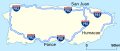 Map of routes in Puerto Rico that receive funding from the Interstate program, but are not signed as Interstate Highways (from Interstate Highway System)
 -
 Commemorative sign introduced in 1993. The system was established during Dwight D. Eisenhower's presidency, and the five stars commemorate his rank as General of the Army during World War II. (from Interstate Highway System)
 -
 I‑787 in Watervliet, New York, showing the exit 8 diamond interchange (from Interstate Highway System)
 -
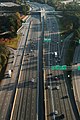
 Motor vehicles on I-95 in Miami (from Interstate Highway System)
 -
 A view of I-75 in Atlanta, Georgia, featuring HOV lanes running alongside the median (from Interstate Highway System)
 -
 The Pershing Map (from Interstate Highway System)
 -
 Map of routes in Alaska that receive funding from the Interstate program, but are not signed as Interstate Highways (from Interstate Highway System)
 -
 The fervor of urban renewal led to the routing of Interstate 81 through the middle of Syracuse's 15th Ward in the 1960s. The viaduct is now slated for demolition. (from Interstate Highway System)
 -

-
 A rural stretch of I-5 in California; two lanes in each direction are separated by a large grassy median and cross-traffic is limited to grade separations such as this overpass. (from Interstate Highway System)
 -
 FDR's hand-drawn map from 1938 (from Interstate Highway System)


_in_Columbia,_Howard_County,_Maryland.jpg)


_just_west_of_Exit_320_in_Charlestown_Township,_Chester_County,_Pennsylvania.jpg)


.jpg)


Subcategories

- Select [►] to view subcategories
Topics
| Signed | |
|---|---|
| Unsigned | |
| Lists | |
| Other | |
Routes in italics are no longer a part of the system. Major Interstates are highlighted. | |
Associated Wikimedia
The following Wikimedia Foundation sister projects provide more on this subject:
-
 Commons
Free media repository -
 Wikibooks
Free textbooks and manuals -
 Wikidata
Free knowledge base -
 Wikinews
Free-content news -
 Wikiquote
Collection of quotations -
 Wikisource
Free-content library -
 Wikiversity
Free learning tools -
 Wiktionary
Dictionary and thesaurus