
Woluwe-Saint-Pierre
Woluwe-Saint-Pierre
| |
|---|---|
 Woluwe Saint-Pierre's Municipal Hall | |
 Flag  Coat of arms | |
Location of Woluwe-Saint-Pierre  | |
 Woluwe-Saint-Pierre Location in Belgium
Woluwe-Saint-Pierre municipality in the Brussels-Capital Region  | |
| Coordinates: 50°50′N 04°28′E / 50.833°N 4.467°E | |
| Country | |
| Community | Flemish Community French Community |
| Region | Brussels-Capital |
| Arrondissement | Brussels-Capital |
| Government | |
| • Mayor | Benoît Cerexhe (LB) |
| • Governing party/ies | LB, Ecolo-Groen, DéFI |
| Area | |
| • Total | 8.94 km2 (3.45 sq mi) |
| Population (2020-01-01)[1] | |
| • Total | 42,119 |
| • Density | 4,700/km2 (12,000/sq mi) |
| Postal codes | 1150 |
| NIS code | 21019 |
| Area codes | 02 |
| Website | www.woluwe1150.be |
Woluwe-Saint-Pierre (French pronunciation: [wolywe sɛ̃ pjɛʁ])[a] or Sint-Pieters-Woluwe (Dutch pronunciation: [sɪnt ˈpitərs ˈʋoːlyu.ə] ) is one of the 19 municipalities of the Brussels-Capital Region, Belgium. Located in the eastern part of the region, it is bordered by Etterbeek, Auderghem and Woluwe-Saint-Lambert, as well as the Flemish municipalities of Kraainem and Tervuren. In common with all of Brussels' municipalities, it is legally bilingual (French–Dutch).
As of 1 January 2022[update], the municipality had a population of 42,216 inhabitants.[2] The total area is 8.94 km2 (3.45 sq mi), which gives a population density of 4,722/km2 (12,230/sq mi). It is mostly a well-to-do residential area, which includes the wide, park-lined, Avenue de Tervueren/Tervurenlaan, and the numerous embassies located near Marshal Montgomery Square. Of the three streams that once crossed the municipality, only the Woluwe, a tributary of the Senne, can still largely be seen today.
History
Middle Ages to 17th century
The first appearance of the name Wolewe dates from 1117 and can be found in a charter from Forest. At that time, the original hamlet and its farms were dependencies of the Park Abbey near Leuven. The onset of difficulties can be traced to the middle of the 16th century, with the hostilities waged by Philip II of Spain against the heretical Protestants and the ensuing poverty and famine took their toll on the entire population. Safety and prosperity returned under the reigns of Archdukes Albert VII and Isabella at the beginning of the 17th century. The first grand alley linking Tervuren to Brussels, then known as the "Street of the Duke", dates from that period.
18th century until today
The French Revolution was also a troubled period for Woluwe-Saint-Pierre. The roads became insecure, the religious freedoms were drastically curtailed, much of the local wild life was exterminated for food, and the lack of coal and wood forced people to use peat for heating. The local administration gained its independence from Brussels, obtained its first mayor on 26 May and its first municipal council in 1819. The commercial opportunities that opened up to the new municipality marked the start of a new era of wealth. The municipality did not expand very quickly, however, until the last two decades of the 19th century. New roads, such as the Avenue de Tervueren/Tervurenlaan, a new train track, imposing mansions, such as the Stoclet Palace, and Woluwe Park, were all built or designed between 1880 and 1910. An important race track, now demolished, was built in 1906. The residential areas came into being right after the First World War and further urbanisation took place after the Second World War. Nowadays, agriculture and fisheries, common before 1918, have completely disappeared. The area now depends nearly exclusively on the service sector of the economy.
Sights
- The extensive Woluwe Park includes giant sequoias, cypresses, and a variety of birds such as mute swans, gulls, and grey herons.
- The imposing modern Municipal Hall is open to visitors.
- The municipality's main church (Saint Peter) was erected in 1755 on the site of a much older building and perpendicular to it, with funds from Forest Abbey. Traces of the older building can still be seen on the left of the current church.
- Several turn-of-the-century houses and manors can still be seen today, such as the Stoclet Palace, which was built between 1905 and 1909 on a design by the Austrian architect Josef Hoffmann for the Belgian financier Adolphe Stoclet, and contains mosaics and paintings by Gustav Klimt.
- The Bibliotheca Wittockiana houses one of the most prestigious bookbinding collections in the world.
- The memorial on the Avenue Jules-César/Julius Caesarlaan to the Belgian Volunteer Corps for Korea, the force sent by Belgium to aid South Korea during the Korean War (1950–1953).
- The Brussels Tram Museum displays a collection of trams and buses of different ages.
-
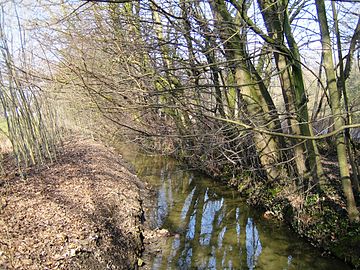 Woluwe stream
 -
 Stoclet Palace by Josef Hoffmann (1911)
 -
 Gombert House (1933)


Famous inhabitants
- Jean Bingen (1920–2012), papyrologist and epigrapher died there
- Henri d'Orléans, Count of Paris (1933–2019), pretender to the French throne
- Eddy Merckx (born 1945), professional cyclist, multiple winner of the Tour de France and Giro d'Italia in the 1960s and 1970s
International relations
Twin towns and sister cities
Woluwe-Saint-Pierre is twinned with:
 Ruyumba, Rwanda
 Gangnam-gu (Seoul), South Korea
 New Iberia, Louisiana, USA
 Pecica, Romania
 Chaoyang, China
 Chennai, India
See also
- Woluwe stream
- Woluwe-Saint-Lambert (Sint-Lambrechts-Woluwe), an adjacent municipality
- Sint-Stevens-Woluwe
References
Footnotes
Citations
- ^ "Bevolking per gemeente op 1 januari 2020". Statbel.
- ^ "Molenbeek-Saint-Jean | IBSA". ibsa.brussels. Retrieved 24 September 2021.
Bibliography
- Falkenback, Pierre (1973). Historique de Woluwe-Saint-Pierre (in French). Brussels: Commune de Woluwe-Saint-Pierre. OCLC 1419423.
- Culot, P. (1996). Bibliotheca Wittockiana. Brussels: Crédit communal, ISBN 90-5544-103-1.
External links
- Official site of the municipality, in French, Dutch, and English
- Official website of the Bibliotheca Wittockiana
Places adjacent to Woluwe-Saint-Pierre | |
|---|---|

| International | |
|---|---|
| National | |
| Geographic | |