
User:Geo Swan/mymaps
Maps made by User:Geo Swan using this online map creation tool.(or now planiglobe)
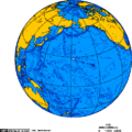
Orthographic
Orthographic North
-
 Image:Arctic Ocean Seaports.png
 -
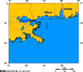
 mage:Jan Mayen orthographic
 -
 North pole february ice-pack 1978-2002
 -
 North pole september ice-pack 1978-2002
 -
 Orthographic projection centered over Iqaluit with latitude and longitude.
 -
 Orthographic projection centered over Iqaluit.
 -
 Orthographic projection centred on the Avalon Peninsula
 -
 Image:Orthographic projection centred over Alert Nunavut.png
 -
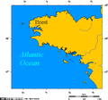
 Orthographic projection centred over Bremen and the Weser watershed
 -
 Orthographic projection centred over Churchill Manitoba
 -
Orthographic projection centred over Churchill, Manitoba, Canada
-
 Orthographic projection centred over Magadan
 -
 Image:Orthographic projection centred over Nakhodka.png
 -
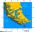
 Image:Orthographic projection centred over Prince Rupert.png
 -
 Orthographic projection centred over Sisimiut
 -
 Orthographic projection over Bathurst Inlet, Nunavut
 -
 Orthographic projection over Grise Fjord
 -
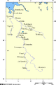
 Orthographic projection over Labrador City
 -
 Orthographic projection over Qaanaaq
 -
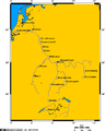
 Orthographic projection over Svalbard
 -
 Orthographic projection over Vladisvostok
 -
 Image:Orthographic sisimiut, qaanag, grise fiord.png -- A Romanian immigrant bought a 5 metre boat in Sisimiut, and piloted it all the way to grise fiord, in an attempt to surreptiously slip back into Canada.
 -


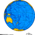
Orthographic Equatorial
-
 Indian Ocean
 -
 Image:Orthographic projection above St Helena.png
 -
 Orthographic projection centred over Easter Island
 -
 Orthographic projection centred over Fernando de Noronha
 -
 Image:Orthographic projection centred over Gongga Shan 1.png
 -
 Image:Orthographic projection centred over Gongga Shan 2.png
 -
 Image:Orthographic projection centred over Gongga Shan 3.png
 -
 Image:Orthographic projection centred over Guam.png
 -
 Image:Orthographic projection centred over Ile Amsterdam
 -
 Orthographic projection centred over Juan Fernandez
 -
 Orthographic projection centred over Pitcairn Island
 -
 Orthographic projection centred over St Peter and St Paul Rocks
 -
 Orthographic projection centred over midway
 -
 Orthographic projection centred over the Galapagos
 -
 Orthographic projection centred over Wallis and Futuna Islands
 -
 Orthographic projection over Diego Garcia
 -
 Orthographic projection over Jarvis Island
 -
 Orthographic projection over Kingman Reef
 -
 Orthographic projection over Palmyra Atoll
 -
 Orthographic projection over Tobago - with Galveston - New Orleans - St Helena
 -
 Image:Orthographic projection over Wake Island.png


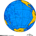
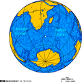
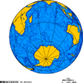
Orthographic South
-
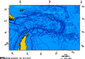
 Drake Passage - Orthographic projection
 -
 Orthographic projection centered on the Prince Edward Islands
 -
 Orthographic projection centered over Bouvet Island
 -
 Orthographic projection centred on the South Sandwich Islands
 -
 Image:Orthographic projection centred over the Iles Crozet.png
 -
 Orthographic projection centred over Kerguelen Island
 -
 Orthographic projection centred over King George Island
 -
 Orthographic projection centred over Ross Island
 -
 Orthographic projection centred over South Georgia Island
 -
 Orthographic projection centred over the Bounty Islands
 -
 Orthographic projection centred over the Heard Islands
 -
 Image:0rthographic projection over Austral Island.png
 -
 Orthographic projection over Gough Island
 -
 Orthographic projection over the Heard Islands
 -
 Orthographic projection over the larsen b ice shelf
 -
 Image:Orthographic projection over Macquarie Island.png
 -
 Orthographic projection over Raoul Island

.png)


Canada
Canadian north of 60
-
 Image:Beaufort Sea and disputed waters.png
 -
 Image:Boothia and melville peninsula 1.PNG
 -
 Image:Communities where Inuinnaqtun is spoken.png
 -
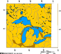
 Image:Great Bear Lake.png
 -
 Image:Great Slave Lake and Lake Athabasca 6.png
 -
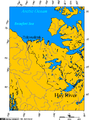 Image:Hay River connection to the Arctic Ocean.png
 -
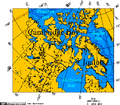 Image:Iqaluit and Cambridge Bay.png
 -
 Image:Labrador City.png
 -
 Image:Lambert Projection of Western Nunavut.png
 -
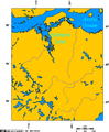 Image:Lambert Projection showing Bathurst Inlet, Nunavut, and environs.png
 -
 Image:Lambert Projection showing the Diavik Diamond Mine, near Barthurst Inlet, Nunavut.png
 -
 Image:Lambert Projection showing the Ekati and Diavik Diamond Mine, near Barthurst Inlet, Nunavut.png
 -
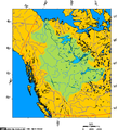 Image:Mackenzie River drainage basin.PNG


Ontario, Canada and nearby
-
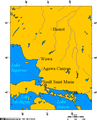 Image:Algoma Central Railway waypoints 1.png
 -
 Image:Breeze - Toronto, Rochester ferry.png
 -
 Image:Ports Colbourne, Weller, Maitland.PNG


Rest of Canada
-
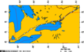
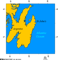 Image:Avalon peninsula - nfld.png
 -
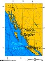 Image:Prince Rupert and Vancouver on the BC Coast.png
 -
 Image:Cape breton island.png
 -
 Image:Churchill river newfoundland and churchill falls.PNG
 -
 Image:Lake Athabasca.png
 -
 Image:Marine Atlantic ferry ports.png
 -
 Image:Prince Rupert Harbour.png


Russian north
-
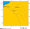
 The Yenisei River basin, Lake Baikal, and the cities of Dikson, Dudinka, Turukhansk, Krasnoyarsk, Irkutsk
 -

-
 Image:Minusa River Valley 1.png
 -
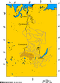 Image:Minusa basin 1.PNG
 -
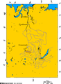 Image:Minusa basin 2.PNG
 -
 Image:Minusa basin 3.PNG
 -
Image:Dikson - Tiksi - Siberia 3.png
-
Image:Polar siberia 4.png
-
Image:Dikson - Siberia 5.png
-
 Image:Tiksi - Siberia - Laptev Sea.png


Afghanistan
-
 Image:Locations mentioned in Khirullah Khairkhwa Tribunal.png
 -
 Image:Mountain passes of Afghanistan.png


Other Asia
-
 Lower yangtze
 -
 Image:Orthographic projection centred over Gwadar, Pakistan.png
 -
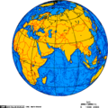 Image:Orthographic projection centred over Karachi, Pakistan.png
 -
 Image:Orthographic projection centred over Qasim Port, Pakistan.png


Europe
-
-
 Cities of the Black Sea
 -
 Elbe watershed
 -
 Jutland peninsula
 -
 Map of cuxhaven hamburg lauenburg lubeck
 -
 Neckar river watershed
 -
 Rhine river
 -
 Seine river watershed
 -
 Weser watershed
 -
 Weser watershed 7


USA
-
 Alaska north shore
 -
 Image:Erie PA on Lake Erie 1.png
 -
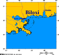 Map of Biloxi and Mississippi coast
 -
 Ports of New Orleans - Biloxi - Mobile
 -
 Image:Selected cities of upstate new york.png


South
-
 Cape horn.png
 -
 Cities of Tierra del Fuego
 -
 South sandwich islands
 -
 Drake Passage - Lambert Azimuthal projection
 -
 Larsen iceshelves


Other
-
Alaska canada border dispute
-
 pproximate area of the Niagara Escarpment
 -
valon Peninsula, Newfoundland and Labrador, Canada
-
Boothia and Melville Peninsulas, Nunavut, Canada
-
Breeze - Toronto, Rochester ferry
-
ape Breton Island, Nova Scotia, Canada
-
Churchill river newfoundland and churchill falls
-
 Cities along Highway 401 Ontario
 -
 Communities of the Greater Toronto Area
 -
 Georgina Island Ontario
 -
 GPLed Grand River
 -
 Lake Simcoe Ontario
 -
Lake Athabasca, Canada
-
Port Dalhousie, in relation to other nearby lakeports.
-
Great Slave Lake and Lake Athabasca, NWT, Canada
-
Great Bear Lake, NWT, Canada
-
Marine Atline ferry ports
-
 Strait of belle isle
 -
 Thunder Bay Ontario
 -
 Vancouver Island
 -
 Walpole island ontario
 -
 Image:Wawa Ontario.png
 -
 Yukon - Kluane Park and Alaska Highway area
 -
Weser watershed 7
-
Strait of belle isle
-
Drake Passage - Falklands - South Georgia - South Sandwich Islands
-
Cities of Tierra del Fuego
-
South sandwich islands
-
 Drake Passage - Lambert Azimuthal projection
 -
Cities of Tierra del Fuego
-
Image:Cape horn.png
-
-
Avalon Peninsula, Newfoundland and Labrador, Canada
-
Cape Breton Island, Nova Scotia, Canada
-
Approximate area of the Niagara Escarpment
-
Breeze - Toronto, Rochester ferry
-
Boothia and Melville Peninsulas, Nunavut, Canada
-
Lake Athabasca, Canada
-
Great Slave Lake and Lake Athabasca, NWT, Canada
-
Great Bear Lake, NWT, Canada
-
Marine Atline ferry ports
-
Walpole island ontario
-
Wawa Ontario
-
Thunder Bay Ontario
-
Map of Biloxi and Mississippi coast
-
Ports of New Orleans - Biloxi - Mobile
-
Communities of the Greater Toronto Area
-
Cities along highway 401 ontario
-
Elbe watershed
-
Georgina Island Ontario
-
Lake Simcoe Ontario
-
Cities of the Black Sea
-
Churchill river newfoundland and churchill falls
-
Seine river watershed
-
Neckar river watershed
-
Lower yangtze
-
Larsen iceshelves
-
Rhine river
-
Weser watershed
-
Vancouver Island
-
Map of cuxhaven hamburg lauenburg lubeck
-
Jutland peninsula
-
Alaska north shore
-
Yukon - Kluane Park and Alaska Highway area
-
GPLed Grand River


2006
-
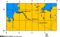
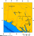
 Watershed of the Saskatchewan River

2007
See also
-
-
 Crown copyright map of Bathurst Inlet
 -
-
Lambert Projection showing Bathurst Inlet, and environs
-
Communities where Inuinnaqtun is spoken
-
Selected cities of upstate new york
-
Mountain passes of Afghanistan
-
Lambert Projection of Western Nunavut
