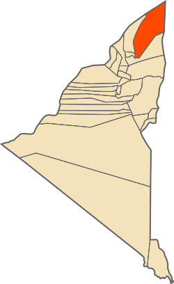
Tinerkouk
Appearance
Tinerkouk
| |
|---|---|
 | |
 | |
| Country | Algeria |
| Province | Timimoun |
| Population (2008)[1] | |
• Total | 15,980 |
| Time zone | UTC+1 (West Africa Time) |
Tinerkouk is a town and commune in Timimoun Province, central Algeria.
Geography
Tinerkouk is located on the southern end of the Grand Erg Occidental. It is served by national road RN118. The nearest civil airport is Timimoun Airport in Timimoun, located about 75km (46mi) away.
Localities of the commune
The commune is composed of 7 localities:[2]
- Zaouiet Debbagh
- Taantast
- Tabelkouza
- Tazliza
- Aïn Hamou
- Fatis
- Oudghagh
- Benzita
Demographics
As of the 2008 Algerian census, Tinerkouk had 8,185 males and 7,795 females.[3]
Economy
The Tinerkouk region is known for its production of dates and the development of market gardening.
The government of Algeria intends to build a film production city in Tinerkouk, the first in southern Algeria, due to its abundant natural and cultural assets.[4]
References
- ^ Recensement 2008 de la population algérienne, wilaya d'Adrar, sur le site de l'ONS.
- ^ "Décret n° 84-365, fixant la composition, la consistance et les limites territoriale des communes. Wilaya d'Adrar" (PDF). Journal officiel de la République Algérienne (67): 1472. 19 December 1984 [1984]. Retrieved 3 October 2019.
- ^ Recensement 2008 de la population algérienne, wilaya d'Adrar, sur le site de l'ONS.
- ^ AE, Rédaction (2022-10-16). "La 1ère ville de production cinématographique dans le Sud sera réalisée à Tinerkouk". Algerie Eco (in French). Retrieved 2023-11-19.
29°45′N 0°30′E / 29.750°N 0.500°E

