Spruce Creek Airport
29°04′49″N 081°02′48″W / 29.08028°N 81.04667°W
Spruce Creek Airport | |||||||||||
|---|---|---|---|---|---|---|---|---|---|---|---|
 | |||||||||||
| Summary | |||||||||||
| Airport type | Private | ||||||||||
| Owner/Operator | Spruce Creek Prop. Owners Assoc. Inc. | ||||||||||
| Serves | Daytona Beach, Florida | ||||||||||
| Location | Port Orange, Florida | ||||||||||
| Elevation AMSL | 24 ft / 7 m | ||||||||||
| Coordinates | 29°04′49″N 081°02′48″W / 29.08028°N 81.04667°W | ||||||||||
| Website | http://www.airport7fl6.com | ||||||||||
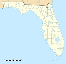
| Map | |||||||||||
 | |||||||||||
| Runways | |||||||||||
| |||||||||||
| Statistics | |||||||||||
| |||||||||||
Spruce Creek Airport (FAA LID: 7FL6) is a private airport located in Port Orange, seven miles (11 km) south of the central business district of Daytona Beach, in Volusia County, Florida, United States.[1] It was originally constructed during World War II as an outlying field (OLF) to nearby Naval Air Station DeLand and NAS Daytona Beach. OLF Spruce Creek originally had four paved 4,000 foot runways and was abandoned by the U.S. Navy in 1946.
Facilities and aircraft
The Spruce Creek Airport covers an area of 1,350 acres (550 ha), which contains one asphalt-paved runway (6/24) measuring 4,000 × 176 ft (1,219 × 54 m). For a 12-month period the airport had 25,000 general aviation aircraft operations, an average of 68 per day. There are 438 aircraft based at this airport: 67% single-engine, 31% multi-engine, 1% jet and 1% helicopter.[1]
See also
References
- ^ a b c FAA Airport Form 5010 for 7FL6 PDF, effective 2007-10-25
External links
- Pictures and Views of the Spruce Creek Fly-In Community
- Community Information website
- News and Activities website
- Spruce Creek German Language Website
- Resources for this airport:
- FAA airport information for 7FL6
- AirNav airport information for 7FL6
- FlightAware airport information and live flight tracker
- SkyVector aeronautical chart for 7FL6
- Spruce Creek Fly-In History
- Spruce Creek Community, history and origins


