
Shotwick
| Shotwick | |
|---|---|
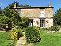
 Houses in Shotwick village | |
 Shotwick Location within Cheshire | |
| OS grid reference | SJ337718 |
| Civil parish | |
| Unitary authority | |
| Ceremonial county | |
| Region | |
| Country | England |
| Sovereign state | United Kingdom |
| Post town | CHESTER |
| Postcode district | CH1 |
| Dialling code | 01244 |
| Police | Cheshire |
| Fire | Cheshire |
| Ambulance | North West |
| UK Parliament | |
Shotwick is a small village and former civil parish, now in the parish of Puddington, on the southern end of the Wirral Peninsula in the unitary authority of Cheshire West and Chester and the ceremonial county of Cheshire, England. The village is close to the county of Flintshire on the England–Wales border.[1] The village was located on the River Dee until it was canalised in 1736 after which the reclaimed land has since developed into the neighbouring Deeside Industrial Park.
History
Shotwick is recorded in the Domesday book[2] (1086), within the Cheshire Hundred of Willaston, with six households listed. Shotwick Castle was built about 1093 by Hugh Lupus, 1st Earl of Chester,[3] at what is now Shotwick Park and near the River Dee, before the area succumbed to the effects of silting.[4] The Norman castle lay in ruins by the 17th century and now only the foundations remain. Henry II left from Shotwick for Ireland and Edward I used the port to leave for Wales in 1278.[5]
The village, including part of the hamlet of Two Mills was within the Wirral Hundred, with a population of 95 in 1801, 100 in 1851, 82 in 1901 and 70 in 1951.[6] It currently has a population of 120.[7] The civil parish was abolished on 1 April 2015 and merged into Puddington.[6][8]
Gallery
-
 St. Michael's church, Shotwick
 -
 Millennium bench
 -
 Cottage in Shotwick


See also
References
- ^ 117 Chester & Wrexham/Caer A Wrecsam (Map). 1:50000. Landranger. Ordnance Survey.
- ^ "Place: Shotwick". Open Domesday. Retrieved 19 June 2018.
- ^ "History of Saughall". Saughall & Shotwick Parish Council. Archived from the original on 28 September 2007. Retrieved 10 May 2007.
- ^ "Ornamental water garden found at Cheshire castle". British Archaeology. May 1997. Archived from the original on 16 July 2012. Retrieved 19 June 2018.
- ^ Thornber, Craig. "Shotwick". Cheshire Antiquities. Retrieved 19 June 2018.
- ^ a b "Shotwick". GENUKI. Retrieved 19 June 2018.
- ^ Chester Diocesan News, December 2014
- ^ "Cheshire West and Chester Registration District". UKBMD. Retrieved 2 September 2023.
External links
![]() Media related to Shotwick at Wikimedia Commons
Media related to Shotwick at Wikimedia Commons