
Sharpsburg, Georgia
Sharpsburg, Georgia | |
|---|---|
 Location in Coweta County and the state of Georgia | |
| Coordinates: 33°20′22″N 84°39′1″W / 33.33944°N 84.65028°W | |
| Country | United States |
| State | Georgia |
| County | Coweta |
| Area | |
| • Total | 0.98 sq mi (2.53 km2) |
| • Land | 0.97 sq mi (2.51 km2) |
| • Water | 0.01 sq mi (0.02 km2) |
| Elevation | 925 ft (282 m) |
| Population (2020) | |
| • Total | 327 |
| • Density | 337.46/sq mi (130.29/km2) |
| Time zone | UTC-5 (Eastern (EST)) |
| • Summer (DST) | UTC-4 (EDT) |
| ZIP code | 30277 |
| Area code(s) | 770, 678 |
| FIPS code | 13-69980[2] |
| GNIS feature ID | 0333018[3] |
| Website | www |
Sharpsburg (ˈʃɑrpsbɝg) is a town in Coweta County, Georgia, United States. It is part of the Atlanta metropolitan area. Its population was 327 at the 2020 census.[4]
History
The Georgia General Assembly incorporated Sharpsburg as a town in 1871.[5] The community was named after Judge Elias Sharp, a local city commissioner.[6]
Geography
Sharpsburg is located in eastern Coweta County at 33°20′22″N 84°39′1″W / 33.33944°N 84.65028°W (33.339337, -84.650155).[7] The town of Turin is immediately to the southeast. Georgia State Route 16 runs through the southern part of Sharpsburg, leading west 10 miles (16 km) to Newnan, the county seat, and southeast 7 miles (11 km) to Senoia. GA 54 leads northeast 5 miles (8 km) to Peachtree City.
According to the United States Census Bureau, Sharpsburg has a total area of 0.60 square miles (1.55 km2), of which 0.004 square miles (0.01 km2), or 0.66%, is water.[4]
Demographics
| Census | Pop. | Note | %± |
|---|---|---|---|
| 1880 | 110 | — | |
| 1890 | 177 | 60.9% | |
| 1900 | 137 | −22.6% | |
| 1910 | 166 | 21.2% | |
| 1920 | 170 | 2.4% | |
| 1930 | 137 | −19.4% | |
| 1940 | 114 | −16.8% | |
| 1950 | 133 | 16.7% | |
| 1960 | 155 | 16.5% | |
| 1970 | 161 | 3.9% | |
| 1980 | 194 | 20.5% | |
| 1990 | 224 | 15.5% | |
| 2000 | 316 | 41.1% | |
| 2010 | 341 | 7.9% | |
| 2020 | 327 | −4.1% | |
| U.S. Decennial Census[8] | |||
As of the census[2] of 2000, there were 316 people, 125 households, and 86 families residing in the town. The population density was 579.0 inhabitants per square mile (223.6/km2). There were 127 housing units at an average density of 232.7 per square mile (89.8/km2). The racial makeup of the town was 94.94% White, 4.11% African American, 0.32% Native American, 0.32% from other races, and 0.32% from two or more races. Hispanic or Latino people of any race were 3.48% of the population.
There were 125 households, out of which 34.4% had children under the age of 18 living with them, 60.8% were married couples living together, 5.6% had a female householder with no husband present, and 31.2% were non-families. 25.6% of all households were made up of individuals, and 5.6% had someone living alone who was 65 years of age or older. The average household size was 2.53 and the average family size was 3.08.
In the town, the population was spread out, with 25.6% under the age of 18, 5.7% from 18 to 24, 36.7% from 25 to 44, 25.0% from 45 to 64, and 7.0% who were 65 years of age or older. The median age was 34 years. For every 100 females, there were 100.0 males. For every 100 females age 18 and over, there were 104.3 males.
The median income for a household in the town was $55,000, and the median income for a family was $68,750. Males had a median income of $41,932 versus $26,250 for females. The per capita income for the town was $23,169. None of the families and 2.4% of the population were living below the poverty line, including no under eighteens and 22.2% of those over 64.
Education
Public education in Sharpsburg is operated by Coweta County School System, with schools including East Coweta High School.
Private schools in the town include Trinity Christian School and Central Christian School.
Faith Lutheran Preschool is a preschool of Faith Lutheran Church in Sharpsburg.[9]
Notable people
- Keith Brooking, football player
- Janet Dykman, Olympic archery champion
- Brooke Hendrix, soccer player
- Allan Kayser, actor
- Josh Andrew Koenig, actor
- Rusty Stevens, actor
- Lynn Westmoreland, politician
References
- ^ "2020 U.S. Gazetteer Files". United States Census Bureau. Retrieved December 18, 2021.
- ^ a b "U.S. Census website". United States Census Bureau. Retrieved January 31, 2008.
- ^ "US Board on Geographic Names". United States Geological Survey. October 25, 2007. Retrieved January 31, 2008.
- ^ a b "Geographic Identifiers: 2010 Demographic Profile Data (G001): Sharpsburg town, Georgia". U.S. Census Bureau, American Factfinder. Archived from the original on February 12, 2020. Retrieved July 31, 2014.
- ^ "Sharpsburg". GeorgiaGov. Retrieved June 3, 2019.
- ^ Krakow, Kenneth K. (1975). Georgia Place-Names: Their History and Origins (PDF). Macon, GA: Winship Press. p. 204. ISBN 0-915430-00-2.
- ^ "US Gazetteer files: 2010, 2000, and 1990". United States Census Bureau. February 12, 2011. Retrieved April 23, 2011.
- ^ "Census of Population and Housing". Census.gov. Retrieved June 4, 2015.
- ^ "FAITH LUTHERAN PRESCHOOL". Faith Lutheran Church. Retrieved August 14, 2020.
Municipalities and communities of Coweta County, Georgia, United States | ||
|---|---|---|
| Cities | 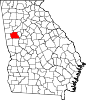 | |
| Towns | ||
| CDP | ||
| Unincorporated communities | ||
| Footnotes | ‡This populated place also has portions in an adjacent county or counties | |
| Authority control databases: Geographic |
|---|