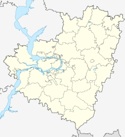
Roshchinsky, Samara Oblast
Roshchinsky
Ро́щинский | |
|---|---|
| Coordinates: 53°03′14″N 50°28′54″E / 53.05389°N 50.48167°E | |
| Country | Russia |
| Federal subject | Samara Oblast |
| Administrative district | Volzhsky District |
| Founded | 1993 |
| Population | |
• Total | 11,920 |
| Time zone | UTC+4 (MSK+1 |
| Postal code(s)[3] | |
| OKTMO ID | 36614156051 |
Roshchinsky (Russian: Ро́щинский) is an urban locality (an urban-type settlement) in Volzhsky District of Samara Oblast, Russia. Population: 8,128 (2021 Census);[4] 11,920 (2010 Census);[1] 12,878 (2002 Census).[5]
History
It started as a small village in 1932.[6] The first military garrison was established here in 1933; several more were organized by the 1960s–1970s.[6] The primary purpose of the garrisons was to train the troops before sending them to East Germany.[6] After the re-unification of Germany in 1990, 100,000 Soviet troops were moved back to Russia, and Roshchinsky became one of the destinations for the returning troops,[6] including the 3rd Guards Spetsnaz Brigade, and the 589th Guards Motor Rifle Regiment (later to become the 15th Guards Separate Motor Rifle Brigade).
The military garrisons were incorporated as an urban-type settlement and named Roshchinsky on June 29, 1999.[7] The name was officially approved by the federal government of June 5, 2000.[8]
References
- ^ a b Russian Federal State Statistics Service (2011). Всероссийская перепись населения 2010 года. Том 1 [2010 All-Russian Population Census, vol. 1]. Всероссийская перепись населения 2010 года [2010 All-Russia Population Census] (in Russian). Federal State Statistics Service.
- ^ "Об исчислении времени". Официальный интернет-портал правовой информации (in Russian). June 3, 2011. Retrieved January 19, 2019.
- ^ Почта России. Информационно-вычислительный центр ОАСУ РПО. (Russian Post). Поиск объектов почтовой связи (Postal Objects Search) (in Russian)
- ^ https://rosstat.gov.ru/storage/mediabank/tab-5_VPN-2020.xlsx
- ^ Federal State Statistics Service (May 21, 2004). Численность населения России, субъектов Российской Федерации в составе федеральных округов, районов, городских поселений, сельских населённых пунктов – районных центров и сельских населённых пунктов с населением 3 тысячи и более человек [Population of Russia, Its Federal Districts, Federal Subjects, Districts, Urban Localities, Rural Localities—Administrative Centers, and Rural Localities with Population of Over 3,000] (XLS). Всероссийская перепись населения 2002 года [All-Russia Population Census of 2002] (in Russian).
- ^ a b c d Unofficial website of Roshchinsky. History of the settlement (in Russian)
- ^ Самарская губернская Дума. Решение №245 от 29 июня 1999 г. «Об образовании на территории Волжского района Самарской области нового населённого пункта и присвоении ему наименования». (Samara Governorate Duma. Decision #245 of June 29, 1999 On Establishing a New Inhabited Locality on the Territory of Volzhsky District of Samara Oblast and on Naming It. ).
- ^ Правительство Российской Федерации. Постановление №437 от 5 июня 2000 г. «О присвоении наименований географическим объектам и переименовании географических объектов в Удмуртской Республике, Республике Алтай, Алтайском крае, Пермской, Самарской и Саратовской областях». (Government of the Russian Federation. Resolution #437 of June 5, 2000 On Naming the Geographical Objects and Renaming Geographical Objects in the Udmurt Republic, the Altai Republic, Altai Krai, Perm, Samara, and Saratov Oblasts. ).
External links
- Unofficial website of Roshchinsky (in Russian)


