Raposo Tavares (district of São Paulo)
Appearance
Raposo Tavares | |
|---|---|
 | |
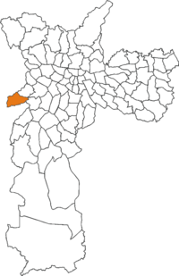
 The location of Raposo Tavares district in São Paulo | |
| Country | Brazil |
| State | São Paulo |
| City | São Paulo |
| Government | |
| • Type | Subprefecture |
| • Subprefect | Daniel Barbosa Rodrigueiro |
| Area | |
| • Total | 12.6 km2 (4.9 sq mi) |
| Population (2000) | |
| • Total | 91.204 |
| • Density | 7.238/km2 (18.75/sq mi) |
| HDI | 0.819 –high |
| Website | Subprefecture of Butantã |
Raposo Tavares is a district in the city of São Paulo, Brazil.
External links
 Media related to Raposo Tavares (district of São Paulo) at Wikimedia Commons
23°35′29.972″S 46°46′52.914″W / 23.59165889°S 46.78136500°W

