
Montaudin
Montaudin | |
|---|---|
 The town hall of Montaudin | |
Location of Montaudin  | |
 Montaudin  Montaudin | |
| Coordinates: 48°23′12″N 0°59′14″W / 48.3867°N 0.9872°W | |
| Country | France |
| Region | Pays de la Loire |
| Department | Mayenne |
| Arrondissement | Mayenne |
| Canton | Gorron |
| Government | |
| • Mayor (2020–2026) | Bernard Ory[1] |
| Area 1 | 21.66 km2 (8.36 sq mi) |
| Population (2021)[2] | 893 |
| • Density | 41/km2 (110/sq mi) |
| Time zone | UTC+01:00 (CET) |
| • Summer (DST) | UTC+02:00 (CEST) |
| INSEE/Postal code | 53154 /53220 |
| Elevation | 150–227 m (492–745 ft) (avg. 206 m or 676 ft) |
| 1 French Land Register data, which excludes lakes, ponds, glaciers > 1 km2 (0.386 sq mi or 247 acres) and river estuaries. | |
Montaudin (French pronunciation: [mɔ̃todɛ̃]) is a commune in the Mayenne department in north-western France.
Gallery
-
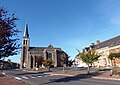 The church of Our Lady, in Montaudin.

See also
References
- ^ "Répertoire national des élus: les maires" (in French). data.gouv.fr, Plateforme ouverte des données publiques françaises. 13 September 2022.
- ^ "Populations légales 2021". The National Institute of Statistics and Economic Studies. 28 December 2023.
Wikimedia Commons has media related to Montaudin.
| Authority control databases: National |
|---|
This Mayenne geographical article is a stub. You can help Wikipedia by expanding it. |