
Lorenzago di Cadore
Lorenzago di Cadore
Lorenžàgo (ladin) | |
|---|---|
| Comune di Lorenzago di Cadore | |
 | |
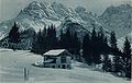
Location of Lorenzago di Cadore  | |
 Lorenzago di Cadore Location of Lorenzago di Cadore in Italy  Lorenzago di Cadore Lorenzago di Cadore (Veneto) | |
| Coordinates: 46°29′N 12°28′E / 46.483°N 12.467°E | |
| Country | Italy |
| Region | Veneto |
| Province | Province of Belluno (BL) |
| Government | |
| • Mayor | Marco D’Ambros (since June 2019) (Civic List) |
| Area | |
| • Total | 27.7 km2 (10.7 sq mi) |
| Population (Dec. 2004)[2] | |
| • Total | 600 |
| • Density | 22/km2 (56/sq mi) |
| Time zone | UTC+1 (CET) |
| • Summer (DST) | UTC+2 (CEST) |
| Postal code | 32040 |
| Dialing code | 0435 |
Lorenzago di Cadore is a comune (municipality) in the Province of Belluno in the Italian region of Veneto, located about 120 kilometres (75 mi) north of Venice and about 45 kilometres (28 mi) northeast of Belluno. As of 31 December 2004, it had a population of 600 and an area of 27.7 square kilometres (10.7 sq mi).[3]
Lorenzago di Cadore borders the following municipalities: Domegge di Cadore, Forni di Sopra, Lozzo di Cadore, Vigo di Cadore. For a number of years, Lorenzago hosted the summer vacation of Pope John Paul II. In 2007, Pope Benedict XVI was on vacation there.
Giulio Tremonti, twice Italian Finance Minister, was granted honorary citizenship on 29 December 2009; though born in Sondrio, his father was a native from Lorenzago[4] and here the son hosted the drafters of the centre-right proposal of Constitutional amendment.[5]
Gallery
-
 The valley of Cridola
 -
 The valley of Tora
 -
 Antelao (3.263 m) seen by the village
 -
 The castle of Mirabello in 1930
 -
 Marmarole (2.932 m), the Titian mountains
 -
 Villa Clarenza was burned by German in 1944
 -
 Cridola's valley and Miaron in 1937
 -
 Aerial view of the town


Demographic evolution

References
- ^ "Superficie di Comuni Province e Regioni italiane al 9 ottobre 2011". Italian National Institute of Statistics. Retrieved 16 March 2019.
- ^ "Popolazione Residente al 1° Gennaio 2018". Italian National Institute of Statistics. Retrieved 16 March 2019.
- ^ All demographics and other statistics: Italian statistical institute Istat.
- ^ "Official website of Lorenzago di Cadore".
- ^ The text, initially drafted in the hut of Lorenzago, has been substantially improved in Parliament: Buonomo, Giampiero (2004). "La Costituzione targata Lorenzago: prima analisi della riforma che lascia da parte le questioni più difficili". Diritto&Giustizia Edizione Online. Archived from the original on 2012-08-01. Retrieved 2016-04-06.
External Links http://www.lorenzago.com