
Kiota
Kiota | |
|---|---|
Commune and village | |
,_grand_mosque,_main_gate.jpg) Main street in front of the Grand mosque | |
| Country | |
| Area | |
| • Total | 68.6 sq mi (177.7 km2) |
| Population (2012 census) | |
| • Total | 25,282 |
| • Density | 370/sq mi (140/km2) |
| Time zone | UTC+1 (WAT) |
Kiota is a small town and rural commune in Niger in the Boboye Department, Dosso Region.[1] As of 2012, it had a population of 25,282.[2]
It is the seat of the most important Tijaniyyah community (a Sufi order) in Niger.
The weekly market is on Fridays.
-
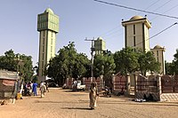 The grand mosque of Kiota
 -
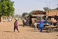 Street scene in Kiota
,_grand_mosque.jpg)
,_street_scene.jpg)
References
- ^ Loi n° 2002-014 du 11 JUIN 2002 portant création des communes et fixant le nom de leurs chefs-lieux[permanent dead link]. Includes list of 213 communes rurales and seats, 52 Communes urbaines and seats
- ^ "Kiota (Commune, Niger) - Population Statistics, Charts, Map and Location". www.citypopulation.de. Retrieved 2024-02-16.
This Niger location article is a stub. You can help Wikipedia by expanding it. |