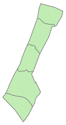
Khan Yunis Governorate
Appearance
Khan Yunis Governorate
محافظة خان يونس | |
|---|---|
 | |
| Coordinates: 31°21′N 34°18′E / 31.35°N 34.3°E | |
| Country | |
| Area | |
• Total | 108 km2 (42 sq mi) |
| Population (2017 Census)[1] | |
• Total | 270,979 |
| • Density | 2,500/km2 (6,500/sq mi) |
| ISO 3166 code | PS-KYS |
|
|
The Khan Yunis Governorate (Arabic: محافظة خان يونس Muḥāfaẓat Ḫān Yūnis) is one of 16 Governorates of Palestine, located in the southern Gaza Strip. Its district capital is Khan Yunis. According to the Palestinian Central Bureau of Statistics, the governorate had a population of 426,056 in mid-2022.[2] Its land area is 69.61% urban, 12.8% rural, and 17.57% comprising the Khan Yunis refugee camp.[3]
Localities
Cities
- Abasan al-Kabira
- Bani Suheila
- Khan Yunis (Khan Younis/Khan Yunus) (seat)
Municipalities
- Abasan al-Saghira
- Al-Qarara (Al Qarara)
- Khuzaʽa
Village councils
- Al-Fukhari (al-Fokari/al-Fukhkhari)
- Qizan an-Najjar (Qizan al-Najar)
- Umm al-Kilab (Umm el-Kelab)
References
- ^ "Main Indicators by Type of Locality - Population, Housing and Establishments Census 2017" (PDF). Palestinian Central Bureau of Statistics (PCBS). Retrieved 2021-01-19.
- ^ "Projected Mid -Year Population for Khan Yunis Governorate by Locality 2017-2026". Palestinian Central Bureau of Statistics. May 30, 2021. Retrieved December 4, 2023.
- ^ "Khan Yunis Governorate Small Area Populations". Palestinian Central Bureau of Statistics. Archived from the original on 2012-02-07. Retrieved December 8, 2024.
External links
 Media related to Khan Yunis Governorate at Wikimedia Commons


