Jerrettspass
Jerrettspass
| |
|---|---|
 Railway bridge at Jerrettspass | |
Location within Northern Ireland | |
| Irish grid reference | J0633 |
| County | |
| Country | Northern Ireland |
| Sovereign state | United Kingdom |
| Post town | NEWRY |
| Postcode district | BT35 |
| Dialling code | 028 |

Jerrettspass (Irish: Bealach Sheirit)[1] is a small village in County Armagh, Northern Ireland,[2] beside the River Blackwater, that forms the border with County Down. It is situated in the townland of Kilmonaghan, in the civil parish of Killevy and the historic barony of Orior Lower,[1] approximately 4 miles north of the city of Newry. It lies within the Newry, Mourne and Down District Council.[3]
History
The English name of the village, Jerrettspass, is reputedly a corruption of a former name, "Gerald" or "Gerrard's Pass".[4]
There is a 1730s lock at Jerrettspass along a canal that was made at the same time, although was replaced by a railway in the 1850s.[citation needed] The canal, known as the Newry Canal, closed in the 1930s.[5] The nearby rail bridge, towpath accommodation bridge and canal bridge are subject to protection as listed buildings.[2]
The Presbyterian church at Jerrettspass was founded in 1801 and, in 1902, was joined with the nearby Drumbanagher church to form the First Drumbanagher and Jerrettspass Presbyterian Church.[4] It was subsequently united in a joint pastorage with Kingsmill Presbyterian Church.[6][7]
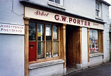
As of the early 20th century, the village of Jerrettspass had a post office, two shops, a public house, blacksmith's forge, a school and church.[8] The post office, which had been in operation for approximately 150 years, closed in 2009.[8][9]
In May 2021, the National Crime Agency discovered 11 firearms in Jerrettspass as part of an investigation into organised crime. It was described as "most significant firearms find in NI in a decade".[10][11]
Demography
NISRA does not publish discrete census data for Jerrettspass.[2][12]
See also
References
- ^ a b "Bealach Sheirit / Jerrettspass". logainm.ie. Placenames Database of Ireland. Retrieved 6 January 2024.
- ^ a b c "Jerrettspass & Lurganare Cluster - Village Renewal and Development Plans" (PDF). newrymournedown.org. Newry, Mourne and Down District Council. July 2012. Retrieved 6 January 2024.
- ^ "Census 2021 - Person and household estimates for settlements CT0046". NISRA.gov.uk.
- ^ a b Halliday, Andrew (1988). "Jerrettspass and District" (PDF). Poyntzpass and District Local History Society. Retrieved 11 December 2023 – via poyntzpass.co.uk.
- ^ Keenan, Shaun (9 November 2021). "Newry Canal should be restored 'before it's too late'". belfastlive.co.uk. Retrieved 12 January 2024.
the [Newry] canal closed in 1936 [..] NMD Council owns the section of Newry Canal from Victoria Lock to just outside Jerrettspass
- ^ "Kingsmills and Jerrettspass Presbyterian Churches". kandjpc.com. Retrieved 6 January 2024.
- ^ Bailie, W. Desmond, ed. (1982). A History of Congregations in the Presbyterian Church in Ireland, 1610-1982. Presbyterian Historical Society of Ireland. p. 413. ISBN 0950144665.
- ^ a b Ferris, Gillian (October 2019). "Porter's Shop" (PDF). Journal of the Poyntzpass and District Local History Society (15): 9–18. JSTOR 48636629.
- ^ Campbell, John (November 2017). "Post Office Closes After 150 Years". Journal of the Poyntzpass and District Local History Society (14): 61. JSTOR 48571906.
- ^ "Assault rifle, pistols and machine guns 'most significant firearms find in NI in a decade'". armaghi.com. 21 May 2021. Retrieved 6 January 2024.
- ^ "Jerrettspass: Eleven firearms discovered in County Armagh". BBC News. 21 May 2021. Retrieved 6 January 2024.
- ^ "Table CT0236NI - Headcount and Household Estimates for Settlements - Census 2011". datavis.nisra.gov.uk.

