Isola di Capo Rizzuto
Isola di Capo Rizzuto | |
|---|---|
| Comune di Isola di Capo Rizzuto | |
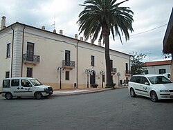
 Palazzo Barracco, the town hall | |
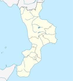
| Coordinates: 38°57′32″N 17°05′44″E / 38.95889°N 17.09556°E | |
| Country | Italy |
| Region | Calabria |
| Province | Crotone (KR) |
| Frazioni | Campolongo, Capo Rizzuto, Le Castella, Sant'Anna, Le Cannella, Marinella |
| Government | |
| • Mayor | (commissar) |
| Area | |
| • Total | 125 km2 (48 sq mi) |
| Elevation | 90 m (300 ft) |
| Population (February 28, 2007)[2] | |
| • Total | 14,839 |
| • Density | 120/km2 (310/sq mi) |
| Demonym | Isolitani |
| Time zone | UTC+1 (CET) |
| • Summer (DST) | UTC+2 (CEST) |
| Postal code | 88841 |
| Dialing code | 0962 |
| Patron saint | Madonna Greca |
| Website | Official website |
Isola di Capo Rizzuto is a comune (municipality) in the province of Crotone, Calabria, Italy. The population of the town is around 15,000.
Overview
Despite the name Isola (island), the town is entirely on the mainland. There are several theories about the name, which may derive from Greek mythology or may be a corruption of a Greek word. Geographically the seaside district of the town of Capo Rizzuto is a peninsula. Elsewhere the main historical attraction, the powerful 16th-century fortification in the district of Le Castella, stands on a piece of land connected to the mainland by a narrow causeway.
In 1977 the archaeologist Domenico Marino discovered and excavated a site on the Capo Piccolo promontory with important Early Bronze Age II and Middle Bronze Age I-II artifacts of Minoan origin, demonstrating early trade contact between the eastern Mediterranean and Italy. The finds are on display in the National Archaeological Museum in nearby Crotone.
The town forms part of the Marine Protected Area Capo Rizzuto.
The Sant'Anna Cara immigrant centre holds 1,500 people at a time.[3]
See also
References
- ^ "Superficie di Comuni Province e Regioni italiane al 9 ottobre 2011". Italian National Institute of Statistics. Retrieved 16 March 2019.
- ^ "Popolazione Residente al 1° Gennaio 2018". Italian National Institute of Statistics. Retrieved 16 March 2019.
- ^ BBC 15 May 2017 Mafia controlled Italy migrant centre, say police
External links
- Comune di Isola di Capo Rizzuto [official website, in Italian]


