
Gwangyang
Gwangyang
광양시 | |
|---|---|
| Korean transcription(s) | |
| • Hangul | 광양시 |
| • Hanja | 光陽市 |
| • Revised Romanization | Gwangyang-si |
| • McCune-Reischauer | Kwangyang-si |
.jpg) A POSCO shipping terminal in front, with the city to the left (2021) | |
 Flag Emblem of Gwangyang | |
 Location in South Korea | |
| Country | |
| Region | Honam |
| Administrative divisions | 1 eup, 6 myeon, 5 dong |
| Government | |
| • Mayor | Jeong In-hwa (정인화) |
| Area | |
| • Total | 446.08 km2 (172.23 sq mi) |
| Population (November, 2022) | |
| • Total | 152,184 |
| • Density | 340/km2 (880/sq mi) |
| • Dialect | Jeolla |
| Time zone | UTC+9 (Korea Standard Time) |
| Area code | +82-61 |
Gwangyang (Korean: 광양; Korean pronunciation: [kwaŋ.jaŋ]) is a city in South Jeolla Province, South Korea. Gwangyang city is the home of POSCO's Gwangyang Steel Works, the largest facility of its kind in the world. The city is also home to K League Classic football side Jeonnam Dragons.
Gwangyang is at the centre of development for the Gwangyang Bay Area Free Economic Zone (GFEZ), the third-largest among the six free economic zones of South Korea, covering 92.7 square kilometers. The Free Economic Zone focus on port container handling, steel production, shipbuilding as well as leisure facilities. The area has become a mega business hub, exploiting its accessibility to China.[1]
Famous people from Gwangyang include National Intelligence Service head Kim Seung-kew. To the north of the city is the county of Gurye, to the east along the Seomjin River is the county of Hadong in Gyeongsangnam-do, and to the south is the Gwangyang Bay. Mountains in the city include Baegunsan (백운산, 1,217m), to the south is Gayasan (가야산, 497m) and Gubonghwasan (구봉화산, 473m). Baegunsan is the second-highest mountain in Jeollanam-do with the exception of Jirisan (지리산, 1,915 m).
The average yearly temperature is 13.7 °C (56.7 °F), the average in January is 0.1 °C (32.2 °F), and the average in July is 27.8 °C (82.0 °F). The average yearly precipitation is 1,296 mm (51.02 in)
As of October 14, 2007, plans are being set up and a referendum is being planned for a merging of the cities of Yeosu, Suncheon and Gwangyang into a new metropolitan city, taking advantage of the Gwangyang Bay Free Economic Zone, Yeosu's Expo 2012 bid and port facilities, Suncheon's educational institutes and Gwangyang's POSCO plant.[1][needs update]
Symbols
- Tree : Gorosoe
- Bird : Sea gull
- Flower : Camellia
Gwangyang Steel Works
The Steel Works in Gwangyang is POSCO's second mill in the country after the mill in Pohang. The mill boasts having the largest steel plant in the world, the most modern technology, and the best facilities for steel manufacturing.[citation needed] It presently produces coil used for making bridges, iron structures, cars, refrigerators, and more. Its production capacity averages about 18 million tons per year. This plant is also a tourist destination for many people, attracting more than 300,000 people from around the globe.
Location
Gwangyang is a strategically important city situated in the southern center of the Korean peninsula. For these geopolitical reasons, Gwangyang is a city which functions as an axis for the balanced development of the country covering South Jeolla area with western parts of Mokpo and Muan.[2]
Places of interest
Gwangyang is home to many unique natural and cultural sites as well as many different festivals during the four seasons. Points of interest include:
- The Baegun mountains
- Maehwa Village
- Yudang Park
- The Natural Resort Park
- Gwangyang Cultural Center
The festivals include:
- The Baegun Mountain Medicinal Water Festival
- The Maehwa Culture Festival
- The Jeoneo Fish Festival
- Gallery, Gwangyang
-
 Gwangyang Cultural Center
 -
 Gwangyang-eup office
 -
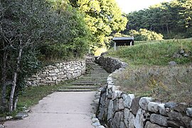 Okryongsa Camellia Forest
 -

-
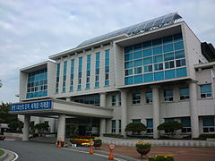
 Gwangyang City Hall
 -
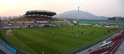 Gwangyang Stadium
 -
 The Maehwa Culture Festival
 -


.jpg)


Festival
Gwangyang is famous for its beautiful apricot trees. In Korean, Ume flower is called maehwa(매화) and it has been honored for its early blooming. Because of its characteristic, the Gwangyang Maehwa Festival is the earliest opened festival in the whole South Jeolla Province area.[3]
Other festivals in Gwangyang are the Baegunsan Mountain Gorosoe Festival, Seomjingang Culture Festival and the Gwangyang Sutbulgui Festival.[4]
International relations
Twin towns – Sister cities
Gwangyang is twinned with:
|
See also
References
- ^ "Gwangyang free economic zone emerges as mega hub". The Korea Times. 2010-11-22. Retrieved 2022-01-15.
- ^ [지역에서 성장동력 찾는다] (1) 호남광역권 : 광주ㆍ전남북 공동투자로 '서남광역개발(주)' 설립을 2008.01.24
- ^ [전남] 섬진강변 매화 절정! YTN 2007-03-16
- ^ "Gwangyang Festivals".
- ^ Cagayan De Oro City adopts Gwangyang, Korea as sister city Archived 2012-11-02 at the Wayback Machine, Philippine Information Agency Retrieved 10 2012
- ^ 友好城市 [Friendly cities]. Shenzhen Foreign Affairs Office. 2011-03-22. Archived from the original on 2014-07-19. Retrieved 2013-08-07.
- ^ 国际友好城市一览表 [International Friendship Cities List]. Shenzhen Foreign Affairs Office. 2011-01-20. Archived from the original on 2013-11-13. Retrieved 2013-08-07.
- ^ 友好交流 [Friendly exchanges]. Shenzhen Foreign Affairs Office. 2011-09-13. Archived from the original on 2014-11-12. Retrieved 2013-08-07.
