
Grosse Pointe Park, Michigan
Grosse Pointe Park, Michigan | |
|---|---|
| City of Grosse Pointe Park | |
 Palmer T. Heenan Municipal Center | |
 Location within Wayne County | |
 Grosse Pointe Park Location within the state of Michigan  Grosse Pointe Park Location within the United States | |
| Coordinates: 42°22′49″N 82°55′51″W / 42.38028°N 82.93083°W | |
| Country | |
| State | |
| County | Wayne |
| Incorporated | 1907 (village) 1950 (city) |
| Government | |
| • Type | Mayor–council |
| • Mayor | Michele Hodges (D) |
| • Manager | Nick Sizeland |
| Area | |
| • City | 3.71 sq mi (9.61 km2) |
| • Land | 2.17 sq mi (5.61 km2) |
| • Water | 1.54 sq mi (4.00 km2) |
| Elevation | 577 ft (176 m) |
| Population (2020) | |
| • City | 11,595 |
| • Density | 5,353.19/sq mi (2,066.76/km2) |
| • Metro | 4,285,832 (Metro Detroit) |
| Time zone | UTC-5 (EST) |
| • Summer (DST) | UTC-4 (EDT) |
| Zip code(s) | 48230 |
| Area code | 313 |
| FIPS code | 26-35540[2] |
| GNIS feature ID | 0627466[3] |
| Website | grossepointepark |
Grosse Pointe Park is a city in Wayne County in the U.S. state of Michigan. The population was 11,555 at the 2010 census.[4]
Bordering on Detroit with frontage on southern Lake St. Clair, it is the southernmost of the Grosse Pointe suburbs. Grosse Pointe Park was incorporated as a village in 1907 and again as a city in 1950.
In November 2021, Grosse Pointe Park elected its first female mayor, Michele Hodges.[5]
History
Before incorporation as a city, the area that would become the city of Grosse Pointe Park was incorporated as the Village of Fairview, which spanned Bewick Street in the west to Cadieux Road in the east in Grosse Pointe Township. The city of Detroit annexed part of the village in the township from Bewick Street to Alter Road in 1907. Fearing further annexation, the part of the village east of Alter Road incorporated as the Village of Grosse Pointe Park later that year.[6] Seeking further annexation protection from Detroit and independence from its township, the village reincorporated as a city in 1950.
Geography
According to the United States Census Bureau, the city has a total area of 3.71 square miles (9.61 km2), of which 2.17 square miles (5.62 km2) is land and 1.54 square miles (3.99 km2) is water.[7] The water is part of Lake St. Clair. Grosse Pointe Park has about 3.5 miles (5.6 km) of borders with Detroit, with one border between Alter Road and Wayburn to the southwest, and another along Mack Avenue to the northwest; its third border on land is with the city of Grosse Pointe along Cadieux Road to the northeast.
Description

.jpg)
The neighborhoods in Grosse Pointe Park are built on a standard grid street pattern which flows out of Detroit, and housing ranges from tightly-packed single- and multi-family brick houses on the far west side of the Park, to rows of traditionally-styled single family homes generally averaging over 3,000 square feet (280 m2), to multimillion-dollar mansions, some of which are found on the lakeshore. The west side of the city features mixed-use neighborhoods, where retail, schools, and churches are within close walking distance. The rest of the city is basically residential, but at the eastern edge residents are in close walking distance to "the Village" shopping district in Grosse Pointe. Many of the houses in the Park were built prior to World War II, and many of these were designed by noted architects using the finest materials. Windmill Pointe Drive, and streets such as Bishop, Kensington, Yorkshire, Edgemont Park, Three Mile Drive, Devonshire, Buckingham, Berkshire, Balfour, Middlesex, and Nottingham among others, each have dozens of large, architecturally significant homes. These mansions and mini-mansions were often placed on large lots which were often split up, the result being that some post-war ranch style homes are mixed in with homes of traditional design.
Grosse Pointe Park includes a large neighborhood located on Windmill Pointe, the edge of which marks the entrance to the Detroit River and the end of Lake St. Clair. A large lakefront park with a pool, gym, movie theaters, and gathering spaces for residents only is found at this spot. At the base of the point, at the foot of Three Mile Drive, is another large park, Patterson Park, which is known for its skating rink and walking trails. One way that people distinguish geography in Grosse Pointe Park is by location north or south of Jefferson Avenue, the south side being generalized as Windmill Pointe.
The Park also includes a section known as the "cabbage patch,"[8] an area of town with multi-family houses in contrast to the single-family homes with larger lots that populate the vast majority of the Grosse Pointes. The cabbage patch is generally considered to be the northwest corner of the city, bounded by Mack, Wayburn, Jefferson, and Somerset, with a small extension south of Jefferson on Nottingham and Beaconsfield. The region's name can be seen in various local establishments such as the Cabbage Patch Cafe and Cabbage Patch Saloon.
Grosse Pointe Park, along with Grosse Pointe and Grosse Pointe Farms, is in the Grosse Pointe South High School district. The elementary school in the Park: Defer, is in addition to one middle school: Pierce Middle School. The eastern Park is also served by Maire Elementary in Grosse Pointe in the Village district. Then serves the one high school, South High School off Fisher Road. There is one private school in the Park, the K-8 St. Clare of Montefalco Catholic School on Charlevoix and Audubon streets.
Demographics
| Census | Pop. | Note | %± |
|---|---|---|---|
| 1910 | 290 | — | |
| 1920 | 1,355 | 367.2% | |
| 1930 | 11,174 | 724.6% | |
| 1940 | 12,646 | 13.2% | |
| 1950 | 13,075 | 3.4% | |
| 1960 | 15,457 | 18.2% | |
| 1970 | 15,641 | 1.2% | |
| 1980 | 13,562 | −13.3% | |
| 1990 | 12,857 | −5.2% | |
| 2000 | 12,443 | −3.2% | |
| 2010 | 11,555 | −7.1% | |
| 2020 | 11,595 | 0.3% | |
| U.S. Decennial Census[9] | |||
2010 census
As of the census[10] of 2010, there were 11,555 people, 4,516 households, and 3,182 families residing in the city. The population density was 5,324.9 inhabitants per square mile (2,056.0/km2). There were 4,997 housing units at an average density of 2,302.8 per square mile (889.1/km2). The racial makeup of the city was 85.0% White, 10.5% African American, 0.2% Native American, 1.8% Asian, 0.5% from other races, and 1.9% from two or more races. Hispanic or Latino of any race were 2.5% of the population.
There were 4,516 households, of which 35.8% had children under the age of 18 living with them, 55.6% were married couples living together, 11.8% had a female householder with no husband present, 3.1% had a male householder with no wife present, and 29.5% were non-families. 24.7% of all households were made up of individuals, and 8.8% had someone living alone who was 65 years of age or older. The average household size was 2.56 and the average family size was 3.10.
The median age in the city was 41.8 years. 26.5% of residents were under the age of 18; 6.6% were between the ages of 18 and 24; 22.1% were from 25 to 44; 32.1% were from 45 to 64; and 12.8% were 65 years of age or older. The gender makeup of the city was 48.4% male and 51.6% female.
2000 census
As of the census[2] of 2000, there were 12,443 people, 4,816 households, and 3,303 families residing in the city. The population density was 5,772.6 inhabitants per square mile (2,228.8/km2). There were 5,043 housing units at an average density of 2,339.6 per square mile (903.3/km2). The racial makeup of the city was 92.48% White, 2.95% African American, 0.35% Native American, 1.82% Asian, 0.03% Pacific Islander, 0.39% from other races, and 1.98% from two or more races. Hispanic or Latino of any race were 1.74% of the population.
There were 4,816 households, out of which 35.6% had children under the age of 18 living with them, 57.3% were married couples living together, 8.5% had a female householder with no husband present, and 31.4% were non-families. 26.2% of all households were made up of individuals, and 7.6% had someone living alone who was 65 years of age or older. The average household size was 2.58 and the average family size was 3.18.
In the city, the population was spread out, with 27.5% under the age of 18, 6.1% from 18 to 24, 29.3% from 25 to 44, 26.3% from 45 to 64, and 10.8% who were 65 years of age or older. The median age was 38 years. For every 100 females, there were 94.1 males. For every 100 females age 18 and over, there were 91.2 males.
The median income for a household in the city was $105,161. Males had a median income of $92,611 versus $63,488 for females. The per capita income for the city was $58,223. About 1.8% of families and 4.0% of the population were below the poverty line, including 3.1% of those under age 18 and 1.9% of those age 65 or over.
Education
Primary and secondary schools
.jpg)
Grosse Pointe Public Schools serves Grosse Pointe Park.
Defer Elementary School, and Pierce Middle School are located in Grosse Pointe Park. Maire Elementary School in Grosse Pointe also serves a section of the city. All residents are zoned to Pierce Middle and Grosse Pointe South High School in Grosse Pointe Farms.[11][12]
St. Clare of Montefalco School, a private Catholic K-8 school, is in Grosse Pointe Park.[13]
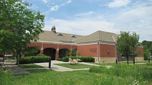
Public libraries
The Grosse Pointe Public Library operates the Carolyn and Ted Ewald Memorial Branch Library in Grosse Pointe Park.[14] The library was scheduled to open in 2004.[15] The 15,000 square feet (1,400 m2) branch was originally scheduled to open in October of that year, but delays moved the opening month to January 2005.[16]
Notable people
- Jane Bashara, marketing executive and murder victim
- Dorothy Marie Donnelly, poet
- Mariela Griffor, author, moved to Grosse Pointe from Chile
- Mark Tremonti, musician
- Anita Baker, singer
- Paul S. Kemp, Author
Images
-
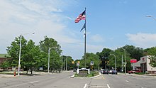 Entrance along Jefferson Avenue
 -
-
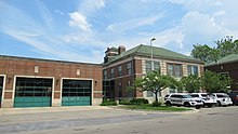 Fire and police department

.jpg)

References
- ^ "2020 U.S. Gazetteer Files". United States Census Bureau. Retrieved May 21, 2022.
- ^ a b "U.S. Census website". United States Census Bureau. Retrieved 2008-01-31.
- ^ U.S. Geological Survey Geographic Names Information System: Grosse Pointe Park, Michigan
- ^ "Race, Hispanic or Latino, Age, and Housing Occupancy: 2010 Census Redistricting Data (Public Law 94-171) Summary File (QT-PL), Grosse Pointe Park city, Michigan". United States Census Bureau. Retrieved September 7, 2011.
- ^ Vanderstelt, Kate (3 Nov 2021). "Park elects first female mayor; all new candidates take council". Grosse Pointe News.
- ^ "History of Grosse Pointe Timeline". gphistorical.org/. Grosse Pointe Historical Society. Retrieved 26 July 2014.
- ^ "US Gazetteer files 2010". United States Census Bureau. Archived from the original on 2012-01-25. Retrieved 2012-11-25.
- ^ "Cabbage Patch skids". Detroit Metro Times. Retrieved 26 May 2015.
- ^ "Census of Population and Housing". Census.gov. Retrieved June 4, 2015.
- ^ "U.S. Census website". United States Census Bureau. Retrieved 2012-11-25.
- ^ "District Map." Grosse Pointe Public School System. Retrieved on January 8, 2017.
- ^ "Zoning Map[permanent dead link]." Grosse Pointe Park, Michigan. Retrieved on January 8, 2017.
- ^ "Home". St. Clare of Montefalco School. Retrieved 2020-05-01.
- ^ "Hours & Location Archived 2010-04-12 at the Wayback Machine." Grosse Pointe Public Library. Retrieved on April 3, 2010.
- ^ "Grosse Pointe Public Library system grows." The Detroit News. January 21, 2004. Retrieved on April 3, 2010.
- ^ "Delays interrupt library work." The Detroit News. October 20, 2004. Retrieved on April 3, 2010.
Further reading
- Detroit & Grosse Pointe Park to Open New Gateway Between Cities—DBusiness, August 18, 2014
- Detroit & Grosse Pointe Park Kercheval Avenue Agreement.—August 18, 2014
External links
Places adjacent to Grosse Pointe Park, Michigan | ||||||||||||||||
|---|---|---|---|---|---|---|---|---|---|---|---|---|---|---|---|---|
| ||||||||||||||||
Municipalities and communities of Wayne County, Michigan, United States | ||
|---|---|---|
| Cities |
|  |
| Charter townships | ||
| Civil townships | ||
| Unincorporated communities | ||
| Footnotes | ‡This populated place also has portions in an adjacent county or counties | |
| Topics | .jpg) | |
|---|---|---|
| Detroit | ||
| Municipalities over 80,000 | ||
| Municipalities 40,000 to 80,000 | ||
| Cultural enclaves | ||
| Satellite cities | ||
| Counties in MSA | ||
| Counties in CSA | ||
| International | |
|---|---|
| National | |
| Geographic | |