
Flakstadøya
 | |
 | |
 Flakstadøya Location of the island  Flakstadøya Flakstadøya (Norway) | |
| Geography | |
|---|---|
| Location | Nordland, Norway |
| Coordinates | 68°04′01″N 13°17′56″E / 68.0670°N 13.2988°E |
| Archipelago | Lofoten |
| Area | 110 km2 (42 sq mi) |
| Length | 20 km (12 mi) |
| Width | 8.5 km (5.28 mi) |
| Highest elevation | 931 m (3054 ft) |
| Highest point | Stjerntinden |
| Administration | |
Norway | |
| County | Nordland |
| Municipality | Flakstad Municipality |
| Demographics | |
| Population | 1119 |
| Pop. density | 10/km2 (30/sq mi) |
Flakstadøya is an island in the Lofoten archipelago in Nordland county, Norway. The entire island lies within Flakstad Municipality with the Vestfjorden on the east side of the island and the Norwegian Sea on the west side of the island.
Geography
The island is connected to the neighboring island of Moskenesøya (to the south and west) by the Kåkern Bridge and Fredvang Bridges. It is connected to the island of Vestvågøya (to the northeast) through the undersea Nappstraum Tunnel. The European route E10 highway crosses the island and connecting to the neighboring islands.[1]
There are several villages on the island including the administrative centre of the municipality, Ramberg, and others such as Fredvang, Nusfjord, Sund, Vikten, and Napp.
Gallery
-
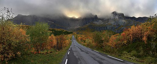 A mountain massif of Flakstadøya island backgrounding the road to Nusfjord village.
 -
 The eastfaces of Stabben, Stortinden and Moltinden in the island of Flakstadøya
 -
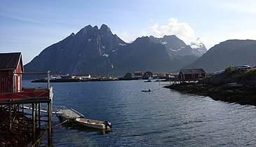 View of the village of Sund
 -
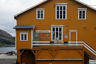 Store in Nusfjord
 -
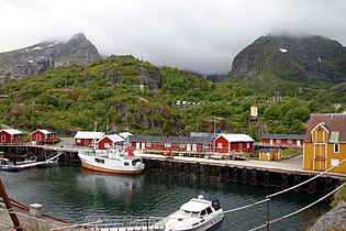 Port of Nusfjord


.jpg)


References
- ^ Store norske leksikon. "Flakstadøya" (in Norwegian). Retrieved 2012-06-14.
External links
 Media related to Flakstadøy at Wikimedia Commons
This article about an island in Nordland is a stub. You can help Wikipedia by expanding it. |