
File:Pondtownmap1908.tif

Size of this JPG preview of this TIF file: 484 × 599 pixels. Other resolutions: 194 × 240 pixels | 388 × 480 pixels | 620 × 768 pixels | 827 × 1,024 pixels | 1,654 × 2,048 pixels | 6,461 × 7,999 pixels.
Original file (6,461 × 7,999 pixels, file size: 295.75 MB, MIME type: image/tiff)
| This is a file from the Wikimedia Commons. Information from its description page there is shown below. Commons is a freely licensed media file repository. You can help. |
Summary
| Description |
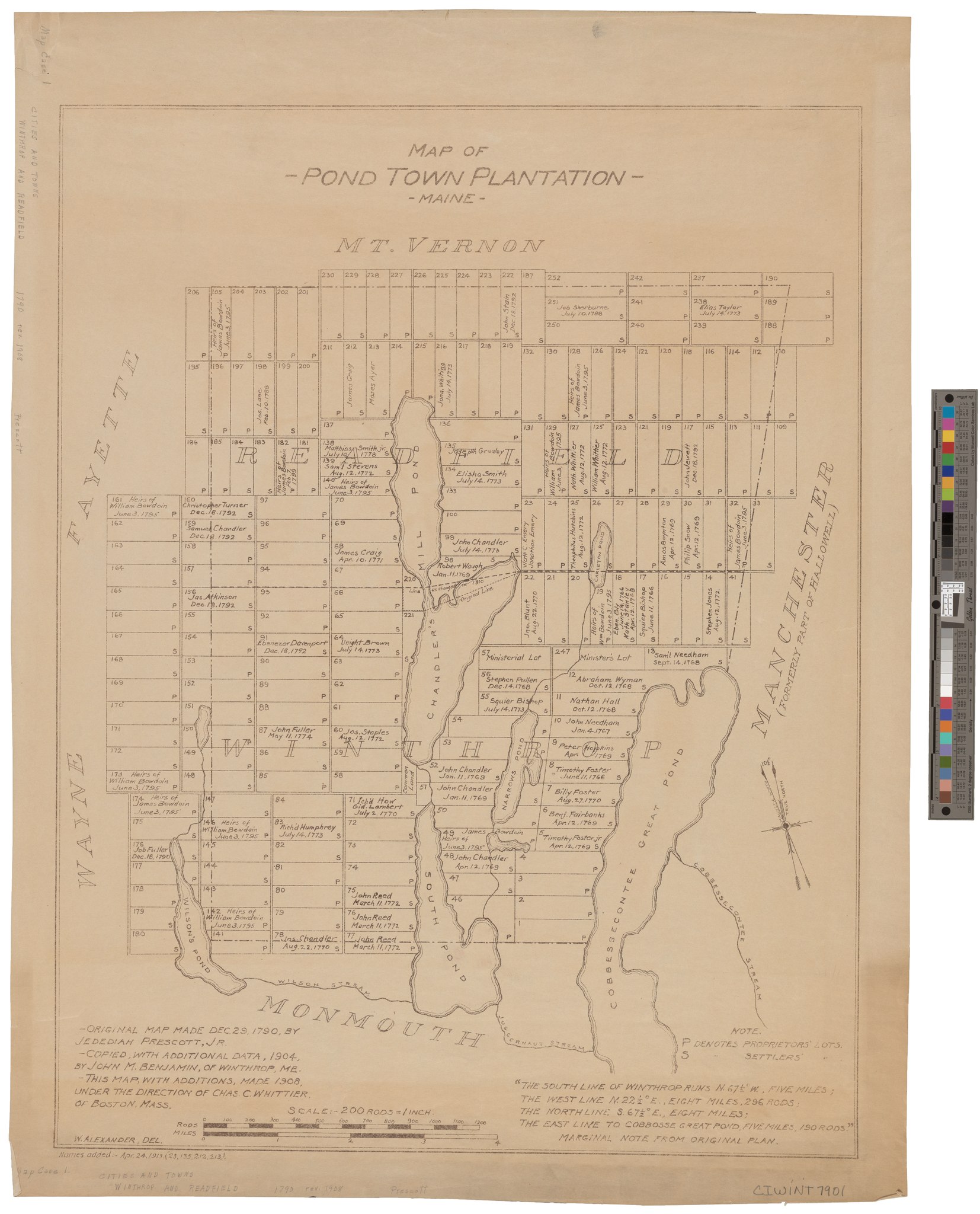
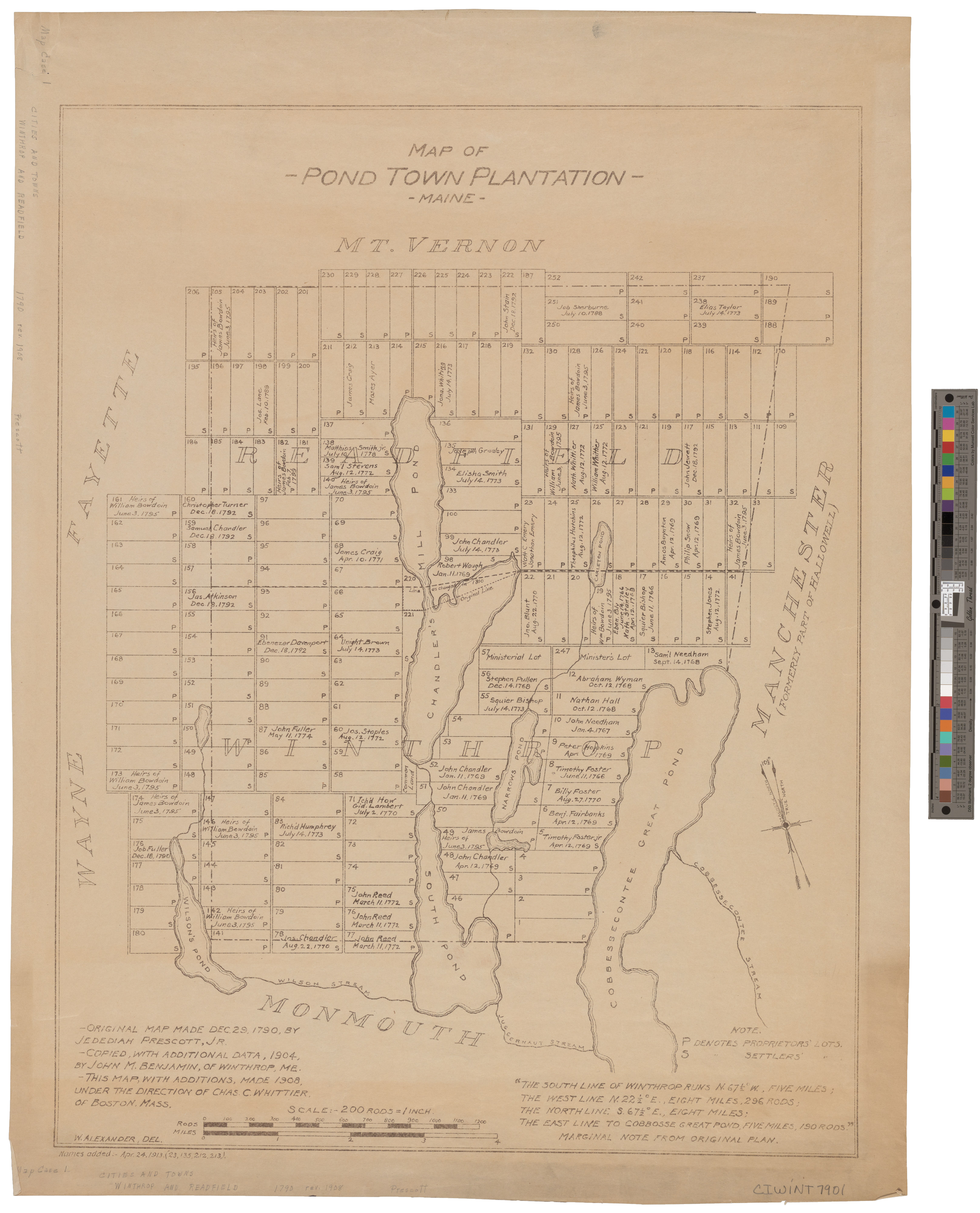
English: 1790 settlers plot map of Pondtown plantation, now Winthrop, Kennebec County, Maine. This is an 1908 copy. |
| Date | |
| Source | https://digitalmaine.com/maps/243/ |
| Author | Map of Pond Town Plantation, Maine. 1908 by Jedediah Brown Prescott. Copy of 1790 printing. |
| Permission (Reusing this file) |
Public Domain |
Licensing
| This map is ineligible for copyright and therefore in the public domain, because it consists entirely of information that is common property and contains no original authorship. For more information, see Commons:Threshold of originality § Maps.
|
File history
Click on a date/time to view the file as it appeared at that time.
| Date/Time | Thumbnail | Dimensions | User | Comment | |
|---|---|---|---|---|---|
| current | 13:44, 11 October 2021 |  | 6,461 × 7,999 (295.75 MB) | Diogenes99 | Uploaded a work by Map of Pond Town Plantation, Maine. 1908 by Jedediah Brown Prescott. Copy of 1790 printing. from https://digitalmaine.com/maps/243/ with UploadWizard |
File usage
The following pages on the English Wikipedia use this file (pages on other projects are not listed):