
Dar Sufeh
Dar Sufeh
درصوفه | |
|---|---|
village | |
 Dar Sufeh | |
| Coordinates: 34°15′47″N 58°27′56″E / 34.26306°N 58.46556°E | |
| Country | |
| Province | Razavi Khorasan |
| County | Gonabad |
| Bakhsh | Kakhk |
| Rural District | Zibad |
| Population (2006) | |
| • Total | 16 |
| Time zone | UTC+3:30 (IRST) |
| • Summer (DST) | UTC+4:30 (IRDT) |
Dar Sufeh (Persian: درصوفه, also Romanized as Dar Şūfeh and Darsūfeh; also known as Darb Sūfeh and Kalāteh-ye Mollā)[1] is a village in Zibad Rural District, Kakhk District, Gonabad County, Razavi Khorasan Province, Iran. At the 2006 census, its population was 16, in 6 families.[2]
References
- ^ Dar Sufeh can be found at GEOnet Names Server, at this link, by opening the Advanced Search box, entering "-3789829" in the "Unique Feature Id" form, and clicking on "Search Database".
- ^ "Census of the Islamic Republic of Iran, 1385 (2006)" (Excel). Statistical Center of Iran. Archived from the original on 2011-09-20.
Gallery
-
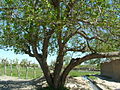
 holy tree
 -
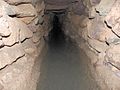
 Zibad Castle
 -
 Zibad Castle
 -
 Zibad Rheum
 -
 Kariz Zebad
 -
 zibad Mountain
 -
 Ferula Zibad
 -
 Sassanian Castel
 -
 Soufe Zibad
 -

-
 Rivas zibad
 -
 Kūh-ZibadZibad Gonabad
 -
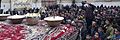 A photograph of Yaldā Night.
 -
 Ancient water clock used in qanat of gonabad 2500 years ago
 -
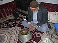 Reconstruction of the scene with a real manager of the water clock, Iran
 -

-

-

-

-

-
-

-

-

-
-
-
-
-

-


| Characters |   .png) | |
|---|---|---|
| Creatures and animals |
| |
| Places | ||
| Structures |
| |
| Manuscripts | ||
| Related | ||
This Gonabad County location article is a stub. You can help Wikipedia by expanding it. |