Culmore, Virginia
This article needs additional citations for verification. (April 2023) |
Culmore, Virginia | |
|---|---|
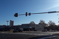
 Culmore Shopping Center in November 2019 | |
| Coordinates: 38°51′21″N 077°08′24″W / 38.85583°N 77.14000°W | |
| Country | United States |
| State | Virginia |
| County | Fairfax |
| Time zone | UTC−5 (Eastern (EST)) |
| • Summer (DST) | UTC−4 (EDT) |
Culmore, Virginia is a small commercial center in Fairfax County, Virginia, United States. It sits between Seven Corners and the Skyline area on State Route 7.[1]
Overview
A part of a larger, unincorporated area known as Bailey's Crossroads, Culmore derives its name from the Culmore Shopping Center which forms its heart. The center is located on the south side of Route 7, or Leesburg Pike, and is situated within the loop formed by Route 7, Glen Carlyn Road, Argyle Drive, and Glen Carlyn Drive.
Culmore Shopping Center contains the Peking Gourmet Inn restaurant, in which President George H.W. Bush dined.
"Culmore" has in recent decades become a place name describing both the shopping center and adjacent buildings, including St. Anthony of Padua Roman Catholic Church and a large group of garden-style apartment homes which are located behind the shopping center. The area is almost entirely inhabited by people of Hispanic, especially Central American, ancestry.
Bailey's Crossroads, in which Culmore Shopping Center is situated, is served by the post office in Falls Church, Virginia and all homes and businesses in the area bear Falls Church postal addresses. Bailey's Crossroads has no local government and falls within the Mason District of the Fairfax County government.[2]
During the American Civil War the Culmore area was the scene of sharpshooting, fighting and repeated skirmishes, particularly during the opening phase of the war when Confederate troops occupied Munson's Hill and Upton's Hill and Culmore formed a "no man's land" between the opposing forces, with Union soldiers encamped to the east.[3]
References
- ^ U.S. Geological Survey Geographic Names Information System: Culmore, Virginia
- ^ "Archived copy" (PDF). Archived from the original (PDF) on 2010-05-27. Retrieved 2010-03-17.
{{cite web}}: CS1 maint: archived copy as title (link) - ^ Bradley E. Gernand, A Virginia Village Goes to War--Falls Church During the Civil War (Donning Company: Virginia Beach, 2002), pp. 16-17, 68-69, 72, 74, 83, 139-141, 205.


