
Charekone
This article needs additional citations for verification. (July 2018) |
Charekone | |
|---|---|
 Charekone Location in Karnataka, India | |
| Coordinates: 14°27′43″N 74°44′47″E / 14.46194°N 74.74639°E | |
| Country | |
| State | Karnataka |
| Region | Malenadu |
| District | Uttara Kannada |
| Educational District | Sirsi |
| Nearest Large City | Sirsi |
| Languages | |
| • Official | Kannada |
| • Dialect | Sirsi Kannada |
| Time zone | UTC+5:30 (IST) |
| PIN | 581xxx |
| Telephone code | +91 0(838x) |
| Vehicle registration | KA 31 Sirsi |
Charekone is a small village in Siddapura Taluk Uttara Kannada District, Karnataka State; Which is about 32 kilometres (20 mi) from Sirsi and 28 kilometres (17 mi) from Siddapur.
It is nestled among the Western Ghats of Karnataka. Areca nut cultivation is the primary occupation of the people in this village.
Demography
Sirsi Kannada Dialect & Havigannada is the spoken language.
Transport
Bus service is provided by KSRTC, which runs buses that connect Charekone to Sirsi.
The nearest railway station is Talaguppa, which is 58 kilometres (36 mi) - connects Shimoga, Mysore, Bangalore, Chennai, Hydrabad etc., and Kumta, which is about 62 kilometres (39 mi) - connects Karwar, Goa, Mumbai, Pune, Mangalore and Kerala.
The nearest airport is Hubli Airport, which connects Bangalore and Mumbai, which is about 140 kilometres (87 mi) from Charekone.
Economy and occupations
The main occupation of the residents is agriculture. Growing Supari (arecanut) is the primary business of the people. Other than arecanut, commodities like paddy, cardamom, coconut and pepper also grown.
-
 Beetle Nut Tree
 -
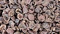 Beetle Nut
 -
 Rice field
 -
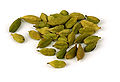 Cardamom
 -
 Coconut
 -
 Betle Leaf
 -
 Pepper Plant
.jpg)


Temples
Nearest temples are Kalleshwara (Shiva) Temple in Magodjaddi Village which is approximately 1 kilometre (0.62 mi) from Charekone, Ganapathi Temple in Heggarabilu Village which is about 2 kilometres (1.2 mi) from Charekone.
Education
- H.P.S Taresar is the Only School near this village - Which is about 1.2 kilometres (0.75 mi) towards Herur
Places to see near Charekone
The region located in the Malnad region, within the Western Ghats. There are forests and hills and waterfalls that are attractive for trekking.
- Unchalli Falls (KeppaJoga) –
- Shri Lakshmi Narasimha Temple, Shriman Nelemavu Mutt.
- Shri Siddivinayaka Temple, Herur
Hospitals
Following hospitals are located Near Charekone.
- Govt Hospital Herur