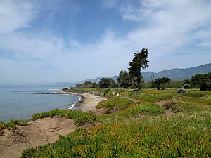
Carpinteria State Beach
Appearance
| Carpinteria State Beach | |
|---|---|
 Carpinteria State Beach coastline | |
| Location | Santa Barbara and Ventura Counties, California, United States |
| Nearest city | Carpinteria, California |
| Coordinates | 34°23′31″N 119°31′16″W / 34.39194°N 119.52111°W |
| Area | 62 acres (25 ha) |
| Established | 1932 |
| Governing body | California Department of Parks and Recreation |
Carpinteria State Beach is a protected beach in the state park system of California, in Santa Barbara County, Southern California.
Features
- Geography
The park is located in the city of Carpinteria, 12 miles (19 km) south of Santa Barbara. The park has 4,685 feet (1,428 m) of beachfront.[1] The address is 205 Palm Ave Carpinteria, CA 93013.
- History
The 62-acre (25 ha) park was established in 1932.[1]
Recreation
Recreational activities include bird watching, ocean swimming, surf fishing, nature walks, camping, and tidepool exploration.[2]

The Carpinteria Harbor Seal Preserve and rookery is located within and south of the park, protecting the Harbor seal (Phoca vitulina). It is one of the four harbor seal rookeries remaining along the Southern California coast.[3]
See also
References
- ^ a b "California State Park System Statistical Report: Fiscal Year 2009/10" (PDF). California State Parks: 18. Retrieved 2011-11-12.
{{cite journal}}: Cite journal requires|journal=(help) - ^ "Carpinteria SB". California State Parks. Archived from the original on 2011-11-02. Retrieved 2011-11-12.
- ^ CarpinteriaCoast.com: Carpinteria Harbor Seal Preserve and rookery . accessed 2.2.2014

External links
Wikimedia Commons has media related to Carpinteria State Beach.


