
Bela Palanka
Bela Palanka
Бела Паланка (Serbian) | |
|---|---|
Town and municipality | |
 View from heights | |
 Coat of arms | |
 Location of the municipality of Bela Palanka within Serbia | |
| Coordinates: 43°13′N 22°19′E / 43.217°N 22.317°E | |
| Country | |
| Region | Southern and Eastern Serbia |
| District | Pirot |
| Settlements | 46 |
| Government | |
| • Mayor | Goran Miljković (SNS) |
| Area | |
| • Urban | 8.28 km2 (3.20 sq mi) |
| • Municipality | 551 km2 (213 sq mi) |
| Elevation | 394 m (1,293 ft) |
| Population (2011 census)[2] | |
| • Town | 8,143 |
| • Town density | 980/km2 (2,500/sq mi) |
| • Municipality | 12,126 |
| • Municipality density | 22/km2 (57/sq mi) |
| Time zone | UTC+1 (CET) |
| • Summer (DST) | UTC+2 (CEST) |
| Postal code | 18310 |
| Area code | +381(0)18 |
| Car plates | PI |
| Website | www |
Bela Palanka (Serbian Cyrillic: Бела Паланка, pronounced [bɛ̂ːlaː pǎlaːŋka]) is a town and municipality located in the Pirot District of southeastern Serbia. According to the 2011 census, the population of the town is 8,143, and the population of the municipality is 12,126. In ancient times, the town was known as Remesiana in Dacia Mediterranea. The name Bela Palanka means 'white town'.
History
Ancient Bela Palanka
The town was originally settled by the Dacians and was known under the ancient name of Aiadava or Aeadaba. Thracians inhabited the area until their assimilation into contemporary ethnic groups in the area.
After the Romans conquered Moesia in 75 BC, the new castrum (imperial domain with estates) and municipium was known initially as Ulpianorum and then Remesiana[3] (Moesi) and stood along the Via Militaris between Naissus and Serdica.
Emperor Justinian had following strongholds in the district of Remesiana:
|
Brittura Subaras Lamponiana Stronges Dalmatas Primiana Phrerraria Topera Tomes Cuas Tzertzenutzas Stens Aeadaba Destreba Pretzouries Cumudeba Deurias Lutzolo Rhepordenes Spelonca Scumbro Briparo Tulcoburgo Longiana Lupophantana Dardapara Burdomina Grinciapana Graecus Drasimarca |
The patron saint of Romania, Nicetas of Remesiana, was a 4th-century bishop at Remesiana. Peter the Hermit was defeated by the Byzantines in the north and regrouped at an evacuated Bela Palanka, gathering the harvest before heading to Constantinople.[4]
Excavations include well-preserved castrum dating to 4th century and a hoard of 260 coins minted during the rule of Constantine I, Theodosius I, Tiberius Claudius Nero.[5] During the 1096 People's Crusade the town, left abandoned by its inhabitants, was briefly occupied by the pilgrims led by Peter the Hermit, Walter of Breteuil and Rainald of Breis.
Ottoman Empire
During the centuries of Ottoman control, Bela Palanka was the site of a major caravanserai (or han) along the Tsarigrad Road. Ottoman authorities ordered the first such caravanserai be built in the settlement (then named Izvor) from wood in 1598-99, during the Long Turkish War, largely due to persistent attacks on travelers by hajduks. This structure deteriorated after a few decades and was replaced by a larger and more durable caravanserai made of stone, commissioned by the local governor, Musa Pasha. This han differed from others in the region because of its large size and because it had separate large rooms for harems of dignitaries. The interior of the han was painted by an artist brought from Buda. To honor its patron, the name of the settlement was then changed to Musa-paša Palanka, from which the town's current name was derived.[6]
Modern Serbia
From 1929 to 1941, Bela Palanka was part of the Morava Banovina of the Kingdom of Yugoslavia.
Geography
Bela Palanka is a small town in the southeast of the country and is surrounded by countryside and mountains such as Golaš. The town is accessible from the nearby city of Niš by the Niš Express buses that run from Niš to Pirot, Babušnica, Dimitrovgrad, and Sofia.
Climate
Bela Palanka has a warm-summer mediterranean climate (Köppen climate classification: Csb), that's very close to a humid subtropical climate (Köppen climate classification: Cfa).
| Climate data for Bela Palanka | |||||||||||||
|---|---|---|---|---|---|---|---|---|---|---|---|---|---|
| Month | Jan | Feb | Mar | Apr | May | Jun | Jul | Aug | Sep | Oct | Nov | Dec | Year |
| Mean daily maximum °C (°F) | 4.6 (40.3) |
6.8 (44.2) |
13.1 (55.6) |
16.8 (62.2) |
21.6 (70.9) |
25.3 (77.5) |
27.6 (81.7) |
27.9 (82.2) |
24.2 (75.6) |
18.1 (64.6) |
10.7 (51.3) |
5.9 (42.6) |
16.9 (62.4) |
| Daily mean °C (°F) | 2.1 (35.8) |
4.2 (39.6) |
6.9 (44.4) |
11.1 (52.0) |
15.7 (60.3) |
19.1 (66.4) |
20.8 (69.4) |
21.2 (70.2) |
17.3 (63.1) |
13.4 (56.1) |
7.8 (46.0) |
3.8 (38.8) |
12.0 (53.5) |
| Mean daily minimum °C (°F) | −0.3 (31.5) |
1.2 (34.2) |
2.7 (36.9) |
6.4 (43.5) |
10.8 (51.4) |
13.9 (57.0) |
16.1 (61.0) |
15.9 (60.6) |
11.5 (52.7) |
8.7 (47.7) |
4.0 (39.2) |
1.2 (34.2) |
7.7 (45.8) |
| Average precipitation mm (inches) | 43 (1.7) |
42 (1.7) |
58 (2.3) |
68 (2.7) |
63 (2.5) |
44 (1.7) |
38 (1.5) |
35 (1.4) |
39 (1.5) |
40 (1.6) |
55 (2.2) |
52 (2.0) |
577 (22.8) |
| Source: Climate-Data.org [7] | |||||||||||||
Settlements
Aside from the town of Bela Palanka, the municipality consists of the following villages:
Demographics
| Year | Pop. | ±% p.a. |
|---|---|---|
| 1948 | 29,641 | — |
| 1953 | 28,756 | −0.60% |
| 1961 | 24,982 | −1.74% |
| 1971 | 21,325 | −1.57% |
| 1981 | 18,744 | −1.28% |
| 1991 | 16,447 | −1.30% |
| 2002 | 14,381 | −1.21% |
| 2011 | 12,126 | −1.88% |
| Source: [8] | ||
According to the 2011 census results, the municipality has 12,126 inhabitants.
Ethnic groups
The ethnic composition of the municipality:
| Ethnic group | Population | % |
|---|---|---|
| Serbs | 10,395 | 85.94% |
| Romani | 1,418 | 11.72% |
| Muslims | 10 | 0.08% |
| Macedonians | 8 | 0.07% |
| Bulgarians | 8 | 0.07% |
| Others | 257 | 2.12% |
| Total | 12,126 |
Economy
The following table gives a preview of total number of registered people employed in legal entities per their core activity (as of 2018):[9]
| Activity | Total |
|---|---|
| Agriculture, forestry and fishing | 14 |
| Mining and quarrying | 41 |
| Manufacturing | 371 |
| Electricity, gas, steam and air conditioning supply | 15 |
| Water supply; sewerage, waste management and remediation activities | 70 |
| Construction | 173 |
| Wholesale and retail trade, repair of motor vehicles and motorcycles | 232 |
| Transportation and storage | 69 |
| Accommodation and food services | 92 |
| Information and communication | 20 |
| Financial and insurance activities | 13 |
| Real estate activities | - |
| Professional, scientific and technical activities | 55 |
| Administrative and support service activities | 45 |
| Public administration and defense; compulsory social security | 141 |
| Education | 159 |
| Human health and social work activities | 120 |
| Arts, entertainment and recreation | 66 |
| Other service activities | 78 |
| Individual agricultural workers | 23 |
| Total | 1,798 |
Gallery
-
 Bela Palanka by night
 -
 Fountain
 -
 Spring
 -

-
 Basilica Apse under excavation in Remesiana
 -
 3rd century Septimius Severus monument in Bela Palanka.
 -
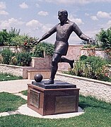 Rajko Mitić Monument


See also
References
- ^ "Municipalities of Serbia, 2006". Statistical Office of Serbia. Retrieved 2010-11-28.
- ^ "2011 Census of Population, Households and Dwellings in the Republic of Serbia: Comparative Overview of the Number of Population in 1948, 1953, 1961, 1971, 1981, 1991, 2002 and 2011, Data by settlements" (PDF). Statistical Office of Republic Of Serbia, Belgrade. 2014. ISBN 978-86-6161-109-4. Retrieved 2014-06-27.
- ^ "Roma Victrix". Archived from the original on 2011-07-15. Retrieved 2011-01-23.
- ^ God's war: a new history of the Crusades-Christopher Tyerman 2006
- ^ Ancient diseases: the elements of palaeopathology-Srboljub Živanović 1982
- ^ Florian Riedler; Nenad Stefanov (6 April 2021). The Balkan Route: Historical Transformations from Via Militaris to Autoput. De Gruyter. ISBN 978-3-11-061706-1.
- ^ "Climate: Bela Palanka, Serbia". Climate-Data.org. Retrieved 16 February 2018.
- ^ "2011 Census of Population, Households and Dwellings in the Republic of Serbia" (PDF). stat.gov.rs. Statistical Office of the Republic of Serbia. Archived from the original (PDF) on 14 July 2014. Retrieved 6 March 2017.
- ^ "MUNICIPALITIES AND REGIONS OF THE REPUBLIC OF SERBIA, 2019" (PDF). stat.gov.rs. Statistical Office of the Republic of Serbia. 25 December 2019. Retrieved 28 December 2019.
External links

| International | |
|---|---|
| National | |