Muhima: Difference between revisions
Appearance
Content deleted Content added
JJMC89 bot (talk | contribs) m Remove {{drafts moved from mainspace}} |
Task 4: Remove Template:Draft categories from mainspace article |
||
| Line 75: | Line 75: | ||
{{Authority control}} |
{{Authority control}} |
||
| ⚫ | |||
{{Draft categories| |
|||
| ⚫ | |||
}} |
|||
{{rwanda-geo-stub}} |
{{rwanda-geo-stub}} |
||
Revision as of 05:08, 9 December 2023
Muhima | |
|---|---|
| Coordinates: 1°56′9″S 30°3′12″E / 1.93583°S 30.05333°E | |
| Country | |
| Province | Kigali Province |
| District | Nyarugenge |
| Area | |
| • Total | 2.944 km2 (1.137 sq mi) |
| Population (2022 census) | |
| • Total | 22,531 |
| • Density | 7,700/km2 (20,000/sq mi) |
| (2022 census) | |
| Time zone | UTC+2 (CAT) |
| • Summer (DST) | UTC+2 (not observed) |
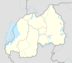
Muhima is a sector (umurenge) in the Kigali Province, Nyarugenge district, Rwanda.[1] It is located in the southwest part of the city of Kigali.
Sectors
Nyarugenge district is divided into 10 sectors (imirenge): Gitega, Kanyinya, Kigali, Kimisagara, Mageragere, Muhima, Nyakabanda, Nyamirambo, Nyarugenge, and Rwezamenyo.[2]
References
- ^ "Muhima (Sector, Rwanda) - Population Statistics, Charts, Map and Location". www.citypopulation.de. Retrieved 2023-12-08.
- ^ "nyarugenge.gow.rw".

