
File:Water receedes on the Darling River (MODIS).jpg

Original file (1,267 × 1,391 pixels, file size: 208 KB, MIME type: image/jpeg)
| This is a file from the Wikimedia Commons. Information from its description page there is shown below. Commons is a freely licensed media file repository. You can help. |
.jpg)
Summary
| Description |
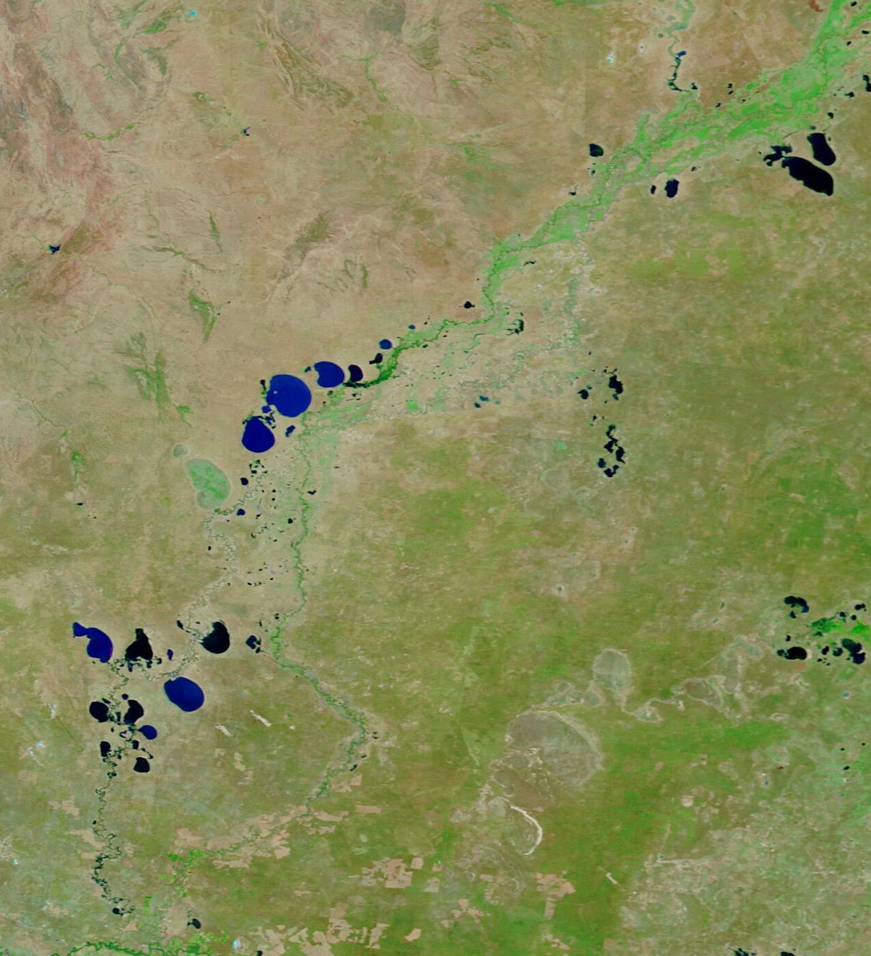
English: In 2022, New South Wales suffered both a wet spring and an exceptionally soggy winter, creating widespread flooding, especially in the Murray and Darling Rivers. According to Australia’s ABC News, more than 200 kilometers (124 miles) of the Darling River had burst its banks since the middle of 2022, bringing flood levels not since 1976. By March 2023, the floodwaters along the Darling River have finally begun to recede.
Today’s Image of the Day shows a comparison of two false-color images acquired by the Moderate Resolution Imaging Spectroradiometer (MODIS) on board NASA’s Terra satellite. The first was acquired on January 17, 2023, when the Darling River remained in heavily flood stage. In the second, acquired on March 18, 2023, the water in the Darling has returned to nearly normal, except for some large pockets of water along the river’s course. In this type of false-color image, water appears dark blue, vegetation bright green, and open land is tan. Flood-and-drought cycles are common along the Darling. As recently as 2019, drought reduced the river to such low levels that hundreds of fish died. Now, after a good water year in 2021 and exceptional floods in 2022, fish populations are on the rise, especially the invasive carp species that lives in the river channel. As the river begins to slowly return to its bank, it is likely that many of the carp will get trapped on land and perish—creating a stench at first, but ultimately enriching the soils. Much of the floodplains along the Darling are used for agriculture, such as croplands or pasture. In dry years, high air temperature and low soil moisture can make for scrubby pasture and low crop yields. This year, farmers are have reason to be hopeful of bumper crops and rich pasture, thanks to the moisture brought by the floods. |
||
| Date | Taken on 18 March 2023 | ||
| Source |
Water receedes on the Darling River (direct link)
|
||
| Author | MODIS Land Rapid Response Team, NASA GSFC |
| This media is a product of the Terra mission Credit and attribution belongs to the mission team, if not already specified in the "author" row |
Licensing
| This file is in the public domain in the United States because it was solely created by NASA. NASA copyright policy states that "NASA material is not protected by copyright unless noted". (See Template:PD-USGov, NASA copyright policy page or JPL Image Use Policy.) | ||
 |
Warnings:
|
File history
Click on a date/time to view the file as it appeared at that time.
| Date/Time | Thumbnail | Dimensions | User | Comment | |
|---|---|---|---|---|---|
| current | 20:01, 31 July 2023 | | 1,267 × 1,391 (208 KB) | OptimusPrimeBot | #Spacemedia - Upload of http://modis.gsfc.nasa.gov/gallery/images/image03222023_250m.jpg via Commons:Spacemedia |
.jpg)