
Search results
There is a page named "File:Wales locator.png" on Wikipedia
 DescriptionWales locator.png English: Wales locator Equirectangular projection, N/S stretching 163 %. Geographic limits of the map: N: 53.5° N S: 51.3°...(414 × 494 (71 KB)) - 11:57, 17 July 2024
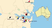 Derivative of File:NSWRL 1908.png, which used File:New South Wales locator-MJC.png. English...(727 × 392 (121 KB)) - 13:40, 14 February 2023
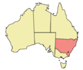 Map of Australia highlighting New South Wales Made in Adobe Illustrator by Martynam and released under the GFDL English...(563 × 476 (12 KB)) - 14:02, 30 October 2021
 This PNG graphic was created with GIMP. English Locator map for South East Australia and New Zealand determination method: SHA-1...(682 × 512 (29 KB)) - 02:48, 20 July 2024
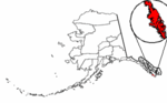 University of Texas at Austin, modified to show counties. http://en.wikipedia.org/wiki/Image:Map_of_Alaska_highlighting_Prince_of_Wales_Island.png English...(300 × 186 (8 KB)) - 11:29, 23 December 2023
 Location of Swansea City and County. From en:WalesSwansea.png English...(200 × 225 (13 KB)) - 16:32, 6 October 2020
 {{Information |Description= {{de|Lagekarte von Powys in Wales}} {{en|Locator map of Powys in Wales}} |Source={{Own}} |Date=2010-05-04 |Author={{U|NordNordWest}}...(1,043 × 1,253 (151 KB)) - 11:08, 31 May 2023
 image is a derivative work of the following images: File:Melaka__state_locator.PNG licensed with PD-self 2007-08-21T11:49:05Z Kawaputra 3000x1025 (120591...(1,560 × 1,021 (105 KB)) - 12:00, 8 June 2023
 Blaenau Gwent. == Licensing == {{PD-self}} [[Category:Locator maps of parliamentary constituencies of Wales]] {{ImageUpload|basic}} Uploaded with derivativeFX...(317 × 343 (29 KB)) - 04:05, 27 December 2023
 org/licenses/by-sa/4.0CC BY-SA 4.0 Creative Commons Attribution-Share Alike 4.0 truetrue English Numbered ward locator map of Newport, Wales (2022)...(1,242 × 1,152 (304 KB)) - 10:07, 20 September 2022
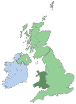 Great Britain with Wales on darker green, remake of [1]. English...(290 × 396 (10 KB)) - 16:08, 6 February 2021
 Map indicating Prince of Wales Strait, Northwest Territories, Canada. Nunavut Northwest Territories Yukon Territory Regions outside Canada (Alaska...(428 × 380 (66 KB)) - 07:41, 7 November 2021
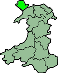 following user names refer to en.wikipedia. one of the traditional counties of Wales Legend: (cur) = this is the current file, (del) = delete this old version...(200 × 250 (24 KB)) - 21:46, 23 April 2024
 Attribution-Share Alike 4.0 truetrue English Numbered ward locator map of Cardiff, Wales (2022) author name string: Sionk Wikimedia username: Sionk URL:...(800 × 571 (135 KB)) - 21:41, 2 February 2024
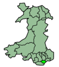 Cardiff in Wales Map by en:User:Morwen Русский: Карта_Кардифф English...(200 × 225 (13 KB)) - 22:28, 10 September 2020
 Ceredigion in Wales Map by en:User:Morwen Русский: Карта_Кередигион English...(200 × 225 (12 KB)) - 07:10, 21 October 2020
 The historic counties of Wales from [1], created by User:Morwen, GNU FDL. English...(400 × 499 (61 KB)) - 17:57, 6 March 2021
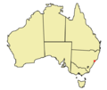 en.wikipedia. 2005-10-10 21:47 Martyman 563×476×8 (11928 bytes) Map of Australia locating Newcastle. Created by me and released under the GFDL English...(563 × 476 (12 KB)) - 01:12, 13 May 2024
 description page was here. All following user names refer to en.wikipedia. 2004-01-22 19:30 Morwen 200×249× (19800 bytes) preserved county of Wales English...(200 × 249 (19 KB)) - 21:20, 23 April 2024
 2005-11-28 19:29 Morwen 400×490× (20119 bytes) Numbered (well, coded) districts of Wales. Based on one of [[User:Keith_Edkins]]'s maps originally. English...(400 × 490 (20 KB)) - 02:26, 10 December 2020


