
Search results
There is a page named "File:Vermont 14.svg" on Wikipedia
 DescriptionVermont 14.svg English: 24 in by 24 in (600 mm by 600 mm) Vermont Route shield, made to the specifications of the 1995 VAOT sign drawing. Uses...(384 × 384 (6 KB)) - 08:38, 20 April 2022
 | 1567×2550 | {{Information |Description=Map of Girl Scout Council in Vermont |Source=my work based on wikipedia county map |Date=2009-02-20 |Author=Emma...(1,567 × 2,550 (90 KB)) - 03:46, 6 January 2021
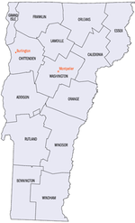 248×408× (33626 bytes) 2003-01-12 05:49 Dachshund 248×408× (46956 bytes) Smaller version of Vermont county map (from PD image) English Vermont county map...(248 × 408 (33 KB)) - 03:24, 15 January 2024
 File:Arlington vt highlight.png (category Locator maps of cities in Vermont)Dimensions | Comment 2004-03-27 03:14 (UTC) | Redjar | 35663 (bytes) | 465×744 | Vermont town map with town highlight 2004-03-22 14:05 (UTC) | Redjar | 40603 (bytes)...(465 × 744 (35 KB)) - 15:43, 14 September 2023
 File:Brighton vt highlight.png (category Brighton, Vermont)following user names refer to en.wikipedia. 2004-03-27 12:14 Redjar 465×744×8 (35767 bytes) Vermont town map with town highlight English determination method:...(465 × 744 (35 KB)) - 06:04, 23 December 2023
 File:Baltimore vt highlight.png (category Baltimore, Vermont)35657 (bytes) | 465×744 | Vermont town map with town highlight 2004-03-22 14:49 (UTC) | Redjar | 40600 (bytes) | 445×724 | Vermont towns map with Baltimore...(465 × 744 (35 KB)) - 06:20, 28 October 2023
 File:Athens vt highlight.png (category Athens, Vermont)following user names refer to en.wikipedia. 2004-03-27 03:14 Redjar 465×744× (35696 bytes) Vermont town map with town highlight English determination method:...(465 × 744 (35 KB)) - 11:22, 29 September 2023
 legislation in Vermont takes effect, civil unions will no longer be offered. Make Vermont solid marriage (actually it still really uses stripes in the SVG, if you...(959 × 593 (95 KB)) - 06:16, 23 March 2023
 0 %. Geographische Begrenzung der Karte: * N: 45.5° N * File:USA Vermont location map.svg licensed with Cc-by-3.0, GFDL 2009-06-14T11:53:24Z Alexrk2 1277x2100...(13,310 × 6,935 (10.66 MB)) - 09:41, 11 January 2024
 140.0 %. Geographische Begrenzung der Karte: * N: 45.5° N * USA Vermont location map.svg licensed with Cc-by-3.0, GFDL 2009-06-14T11:53:24Z Alexrk2 1277x2100...(13,310 × 6,935 (9.24 MB)) - 09:40, 11 January 2024
 1� File:USA Vermont location map.svg licensed with Cc-by-3.0, GFDL 2009-06-14 11:53:24 Alexrk2 1277x2100 (265267 Bytes) minor enh 2009-06-14 11:17:38 Alexrk2...(2,129 × 1,573 (646 KB)) - 14:27, 5 April 2024
 0 %. Geographische Begrenzung der Karte: * N: 45.5° N * File:USA Vermont location map.svg licensed with Cc-by-3.0, GFDL 2009-06-14T11:53:24Z Alexrk2 1277x2100...(3,485 × 3,355 (930 KB)) - 07:18, 30 October 2020
 Geographische Begrenzung der Karte: * N: 42.7° N * S File:USA Vermont location map.svg licensed with Cc-by-3.0, GFDL 2009-06-14T11:53:24Z Alexrk2 1277x2100...(1,705 × 1,823 (812 KB)) - 10:16, 11 October 2020
 Begrenzung der Karte: * N: 42.2° N * S: 41.0° N * W: 72.1� File:USA Vermont location map.svg licensed with Cc-by-3.0, GFDL 2009-06-14T11:53:24Z Alexrk2 1277x2100...(734 × 721 (154 KB)) - 23:29, 18 December 2020
 choice. This image is a derivative work of the following images: File:Vermont_Locator_Map.PNG licensed with Cc-by-sa-2.5, Cc-by-sa-3.0-migrated, GFDL...(744 × 1,052 (6 KB)) - 22:00, 23 November 2022
 is a derivative work of the following images: File:2010_House_elections.svg licensed with PD-self 2010-12-08T21:59:10Z Kurykh 2583x1557 (647548 Bytes)...(830 × 544 (24 KB)) - 12:13, 16 January 2024
 images: File:Blank_US_Map.svg licensed with GFDL 2008-10-09T16:36:40Z Howcheng 959x593 (80121 Bytes) Reverted to version as of 08:32, 14 June 2007 2008-03-12T00:20:02Z...(959 × 593 (202 KB)) - 14:57, 24 January 2022
 0 %. Geographische Begrenzung der Karte: * N: 45.5° N * File:USA Vermont location map.svg licensed with Cc-by-3.0, GFDL 2009-06-14T11:53:24Z Alexrk2 1277x2100...(1,114 × 1,758 (321 KB)) - 17:14, 20 February 2024
 0 %. Geographische Begrenzung der Karte: * N: 45.5° N * File:USA Vermont location map.svg licensed with Cc-by-3.0, GFDL 2009-06-14T11:53:24Z Alexrk2 1277x2100...(3,289 × 4,039 (1.68 MB)) - 15:23, 9 November 2023
 8 286 186 Pennsylvania 240 50 8 8 286 186 New York 252 36 8 8 286 186 Vermont 259 40 8 8 286 186 New Hampshire 263 48 8 8 286 186 Massachusetts 263 56...(286 × 186 (137 KB)) - 08:33, 15 February 2021


.png)


