
Search results
There is a page named "File:Tandridge UK political composition map.svg" on Wikipedia
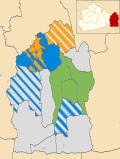 image is a derivative work of the following images: File:Tandridge_UK_ward_map_2010_(blank).svg licensed with Cc-by-sa-3.0 2011-04-25T00:02:35Z Nilfanion...(956 × 1,266 (415 KB)) - 19:30, 30 May 2023
 DescriptionTandridge UK ward map 2010 (blank).svg Map of Tandridge, Surrey, UK with electoral wards shown. Equirectangular map projection on WGS 84 datum...(956 × 1,266 (378 KB)) - 08:31, 27 October 2020

.svg)