
File:South America-fr.svg

Size of this PNG preview of this SVG file: 528 × 600 pixels. Other resolutions: 211 × 240 pixels | 423 × 480 pixels | 676 × 768 pixels | 901 × 1,024 pixels | 1,803 × 2,048 pixels | 530 × 602 pixels.
Original file (SVG file, nominally 530 × 602 pixels, file size: 166 KB)
| This is a file from the Wikimedia Commons. Information from its description page there is shown below. Commons is a freely licensed media file repository. You can help. |
Summary
| Description |
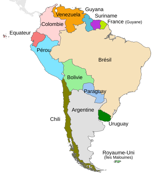
English: Political map of South America. Français : Carte politique de l'Amérique du Sud. |
||
| Date | |||
| Source |
This file was derived from: South America-en.svg: |
||
| Author | DavoO Themightyquill Sémhur | ||
| SVG development |
|
| Object location | | View this and other nearby images on: OpenStreetMap |
|---|
Licensing
I, the copyright holder of this work, hereby publish it under the following license:
This file is licensed under the Creative Commons Attribution-Share Alike 3.0 Unported license.
- You are free:
- to share – to copy, distribute and transmit the work
- to remix – to adapt the work
- Under the following conditions:
- attribution – You must give appropriate credit, provide a link to the license, and indicate if changes were made. You may do so in any reasonable manner, but not in any way that suggests the licensor endorses you or your use.
- share alike – If you remix, transform, or build upon the material, you must distribute your contributions under the same or compatible license as the original.
Original upload log
This image is a derivative work of the following images:
- South America-en.svg licensed with Cc-by-sa-3.0
- 2010-12-23T14:03:31Z Kmusser 530x602 (186901 Bytes) delete square
- 2010-12-22T11:02:38Z Themightyquill 530x602 (187024 Bytes) unexplained black square?
- 2010-12-22T11:00:03Z Themightyquill 530x602 (187024 Bytes) Falklands, central america connection
- 2010-12-22T10:28:23Z Themightyquill 530x602 (168629 Bytes) move "argentina"
- 2010-12-22T10:27:05Z Themightyquill 530x602 (168627 Bytes) fix spelling
- 2010-12-22T10:24:02Z Themightyquill 530x602 (168233 Bytes) {{Information |Description={{en|Map of countries in South America}} |Source=*[[:File:Map-Latin_America.svg|]] |Date=2010-12-22 10:23 (UTC) |Author=*[[:File:Map-Latin_America.svg|]]: *[[:File:Map-Latin_America2.png|Map-Latin_A
Uploaded with derivativeFX
File history
Click on a date/time to view the file as it appeared at that time.
| Date/Time | Thumbnail | Dimensions | User | Comment | |
|---|---|---|---|---|---|
| current | 19:05, 21 May 2014 | | 530 × 602 (166 KB) | Sémhur | Valid SVG |
| 20:44, 2 June 2012 |  | 530 × 602 (167 KB) | Sémhur | == {{int:filedesc}} == {{Information |Description={{Multilingual description |en= Political map of en:South America. |fr= Carte politique de l'fr:Amérique du Sud. }} |Source={{Derived from|South_America-en.svg|display=50}} |Date=2012-06-02... |
File usage
No pages on the English Wikipedia use this file (pages on other projects are not listed).
Global file usage
The following other wikis use this file:
- Usage on fr.wikipedia.org
- Usage on ht.wikipedia.org
- Usage on ie.wikipedia.org
- Usage on mg.wikipedia.org
- Usage on pcd.wikipedia.org