
File:Regions and Prefectures of Japan no labels.svg

Size of this PNG preview of this SVG file: 671 × 600 pixels. Other resolutions: 268 × 240 pixels | 537 × 480 pixels | 859 × 768 pixels | 1,145 × 1,024 pixels | 2,291 × 2,048 pixels | 831 × 743 pixels.
Original file (SVG file, nominally 831 × 743 pixels, file size: 670 KB)
| This is a file from the Wikimedia Commons. Information from its description page there is shown below. Commons is a freely licensed media file repository. You can help. |
Summary
| Description |
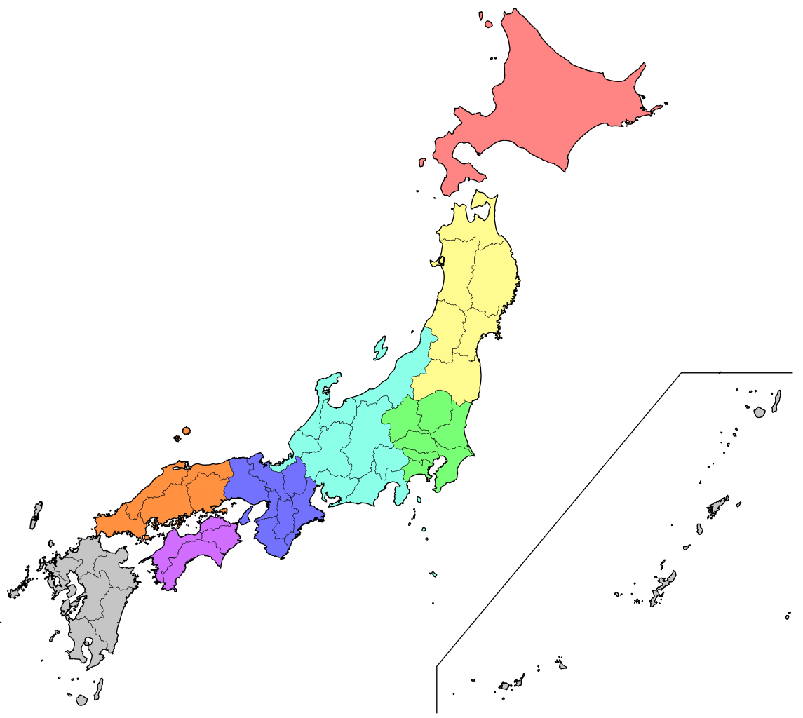
Deutsch: Karte der Regionen und Präfekturen Japans ohne Beschriftung.
English: Map of the regions and prefectures of Japan without labels.
Français : Carte des régions et préfectures du Japon sans inscriptions. |
||
| Date | |||
| Source |
This file was derived from: Niigata in Japan.svg |
||
| Author |
|
||
| Permission (Reusing this file) |
I, the copyright holder of this work, hereby publish it under the following licenses:
This file is licensed under the Creative Commons Attribution-Share Alike 4.0 International license.
You may select the license of your choice. |
||
| Other versions |
[]
|
||
| SVG development | This vector image was created with Adobe Illustrator. |


.svg)
.svg)
.svg)
.svg)


.svg)


.png)

.png)
.svg)

.svg)


File history
Click on a date/time to view the file as it appeared at that time.
| Date/Time | Thumbnail | Dimensions | User | Comment | |
|---|---|---|---|---|---|
| current | 09:37, 7 January 2018 | | 831 × 743 (670 KB) | Furfur | a more detailed map ... |
| 20:33, 28 May 2017 |  | 760 × 1,000 (51 KB) | Furfur | Detail | |
| 19:30, 28 May 2017 |  | 760 × 1,000 (51 KB) | Furfur | == {{int:filedesc}} == {{Information |Description={{User:Medium69/Traduction}} {{de|1=Karte der Regionen und Präfekturen Japans ohne Beschriftung.}} {{en|1=Map of the regions and prefectures of Japan withour labels.}} {{fr|Carte des régions et préfe... |
File usage
The following pages on the English Wikipedia use this file (pages on other projects are not listed):
- List of municipal flags of Chūbu region
- List of municipal flags of Chūgoku region
- List of municipal flags of Hokkaidō
- List of municipal flags of Kansai region
- List of municipal flags of Kantō region
- List of municipal flags of Kyūshū
- List of municipal flags of Shikoku
- List of municipal flags of Tōhoku region
- List of regions of Japan
Global file usage
The following other wikis use this file:
- Usage on af.wikipedia.org
- Kioesjoe
- Sjikokoe
- Hokkaido
- Prefekture van Japan
- Tokio
- Sjabloon:Prefekture van Japan
- Akita-prefektuur
- Aomori-prefektuur
- Fukushima-prefektuur
- Iwate-prefektuur
- Miyagi-prefektuur
- Yamagata-prefektuur
- Chiba-prefektuur
- Gunma-prefektuur
- Ibaraki-prefektuur
- Kanagawa-prefektuur
- Saitama-prefektuur
- Tochigi-prefektuur
- Aichi-prefektuur
- Fukui-prefektuur
- Gifu-prefektuur
- Ishikawa-prefektuur
- Nagano-prefektuur
- Niigata-prefektuur
- Shizuoka-prefektuur
- Toyama-prefektuur
- Yamanashi-prefektuur
- Hyogo-prefektuur
- Kioto-prefektuur
- Mie-prefektuur
- Nara-prefektuur
- Osaka-prefektuur
- Shiga-prefektuur
- Wakayama-prefektuur
- Hiroshima-prefektuur
- Okayama-prefektuur
- Shimane-prefektuur
- Tottori-prefektuur
- Yamaguchi-prefektuur
- Ehime-prefektuur
- Kagawa-prefektuur
- Kochi-prefektuur
- Tokushima-prefektuur
- Fukuoka-prefektuur
- Kagoshima-prefektuur
- Kumamoto-prefektuur
- Miyazaki-prefektuur
- Nagasaki-prefektuur
- Oita-prefektuur
- Saga-prefektuur
View more global usage of this file.