
Search results
There is a page named "File:Regional Ambassadors Map.png" on Wikipedia
 map of the United States in scalable vector form. |Source=Own work, based on [[:Image:Electorial map.svg]], inspired by [[:Image:BlankMap-World.png]]...(2,000 × 1,237 (256 KB)) - 13:01, 11 September 2020
 The map was created using ArcMap 10 and exporting out a PNG file. This map is provided "as is", without warranty of any kind, express or implied, including...(3,300 × 2,100 (158 KB)) - 20:28, 28 September 2022
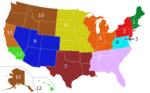 DescriptionRegional Ambassadors Map Proposal.png English: A map showing proposal for regions for the regional ambassadors Date 11 April 2011 Source This...(2,000 × 1,237 (242 KB)) - 13:17, 1 November 2023
 map of the United States in scalable vector form. |Source=Own work, based on [[:Image:Electorial map.svg]], inspired by [[:Image:BlankMap-World.png]]...(959 × 653 (152 KB)) - 21:23, 14 August 2024
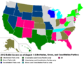 map of the United States in scalable vector form. |Source=Own work, based on [[:Image:Electorial map.svg]], inspired by [[:Image:BlankMap-World.png]]...(979 × 749 (83 KB)) - 03:18, 2 October 2023
 File:Black % by U.S. state 1990.svg (category Maps of ethnic groups in the United States)map of the United States in scalable vector form. |Source=Own work, based on [[:Image:Electorial map.svg]], inspired by [[:Image:BlankMap-World.png]]...(744 × 484 (261 KB)) - 14:45, 25 November 2023
 File:Black % by U.S. state 1900.svg (category Maps of ethnic groups in the United States)map of the United States in scalable vector form. |Source=Own work, based on [[:Image:Electorial map.svg]], inspired by [[:Image:BlankMap-World.png]]...(749 × 527 (168 KB)) - 14:45, 25 November 2023
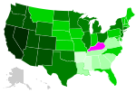 File:Black population % change by U.S. state 1900 1990.svg (category Maps of ethnic groups in the United States)map of the United States in scalable vector form. |Source=Own work, based on [[:Image:Electorial map.svg]], inspired by [[:Image:BlankMap-World.png]]...(744 × 508 (176 KB)) - 01:06, 26 November 2023
 File:Europe Jewish population % change 1945 2010.svg (category Invalid SVG created with Other tools:Maps)map of the United States in scalable vector form. |Source=Own work, based on [[:Image:Electorial map.svg]], inspired by [[:Image:BlankMap-World.png]]...(2,458 × 2,048 (450 KB)) - 18:17, 5 September 2022
 File:State of Deseret, vector image - 2011.svg (category Maps of the territorial evolution of Utah)map of the United States in scalable vector form. |Source=Own work, based on [[:Image:Electorial map.svg]], inspired by [[:Image:BlankMap-World.png]]...(371 × 398 (19 KB)) - 13:40, 12 November 2022
 File:State of Deseret, vector image cropped - 2011.svg (category Maps of the territorial evolution of Utah)map of the United States in scalable vector form. |Source=Own work, based on [[:Image:Electorial map.svg]], inspired by [[:Image:BlankMap-World.png]]...(320 × 310 (29 KB)) - 13:41, 12 November 2022
 File:112th United States Congress 2nd Session Senate Vote 251.svg (category Invalid SVG created with Other tools:World maps)map of the United States in scalable vector form. |Source=Own work, based on [[:Image:Electorial map.svg]], inspired by [[:Image:BlankMap-World.png]]...(512 × 512 (241 KB)) - 02:36, 23 March 2023
 File:Emigrant trails - Various emigrant trails showing California gold fields.svg (category Maps of the Oregon Trail)map of the United States in scalable vector form. |Source=Own work, based on [[:Image:Electorial map.svg]], inspired by [[:Image:BlankMap-World.png]]...(282 × 291 (97 KB)) - 12:44, 23 August 2022
 File:Swing states 2012.svg (category SVG maps of the United States)map of the United States in scalable vector form. |Source=Own work, based on [[:Image:Electorial map.svg]], inspired by [[:Image:BlankMap-World.png]]...(929 × 588 (174 KB)) - 02:02, 2 September 2023
 File:Borders of Four Corners, USA survey years.svg (category Maps of the Southwestern United States)map of the United States in scalable vector form. |Source=Own work, based on [[:Image:Electorial map.svg]], inspired by [[:Image:BlankMap-World.png]]...(240 × 250 (63 KB)) - 21:30, 28 February 2024
 File:Evolution of borders at Four Corners, USA - June 2013.gif (category Maps of the territorial evolution of Utah)map of the United States in scalable vector form. |Source=Own work, based on [[:Image:Electorial map.svg]], inspired by [[:Image:BlankMap-World.png]]...(1,000 × 758 (617 KB)) - 11:20, 25 October 2023
 File:RL34086 (IA RL34086-crs).pdf (matches file content)Australia’s regional interests focus on the islands south of the equator, including the relatively large Melanesian nations of Papua New Guinea (PNG) and the...(1,239 × 1,752 (403 KB)) - 06:00, 14 February 2023
 File:Integrating Defense, Diplomacy, and Development (3 D) in the Naval Special Warfare operator (IA integratingdefen109455002).pdf (matches file content)Public Affairs Officer PEPFAR President's Emergency Plan for AIDS Relief PNG persona non grata PRODEV Professional Development ROMO Range Of Military...(1,275 × 1,650 (851 KB)) - 12:52, 16 March 2022
 order to assess the Chinese government’s motives and methods for greater regional presence. By exploring China’s use of diplomacy, economic measures, and...(1,275 × 1,650 (3.7 MB)) - 12:49, 3 February 2021
 File:Civil Service Journal January-March 1969- Vol 9 Iss 3 (IA sim civil-service-journal january-march-1969 9 3).pdf (matches file content)most daring adventures in our Nation’s history. = -:- . 4 . « et ~ Png Z rig “>? . 5 eas .% 7 =e. - . > 4 - , os e & a . “—< ” pr...(1,050 × 1,475 (11.77 MB)) - 12:23, 18 March 2024


