
Search results
There is a page named "File:Provinces of Korea-en.svg" on Wikipedia
 DescriptionProvinces of Korea-en.svg English: Provinces of North and South Korea as they are currently Date 31 August 2020 Source Author Original by Kanguole;...(512 × 830 (333 KB)) - 14:04, 1 January 2022
 Creative Commons Attribution-Share Alike 4.0 truetrue English Provinces of Joseon from 1413 to 1896 with Korean (Hanja) labels Korean 漢字로 表記한 朝鮮八道 地圖...(512 × 830 (128 KB)) - 08:52, 14 September 2023
 I, the copyright holder of this work, hereby publish it under the following licenses: This file is licensed under the Creative Commons Attribution-Share...(512 × 830 (233 KB)) - 13:13, 10 February 2023
 I, the copyright holder of this work, hereby publish it under the following licenses: This file is licensed under the Creative Commons Attribution-Share...(512 × 830 (227 KB)) - 13:12, 10 February 2023
 Image:Canadian Air Command flag.svg Image:Canadian Forces Flag.svg Image:Naval Auxiliary Jack of Canada.svg Image:Naval Jack of Canada.svg Advertising and Commercial...(1,200 × 600 (699 bytes)) - 21:50, 3 February 2024
 DescriptionProvinces of Korea (ROK point of view)-en.svg English: De Jure Provinces of Korea as claimed by the Government of South Korea Date 17 January...(512 × 830 (300 KB)) - 14:04, 1 January 2022
 DescriptionProvinces of Korea (DPRK point of view)-en+Inter-Korean border.svg English: De Jure Provinces of Korea as claimed by the Government of North Korea Date...(512 × 830 (277 KB)) - 00:43, 11 April 2022
 I, the copyright holder of this work, hereby publish it under the following license: English Map of Chosan provinces (1413–1896) in Persian language. Persian...(2,526 × 4,096 (2.58 MB)) - 04:50, 4 March 2024
 available|new image name}}. It is recommended to name the SVG file “Provinces of North Korea.svg”—then the template Vector version available (or Vva) does...(488 × 524 (16 KB)) - 06:39, 16 October 2020
 browse for more. FDFBEA → Marked territory F2F2F2 → Other state/provinces of Venezuela 656564 → Lines/boundaries C7E7FB → Waterbodies ...(512 × 386 (1.4 MB)) - 23:54, 1 January 2024
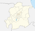 browse for more. FDFBEA → Marked territory F2F2F2 → Other state/provinces of Venezuela 656564 → Lines/boundaries C7E7FB → Waterbodies ...(512 × 448 (1.8 MB)) - 02:45, 22 May 2024
 territory FDFBEA → Marked state/province F6E1B9 → Other state/provinces of Venezuela 656564 → Lines/boundaries C7E7FB → Water bodies ...(512 × 593 (2.39 MB)) - 05:17, 9 June 2024
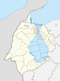 browse for more. FDFBEA → Marked territory F2F2F2 → Other state/provinces of Venezuela DFDFDF → Other countries 656564 → Lines/boundaries...(512 × 684 (2.88 MB)) - 16:51, 8 June 2024
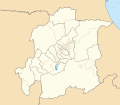 browse for more. FDFBEA → Marked territory F6E1B9 → Other state/provinces of Venezuela 656564 → Lines/boundaries C7E7FB → Waterbodies ...(512 × 448 (1.8 MB)) - 00:00, 2 January 2024
 browse for more. FDFBEA → Marked territory F6E1B9 → Other state/provinces of Venezuela 656564 → Lines/boundaries C7E7FB → Waterbodies ...(512 × 386 (1.4 MB)) - 23:54, 1 January 2024
 browse for more. FDFBEA → Marked territory F2F2F2 → Other state/provinces of Venezuela 656564 → Lines/boundaries 45C5ED → Rivers C7E7FB...(512 × 386 (556 KB)) - 23:56, 1 January 2024
 browse for more. FDFBEA → Marked territory F6E1B9 → Other state/provinces of Venezuela DFDFDF → Other countries 656564 → Lines/boundaries...(512 × 684 (2.88 MB)) - 16:50, 8 June 2024
 Guinea (including eastern portion of Indonesia (Aru Islands)) and mainland provinces of Papua New Guinea) south/east of Lydekker Line (delimiting continental...(541 × 541 (293 KB)) - 14:22, 14 June 2024
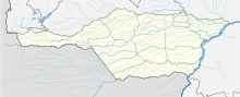 browse for more. FDFBEA → Marked territory F2F2F2 → Other state/provinces of Venezuela DFDFDF → Other countries 656564 → Lines/boundaries...(512 × 209 (1.77 MB)) - 22:47, 7 March 2024
 F6E1B9 → Other state/provinces of Venezuela 656564 → Lines/boundaries C12836 → Marked state/province FDFBEA → Rest of Venezuela DFDFDF...(512 × 386 (553 KB)) - 05:17, 9 June 2024


-en.svg)
-en%2BInter-Korean_border.svg)


.svg)

