
File:Poland in the early 14th century..JPG
Size of this preview: 760 × 599 pixels. Other resolutions: 304 × 240 pixels | 609 × 480 pixels | 909 × 717 pixels.
Original file (909 × 717 pixels, file size: 275 KB, MIME type: image/jpeg)
| This is a file from the Wikimedia Commons. Information from its description page there is shown below. Commons is a freely licensed media file repository. You can help. |
Summary
| Description |
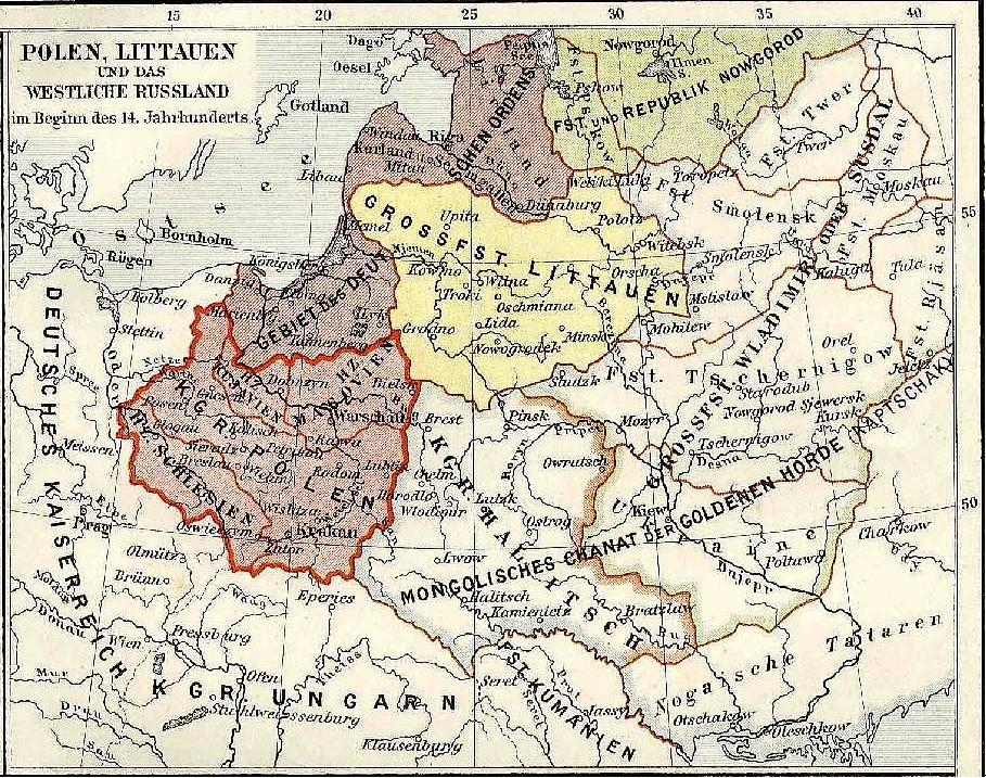
English: Map of Poland in the 14th century after the loss of Lubusz Land and temporarily loss of Pomerelia but before the loss of Silesia. |
| Date | |
| Source | Photograph of a map from Meyers Konv. Lexikon |
| Author | Karl Wolf |
Licensing
|
This work is in the public domain in its country of origin and other countries and areas where the copyright term is the author's life plus 70 years or fewer. | |
| This file has been identified as being free of known restrictions under copyright law, including all related and neighboring rights. | |
File history
Click on a date/time to view the file as it appeared at that time.
| Date/Time | Thumbnail | Dimensions | User | Comment | |
|---|---|---|---|---|---|
| current | 15:03, 30 August 2009 | | 909 × 717 (275 KB) | Opole.pl | {{Information |Description={{en|1=Map of Poland in the 14th century after the loss of Lubusz Land and temporarily loss of Pomerelia but before the loss of Silesia.}} |Source=Photograph of a map from Meyers Konv. Lexikon |Author=Karl Wolf |Date=1908 |Permi |
File usage
The following pages on the English Wikipedia use this file (pages on other projects are not listed):
Global file usage
The following other wikis use this file:
- Usage on es.wikipedia.org
- Usage on it.wikipedia.org
- Usage on uk.wikipedia.org