
Search results
There is a page named "File:Pakistan 2002 CIA map.jpg" on Wikipedia
 Pakistan http://hdl.loc.gov/loc.gmd/g7640.ct000786 English...(1,626 × 2,000 (589 KB)) - 18:08, 14 November 2022
 [[2002年]][[巴基斯坦]]分省与国境地图 |B= Qingdou制作 |C= 2007-04-09 |D= Qingdou |E= {{Cc-by-1.0}} |F= [http://commons.wikimedia.org/wiki/Image:Pakistan_2002_CIA_map.jpg...(1,626 × 2,000 (882 KB)) - 16:01, 26 October 2023
 {{Information |Description=Geography map of Pakistan |Source=self-made, helped with [[:Image:Pakistan 2002 CIA map.jpg]] (PD) |Date=16 Sep 2007 |Author=...(1,625 × 1,688 (714 KB)) - 16:07, 21 February 2022
 {{Information |Description=Geography map of Pakistan |Source=self-made, helped with [[:Image:Pakistan 2002 CIA map.jpg]] (PD) |Date=16 Sep 2007 |Author=...(1,625 × 1,688 (651 KB)) - 16:07, 21 February 2022
 with Pakistan and Yemen ( ) Author Pagan, David S. Title Effects of UAVs on interstate relationships: a case study of U.S. relations with Pakistan and...(1,275 × 1,650 (794 KB)) - 10:42, 15 December 2021
 DescriptionPakistan geography es.svg Español: Mapa de la geografía de Pakistán Date 16 September 2007 Source self-made, helped with Image:Pakistan 2002 CIA map.jpg...(1,625 × 1,688 (650 KB)) - 14:34, 26 April 2022
 Postgraduate School Description Balochistan, the southwestern province of Pakistan, is taking on increased importance in regional affairs. With the discovery...(1,275 × 1,650 (936 KB)) - 22:38, 20 August 2020
 File:Prospects for an independent Kurdistan? (IA prospectsfornind109454208).pdf (matches file content)Table 27 Perry-Castañeda Library Map Collection, http://www.lib.utexas.edu/maps/middle_east_and_asia/turkey_ne_2002.jpg, website accessed on 9/8/2007. 28...(1,275 × 1,650 (1.52 MB)) - 19:26, 26 July 2020
 pdf Author Kenneth Katzman Permission (Reusing this file) Other versions Derivative works of this file: CRS map of Afghanistan 2005-11-22.jpg...(1,275 × 1,650 (618 KB)) - 16:23, 30 August 2021
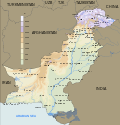 DescriptionPakistan geography en.svg Geography map of Pakistan Date 16 September 2007 Source self-made, helped with Image:Pakistan 2002 CIA map.jpg (PD) Author...(1,625 × 1,688 (650 KB)) - 14:34, 26 April 2022
 English The disputed Kashmir region showing the regions (administered by India, Pakistan, and China; names of administrative entities have been updated)...(2,418 × 2,992 (1.6 MB)) - 12:39, 21 June 2024
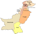 Image:Pakistan 2002 CIA map.jpg (PD) Author Jarke Other versions Derivative works of this file: Pakistan NWFP FATA areas with localisation map.svg: ...(1,126 × 1,052 (139 KB)) - 21:12, 9 April 2024
 territories of Pakistan blank.svg Blank map of the provinces and territories of Pakistan. Date 12 September 2007 Source Image:Pakistan 2002 CIA map.jpg (PD) Author...(1,126 × 1,052 (132 KB)) - 14:40, 15 May 2021
 DescriptionPakistan geography mk.svg Geography map of Pakistan in Macedonian. Date 16 September 2007 Source self-made, helped with Image:Pakistan 2002 CIA map.jpg...(1,625 × 1,688 (653 KB)) - 01:47, 19 May 2023
 "Base 802863AI (C00341) 4-02." Title InfoField Pakistan. Shelf ID InfoField G7640 2002 .U51 Date 2002 Source https://www.loc.gov/item/2002623149/ Author...(2,170 × 2,789 (878 KB)) - 09:07, 9 April 2023
 Congress Web site as a raster image. Title InfoField Pakistan. Shelf ID InfoField G7640 2002 .U5 Date 2002 Source https://www.loc.gov/item/2002623148/ Author...(2,050 × 2,819 (764 KB)) - 09:07, 9 April 2023
 InfoField Pakistan · Jammu And Kashmir · India · Kashmir · Jammu Part of InfoField American Memory · General Maps · Catalog · Geography And Map Division...(2,007 × 2,392 (647 KB)) - 10:44, 16 November 2021


