
Search results
There is a page named "File:Nova Scotia topographic map.png" on Wikipedia
 DescriptionNova Scotia topographic map.png English: Topographic location map of Nova Scotia, Canada Equirectangular projection, N/S stretching 145 %. Geographic...(1,342 × 1,096 (1.21 MB)) - 15:16, 20 October 2022
 DescriptionDurham (Topographical township map of Pictou county Nova Scotia, 1864).png Plan of en:Durham, Nova Scotia Date 1864 Source Topographical township map of Pictou...(743 × 1,312 (2.79 MB)) - 20:35, 3 April 2021
 DescriptionKennetcookWatershed.png English: Map of Kennetcook River watershed in Nova Scotia. Created using data from the Topographical Atlas of Canada[1]. colours...(1,056 × 1,056 (158 KB)) - 15:52, 23 September 2020
 DescriptionNovascotia topo.png English: Topography of Nova Scotia, created with GMT 5.1.2 Date 6 March 2016 Source Source: At least one of the following...(2,000 × 1,596 (2.26 MB)) - 01:11, 10 January 2022
 description of the provinces of Lower and Upper Canada, New Brunswick, Nova Scotia / by Joseph Bouchette. 1831 Date 1830 Source [1] Author Joseph Bouchette...(1,177 × 991 (937 KB)) - 15:17, 5 May 2024
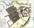 description of the provinces of Lower and Upper Canada, New Brunswick, Nova Scotia / by Joseph Bouchette. 1831 Date 1830 Source https://numerique.banq.qc...(2,856 × 2,320 (10.66 MB)) - 15:17, 5 May 2024

.png)


