
File:Noble Knob looking North.jpg
Size of this preview: 800 × 600 pixels. Other resolutions: 320 × 240 pixels | 640 × 480 pixels | 1,024 × 768 pixels | 1,280 × 960 pixels | 2,560 × 1,920 pixels | 3,264 × 2,448 pixels.
Original file (3,264 × 2,448 pixels, file size: 7.55 MB, MIME type: image/jpeg)
| This is a file from the Wikimedia Commons. Information from its description page there is shown below. Commons is a freely licensed media file repository. You can help. |
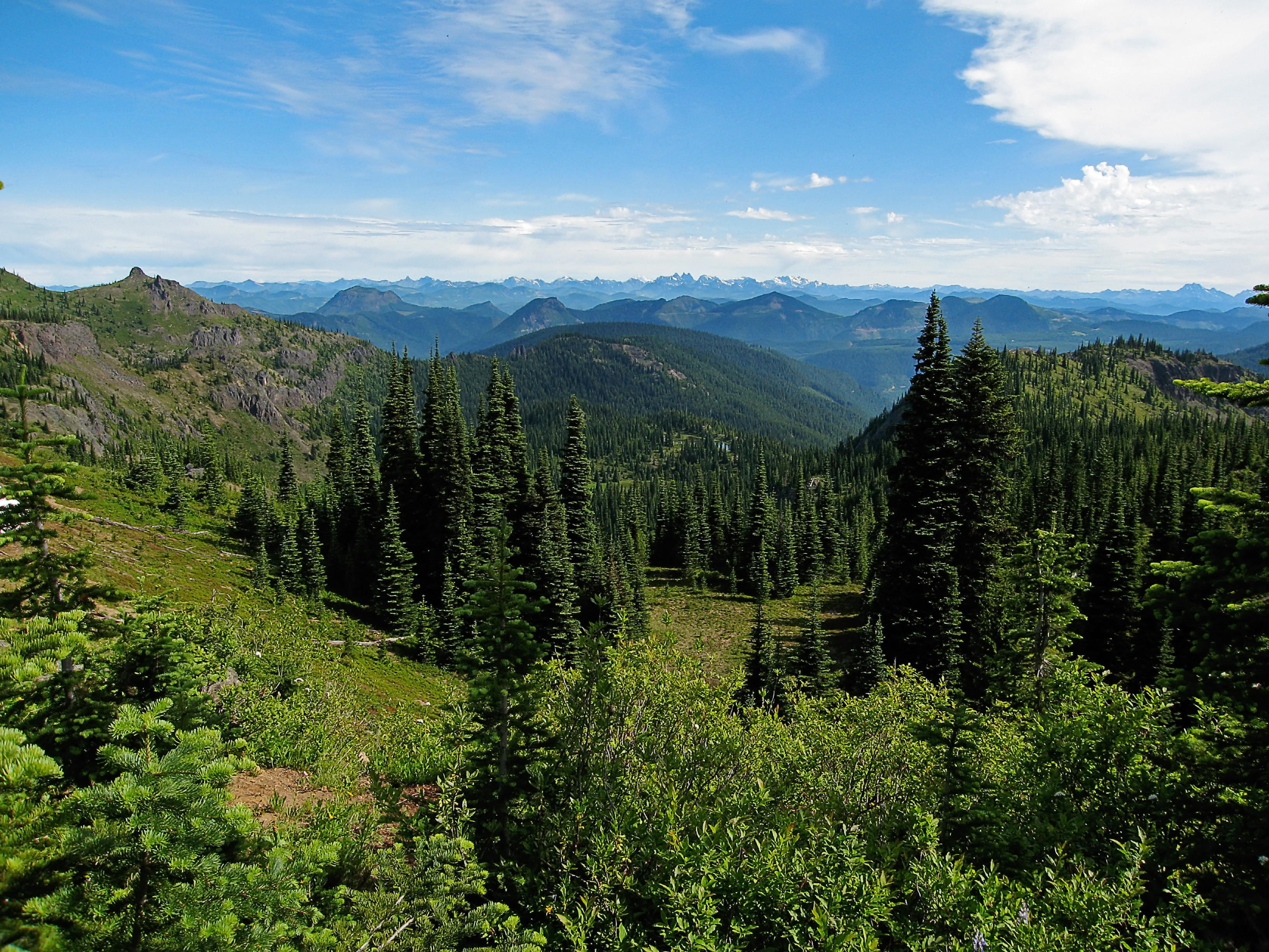
| Description | After getting around Mutton Mountain, the trail to Noble Knob reaches a high point with nice views. This photo is looking north or northeast, down into the Lost Creek valley. The near mountain on the far left side is part of Noble Knob. Mutton Mountain is off the right edge of the photo. In the distance is the Cascades. The sharp mountains in the center are the peaks near Snoqualmie Pass. Behind them is Glacier Peak (large or original size view to see). Even Mount Baker is visible in the original size, off to the left, but it is small and faint. |
| Date | |
| Source | View north from the trail |
| Author | Pfly (talk · contribs), on flickr |
| Camera location | | View this and other nearby images on: OpenStreetMap |
|---|
Licensing
This file is licensed under the Creative Commons Attribution-Share Alike 2.0 Generic license.
- You are free:
- to share – to copy, distribute and transmit the work
- to remix – to adapt the work
- Under the following conditions:
- attribution – You must give appropriate credit, provide a link to the license, and indicate if changes were made. You may do so in any reasonable manner, but not in any way that suggests the licensor endorses you or your use.
- share alike – If you remix, transform, or build upon the material, you must distribute your contributions under the same or compatible license as the original.
| This image, originally posted to Flickr, was reviewed on March 14, 2009 by the administrator or reviewer File Upload Bot (Magnus Manske), who confirmed that it was available on Flickr under the stated license on that date. |
File history
Click on a date/time to view the file as it appeared at that time.
| Date/Time | Thumbnail | Dimensions | User | Comment | |
|---|---|---|---|---|---|
| current | 06:21, 14 March 2009 | | 3,264 × 2,448 (7.55 MB) | File Upload Bot (Magnus Manske) | {{Information |Description= After getting around Mutton Mountain, the trail to Noble Knob reaches a high point with nice views. This photo is looking north or northeast, down into the Lost Creek valley. The near mountain on the far left side is part of |
File usage
The following pages on the English Wikipedia use this file (pages on other projects are not listed):
Global file usage
The following other wikis use this file:
- Usage on cs.wikipedia.org
- Usage on el.wikipedia.org
- Usage on es.wikipedia.org
- Usage on fr.wikipedia.org
- Chaîne des Cascades
- Chaînes côtières du Pacifique
- Utilisateur:Gemini1980
- Portail:Californie
- Wikipédia:Sélection/Californie
- Wikipédia:Sélection/Canada
- Wikipédia:Sélection/Colombie-Britannique
- Wikipédia:Sélection/Amérique
- Wikipédia:Sélection/Oregon
- Wikipédia:Sélection/Washington (État)
- Wikipédia:Lumière sur/Août 2010
- Wikipédia:Sélection/Montagne
- Wikipédia:Lumière sur/Chaîne des Cascades
- Wikipédia:Sélection/États-Unis/Articles de qualité
- Wikipédia:Lumière sur/Juillet 2018
- Usage on id.wikipedia.org
- Usage on incubator.wikimedia.org
- Usage on it.wikipedia.org
- Usage on pl.wikipedia.org
- Usage on ru.wikipedia.org
- Usage on sw.wikipedia.org
- Usage on vi.wikipedia.org