
Search results
There is a page named "File:Map of geographical regions of Kosovo.png" on Wikipedia
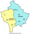 English: Map of geographical regions of Kosovo - Kosovo (proper) and Metohija. Serbian: Мапа географских региона Косова - (ужег) Косова и Метохије. Copied...(838 × 946 (49 KB)) - 14:29, 7 May 2024
 http://sr.wikipedia.org/wiki/%D0%A1%D0%BB%D0%B8%D0%BA%D0%B0:Kosovo_i_Metohija_doline.PNG konstruktören har släppt upphovsrätten och den är inte upphovsrättsskyddad...(908 × 1,028 (60 KB)) - 20:41, 23 October 2021
 http://sr.wikipedia.org/wiki/%D0%A1%D0%BB%D0%B8%D0%BA%D0%B0:Kosovo_i_Metohija_doline.PNG konstruktören har släppt upphovsrätten och den är inte upphovsrättsskyddad...(838 × 946 (27 KB)) - 20:14, 23 October 2021
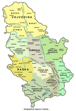 Map of geographical regions in Serbia. Mapa geografskih regija u Srbiji. self made map by user:PANONIAN Milovan Radovanović, Kosovo i Metohija - antropogeografske...(1,100 × 1,606 (209 KB)) - 02:47, 2 August 2023
 2009-08-16T06:21:16Z Hoshie 2753x1400 (177773 Bytes) added Kosovo; see [[see Image talk:Continental-Europe-map.png#Kosovo - a solution]] for details 2009-07-18T07:08:36Z...(631 × 514 (33 KB)) - 05:30, 28 December 2020
 2009-08-16T06:21:16Z Hoshie 2753x1400 (177773 Bytes) added Kosovo; see [[see Image talk:Continental-Europe-map.png#Kosovo - a solution]] for details 2009-07-18T07:08:36Z...(683 × 517 (34 KB)) - 05:30, 28 December 2020
 2009-08-16T06:21:16Z Hoshie 2753x1400 (177773 Bytes) added Kosovo; see [[see Image talk:Continental-Europe-map.png#Kosovo - a solution]] for details 2009-07-18T07:08:36Z...(559 × 460 (26 KB)) - 05:30, 28 December 2020
 2009-08-16T06:21:16Z Hoshie 2753x1400 (177773 Bytes) added Kosovo; see [[see Image talk:Continental-Europe-map.png#Kosovo - a solution]] for details 2009-07-18T07:08:36Z...(679 × 515 (26 KB)) - 22:42, 19 July 2024
 self made map by user:PANONIAN References for historical/geographical borders of Syrmia and modern state borders: Školski istorijski atlas, Zavod za izdavanje...(1,082 × 662 (58 KB)) - 21:32, 14 September 2023
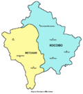 http://www.rastko.rs/kosovo/crucified/img/metoh.jpg Milovan Radovanović, Kosovo i Metohija - antropogeografske, istorijskogeografske, demografske i geopolitičke...(838 × 946 (41 KB)) - 05:04, 14 May 2022
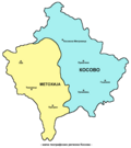 http://www.rastko.rs/kosovo/crucified/img/metoh.jpg Milovan Radovanović, Kosovo i Metohija - antropogeografske, istorijskogeografske, demografske i geopolitičke...(838 × 946 (41 KB)) - 20:41, 23 October 2021
 User:PANONIAN. English language version - File:Syrmia.png References for historical/geographical borders of Syrmia and modern state borders: Školski istorijski...(1,082 × 662 (54 KB)) - 10:40, 3 October 2023
 uploaded new improved map version and translated it into Bulgarian, since it was used in Bulgarian Wikipedia. http://www.rastko.rs/kosovo/crucified/img/metoh...(838 × 946 (40 KB)) - 02:52, 22 October 2020
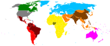 Regions and countries shown on the map are as defined for the allocation of visas in the United States Diversity Visa lottery. The countries are all those...(1,480 × 625 (39 KB)) - 12:13, 9 June 2024
 Regions and countries shown on the map are as defined for the allocation of visas in the United States Diversity Visa lottery. The countries are all those...(2,756 × 1,399 (825 KB)) - 16:37, 20 October 2023
 I, the copyright holder of this work, hereby publish it under the following license: Milovan Radovanović, Kosovo i Metohija - antropogeografske, istorijskogeografske...(1,100 × 1,464 (181 KB)) - 04:27, 27 February 2023
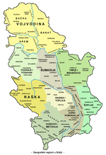 I, the copyright holder of this work, hereby publish it under the following license: Milovan Radovanović, Kosovo i Metohija - antropogeografske, istorijskogeografske...(1,100 × 1,606 (207 KB)) - 04:27, 27 February 2023
 included here. 2593 566 62 62 4974 2519 Kosovo is regarded by the UN as part of Serbia, they are reviewing Kosovo's status. 1610 2021 516 205 4974 2519 These...(4,974 × 2,519 (750 KB)) - 05:20, 6 July 2024
 boundaries: the map contains coding for various disputed sovereignty claims: Largely unrecognized countries, such as Abkhazia (xa), Artsakh (xn), Kosovo: xk: included...(2,754 × 1,398 (1.05 MB)) - 22:57, 31 December 2023
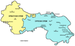 png English: Map of Syrmia region - Serbian language version. Serbian: Мапа Срема - верзија на српском језику. References for historical/geographical...(1,082 × 662 (53 KB)) - 20:41, 23 October 2021


