
Search results
There is a page named "File:Map of Ohio highlighting Lorain County.svg" on Wikipedia
 DescriptionMap of Ohio highlighting Lorain County.svg English: This is a locator map showing Lorain County in Ohio. For more information, see Commons:United...(1,050 × 1,141 (37 KB)) - 02:39, 25 June 2024
 as the original. https://creativecommons.org/licenses/by-sa/3.0CC BY-SA 3.0 Creative Commons Attribution-Share Alike 3.0 truetrue English ELyria ohio...(1,700 × 1,167 (84 KB)) - 13:35, 23 September 2022
 DescriptionMap of Lorain County Ohio Highlighting Lorain City.png English: Map of the municipal and township boundaries of Lorain County, Ohio, United States...(573 × 1,167 (44 KB)) - 14:12, 23 September 2022
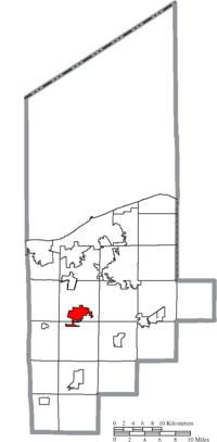 DescriptionMap of Lorain County Ohio Highlighting Oberlin City.png English: Map of the municipal and township boundaries of Lorain County, Ohio, United States...(573 × 1,167 (44 KB)) - 14:36, 23 September 2022


