
File:Macedonians coloured on this map from 1922.jpg
Size of this preview: 736 × 599 pixels. Other resolutions: 295 × 240 pixels | 590 × 480 pixels | 943 × 768 pixels | 1,258 × 1,024 pixels | 1,810 × 1,474 pixels.
Original file (1,810 × 1,474 pixels, file size: 719 KB, MIME type: image/jpeg)
| This is a file from the Wikimedia Commons. Information from its description page there is shown below. Commons is a freely licensed media file repository. You can help. |
Summary
| Description |
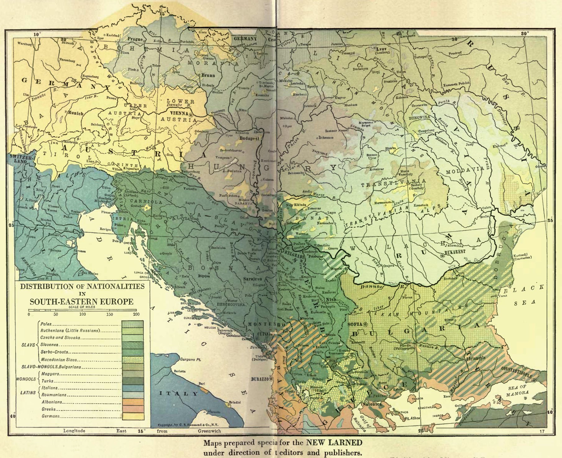
English: "Distribution of nationalities in southeastern Europe", early 20th cent. |
| Date | |
| Source | Map 15 in: J. N. Larned, The New Larned History for Ready Reference, Reading and Research, Springfield: C.A Nichols, 1922. Vol. 1, after p.820. (cf. https://archive.org/details/newlarnedhistory01larnuoft) |
| Author | J. N. Larned et al. |
| Other versions | distribution-of-nationalities-in-south-eastern-europe-1922-ver2.JPG. Compare near-identical map here: [1], credited to The Victory Atlas of the War (New York, NY: Charles Scribner's Sons, 1918) |
Licensing
|
This work is in the public domain in its country of origin and other countries and areas where the copyright term is the author's life plus 70 years or fewer. | |
| This file has been identified as being free of known restrictions under copyright law, including all related and neighboring rights. | |
File history
Click on a date/time to view the file as it appeared at that time.
| Date/Time | Thumbnail | Dimensions | User | Comment | |
|---|---|---|---|---|---|
| current | 22:55, 20 October 2010 | | 1,810 × 1,474 (719 KB) | DraganKitanoski | {{Information |Description={{en|1=The area of the most concentration of the Macedonians in the xx c}} |Source={{own}} |Author=DraganKitanoski |Date=1922 |Permission= |other_versions=distribution-of-nationalities-in-south-eastern-e |
File usage
The following pages on the English Wikipedia use this file (pages on other projects are not listed):
Global file usage
The following other wikis use this file:
- Usage on es.wikipedia.org
- Usage on eu.wikipedia.org
- Usage on sr.wikipedia.org
- Usage on tr.wikipedia.org