
Search results
There is a page named "File:Levant Amarna.svg" on Wikipedia
 derivative work of the following images: File:Near_East_topographic_map-blank.svg licensed with Cc-by-sa-3.0,2.5,2.0,1.0, GFDL 2009-08-18T18:31:37Z Sémhur...(354 × 615 (322 KB)) - 16:43, 9 November 2020
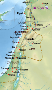
 3 "provinces" égyptiennes. Date 11 March 2018 Source Levant Amarna.svg Author Levant Amarna.svg: Zunkir Rivers & lakes: Natural Earth Coast, altitude...(412 × 685 (5.96 MB)) - 04:45, 10 November 2021
 Mesopotamie PB.PNG File:Carte du Mitanni.png File:Hethiter.svg File:KarumKanis.svg File:Levant Amarna.svg Mithridates in 88aC.png File:Médio-assyrien.png File:Mithridates...(2,425 × 1,581 (2.33 MB)) - 23:59, 25 January 2024
 cities selected for the Southern portion of the map are from The Southern Levant (Cisjordan) during the Late Bronze Age (2013) by Nava Panitz-Cohen (University...(512 × 1,142 (484 KB)) - 01:42, 14 April 2024


