
File:Lebanon location map Topographic.png

Size of this preview: 521 × 599 pixels. Other resolutions: 209 × 240 pixels | 417 × 480 pixels | 993 × 1,142 pixels.
Original file (993 × 1,142 pixels, file size: 990 KB, MIME type: image/png)
| This is a file from the Wikimedia Commons. Information from its description page there is shown below. Commons is a freely licensed media file repository. You can help. |
Summary
| Camera location | | View this and other nearby images on: OpenStreetMap |
|---|
| Description |
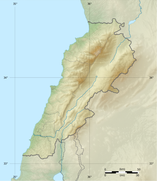
Deutsch: Positionskarte des Libanon
Quadratische Plattkarte, N-S-Streckung 115 %. Geographische Begrenzung der Karte: Français : Carte physique vierge du Liban, destinée à la géolocalisation.
Projection equirectangulaire, N/S stretching 115 %. Limites géographiques de la carte: English: Location map of Lebanon
Equirectangular projection, N/S stretching 115 %. Geographic limits of the map:
|
||
| Date | |||
| Source |
Topographic background map: Own work
|
||
| Author | Vivepat and NordNordWest | ||
| Permission (Reusing this file) |
|
||
| Other versions |
|


Licensing
I, the copyright holder of this work, hereby publish it under the following licenses:

|
Permission is granted to copy, distribute and/or modify this document under the terms of the GNU Free Documentation License, Version 1.2 only as published by the Free Software Foundation; with no Invariant Sections, no Front-Cover Texts, and no Back-Cover Texts. A copy of the license is included in the section entitled GNU Free Documentation License. | 1.2 only |
|
|
Permission is granted to copy, distribute and/or modify this document under the terms of the GNU Free Documentation License, Version 1.3 or any later version published by the Free Software Foundation; with no Invariant Sections, no Front-Cover Texts, and no Back-Cover Texts. A copy of the license is included in the section entitled GNU Free Documentation License.
|
If this file is eligible for relicensing, it may also be used under the Creative Commons Attribution-ShareAlike 3.0 license. The relicensing status of this image needs to be manually reviewed by an experienced user. You can help.
|
You may select the license of your choice.
File history
Click on a date/time to view the file as it appeared at that time.
| Date/Time | Thumbnail | Dimensions | User | Comment | |
|---|---|---|---|---|---|
| current | 06:17, 22 June 2017 | | 993 × 1,142 (990 KB) | Vivepat | correction lat/lon |
| 06:10, 22 June 2017 |  | 993 × 1,142 (990 KB) | Vivepat | Lattitude error correction | |
| 05:59, 22 June 2017 |  | 993 × 1,142 (990 KB) | Vivepat | update of the map using the Wikipedia maps conventions | |
| 22:12, 15 June 2012 |  | 1,581 × 1,818 (3.35 MB) | Dr Brains |
File usage
The following pages on the English Wikipedia use this file (pages on other projects are not listed):
- 1585 Ottoman expedition against the Druze
- 1956 Chim earthquake
- 551 Beirut earthquake
- Aach ed Djâjé
- Aafrah
- Aard el Borj
- Aarid Maql Saab
- Abd al-Wahid Mosque
- Al-Attar Mosque
- Al-Burtasi Mosque
- Al-Tawbat Mosque
- Al-Uwaysiyat Mosque
- Al Shouf Cedar Nature Reserve
- Antelias cave
- Arqa
- Assaf Abu Rahhal
- Beirut
- Belat temple
- Bqaa Safrin
- Cedars of God
- Ejdabrine
- Faqra
- Ghadir River
- Gibelacar
- Jabal Moussa Biosphere Reserve
- Kadisha Valley
- Kisrawan campaigns (1292–1305)
- Ksar Akil
- Ladder of Tyre
- Lake Qaraoun
- Layal Najib
- Lee Observatory
- Mansouri Great Mosque
- Mount Betarim
- Mount Lebanon
- Near East earthquakes of 1759
- Qalaat Faqra
- Qurnat as Sawda'
- Raghida Dergham
- Ras Baalbek (Rock Shelter)
- Ras El Kelb
- Sannine Formation
- Sidon
- Siege of Tripoli
- Siege of Tripoli (1271)
- Siege of Tyre (1187)
- Siege of Tyre (332 BC)
- Stelae of Nahr el-Kalb
- Tell Deir
- Tyre, Lebanon
- Zaarour
- Zahrani River
- User:Al Ameer son/Battle of Anjar
- User:Crtew/Ali Shaaban
- User:Crtew/Military attacks on the media during the 2006 Lebanon War
- User:Crtew/The role of female journalists
- User:MinorProphet/Draft subpages/HMS Cyclops (1839)
- Module:Location map/data/Lebanon
- Module:Location map/data/Lebanon/doc
Global file usage
The following other wikis use this file:
- Usage on als.wikipedia.org
- Usage on an.wikipedia.org
- Usage on ar.wikipedia.org
- Usage on arz.wikipedia.org
- Usage on ast.wikipedia.org
- Usage on az.wikipedia.org
- Usage on bn.wikipedia.org
- Usage on bs.wikipedia.org
- Usage on ca.wikipedia.org
- Usage on ceb.wikipedia.org
- Usage on ce.wikipedia.org
- Usage on cs.wikipedia.org
- Usage on da.wikipedia.org
- Usage on el.wikipedia.org
- Usage on eo.wikipedia.org
View more global usage of this file.