
File:Le Canada ou Nouvelle France.jpg
Size of this preview: 800 × 547 pixels. Other resolutions: 320 × 219 pixels | 640 × 437 pixels | 1,024 × 700 pixels | 1,280 × 874 pixels | 2,020 × 1,380 pixels.
Original file (2,020 × 1,380 pixels, file size: 1.29 MB, MIME type: image/jpeg)
| This is a file from the Wikimedia Commons. Information from its description page there is shown below. Commons is a freely licensed media file repository. You can help. |
| Description |
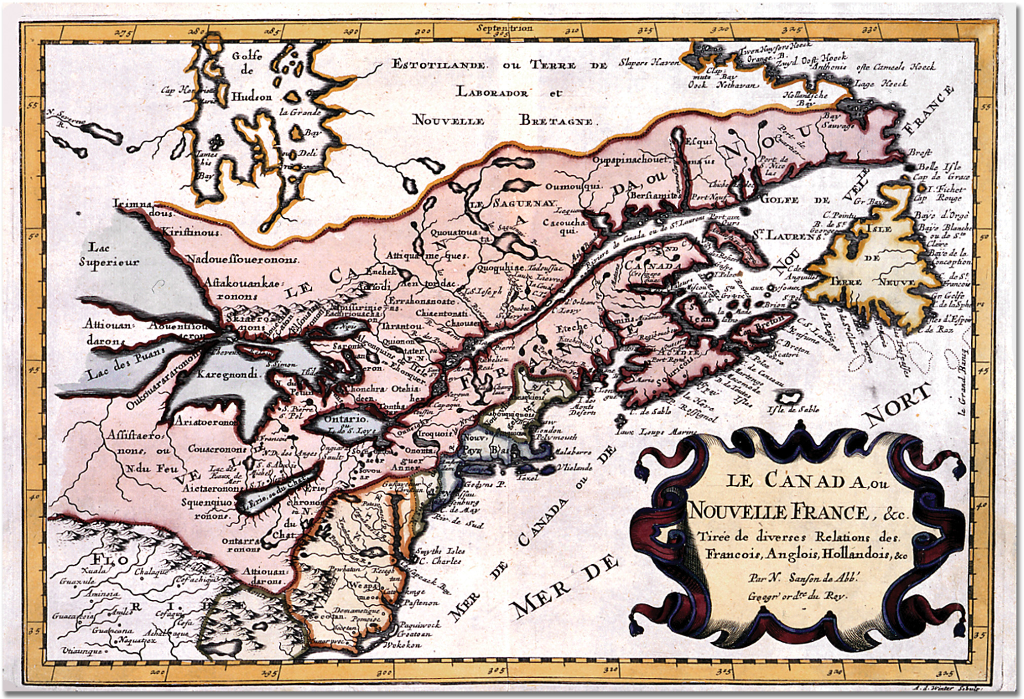
Français : Le Canada, ou Nouvelle France, &c. tirée de diverses Relations des Francois, Anglois, Hollandois, &c Carte de l'est de Canada. |
| Date | réalisée aux environs de 1660. |
| Source | Archives de l'Ontario, référence C 78, A0 4943. |
| Author | le cartographe français Nicolas Sanson. |
|
This work is in the public domain in its country of origin and other countries and areas where the copyright term is the author's life plus 70 years or fewer. | |
| This file has been identified as being free of known restrictions under copyright law, including all related and neighboring rights. | |
Le fait d'avoir numérisé l'image ne peut être considéré comme une œuvre de l'esprit, et n'est donc pas protégé par le droit d'auteur.
File history
Click on a date/time to view the file as it appeared at that time.
| Date/Time | Thumbnail | Dimensions | User | Comment | |
|---|---|---|---|---|---|
| current | 13:00, 6 June 2006 | | 2,020 × 1,380 (1.29 MB) | IP 84.5~commonswiki | * '''Titre :''' ''Le Canada ou Nouvelle France, &c. <small>tirée de diverses Relations des Francois, Anglois, Hollandois, &c.</small>'' * '''Description :''' carte du Golfe du Saint-Laurent, au Canada. * '''Aut |
File usage
The following pages on the English Wikipedia use this file (pages on other projects are not listed):
Global file usage
The following other wikis use this file:
- Usage on ar.wikipedia.org
- Usage on de.wikipedia.org
- Usage on fr.wikipedia.org
- Usage on it.wikipedia.org
- Usage on uk.wikipedia.org
- Usage on uz.wikipedia.org
- Usage on zh.wikipedia.org