
Search results
There is a page named "File:KunashirMap.png" on Wikipedia
 4.0 Creative Commons Attribution-Share Alike 4.0 truetrue English Map of Kunashir Island author name string: Vallee Wikimedia username: Vallee URL: https://commons...(4,320 × 4,320 (12.71 MB)) - 11:33, 23 June 2024
 together with the islands Iturup, Kunashir, and Shikotan under the Shimoda Treaty of 1855 (see Image:Kurilenkonflikt.png). Not shown are the smaller rock...(291 × 178 (5 KB)) - 05:27, 13 September 2020
 Map of Kunashir island and town of Yuzhno-Kurilsk relative to other Russian Far East cities. English...(514 × 277 (16 KB)) - 08:27, 4 October 2020
 Nemuro Br 16cl.png]] 2005-08-06 12:46 Ellery 384×215× (3988 bytes) [[日本]]與[[俄羅斯]]間存有爭議的[[北方四島]]地圖. 本圖來自日文維基. English Iturup Island, Kunashir Island, Shikotan...(768 × 429 (13 KB)) - 06:33, 22 June 2024
 DescriptionSakhalin Oblast without Kunashir, Shikotan, Iturup and the Habomai Islands.png Карта Сахалінської області згідно позиції Японії. Без островів...(800 × 960 (84 KB)) - 09:51, 5 January 2021
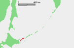 DescriptionKuriles Kunashir.PNG Location of Kunashir Island (Кунашир / 国後島), Kuril Islands, Russia Date 3 July 2009 Source Own work based on PD map Author edited...(365 × 235 (4 KB)) - 17:10, 22 October 2020
 DescriptionKunashir topomap.png Русский: Топографическая карта острова Кунашир Date 2012 Source OpenStreetMap.org, OpenCyclemap.org Author OpenStreetMap, OpenCyclemap...(876 × 909 (281 KB)) - 13:16, 23 October 2020
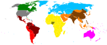 or China, all under Asia). The southern Kuril Islands (Habomai, Iturup, Kunashir and Shikotan), administered by Russia and claimed by Japan, are treated...(1,480 × 625 (39 KB)) - 12:13, 9 June 2024
 English Map of the Northern Territories of Japan (Kuril Islands)...(1,787 × 917 (415 KB)) - 06:33, 22 June 2024
 English Japanese Map of the Northern Territories of Japan (Kuril Islands) Japanese 日本の北方領土の地図(千島列島)...(1,787 × 917 (414 KB)) - 06:33, 22 June 2024
 DescriptionKunashir con Yuzhno-Kurilsk.png Español: Isla Kunashir y la localización de Yuzhno-Kurilsk. He usado Image:Okhotsk-Japan5ION.png y Image:Kunashir.jpg...(760 × 647 (39 KB)) - 09:58, 13 September 2020
 or China, all under Asia). The southern Kuril Islands (Habomai, Iturup, Kunashir and Shikotan), administered by Russia and claimed by Japan, are treated...(2,756 × 1,399 (825 KB)) - 16:37, 20 October 2023
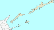 elements that have been taken or adapted from this file: ja:File:Japan map.png by User:Koba-chan and other users. Author Koba-chan at Japanese Wikipedia...(384 × 215 (4 KB)) - 06:33, 22 June 2024
 nl/products/web-map-server/examples/ and was released by the copyright holder. Permission is granted to copy, distribute and/or modify this map since it is...(1,146 × 780 (616 KB)) - 06:33, 22 June 2024
 elements that have been taken or adapted from this file: ja:File:Japan map.png by User:Koba-chan and other users. Author Koba-chan at Japanese Wikipedia...(768 × 429 (6 KB)) - 06:33, 22 June 2024
 File:Administrative division of Nemuro subprefecture.gif (category Maps of Nemuro subprefecture)Shibetsu 5 Menashi 6 Shikotan Kunashir 7 Tomari 8 Ruyobetsu 9 Etorohu 10 Shyna 11 Shibetoro A: Khabomai B: Shikotan C: Kunashir D: Iturup 日本語: 1 根室市 2 別海町...(600 × 344 (38 KB)) - 21:46, 10 July 2023
 File:Hokkaido Nemuro Br 16cl.GIF (category Kunashir)of 5 Nov. 1897). Including the lower Kuril Islands. 日本語: 紗那支庁と根室支庁の範囲(1897/11/5) Date 5 September 2010 Source Hokkaido_Nemuro_Br_16cl.png Author Okia...(768 × 429 (7 KB)) - 06:33, 22 June 2024


