Search results
Appearance
There is a page named "File:Inverclyde UK location map.svg" on Wikipedia
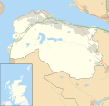
- DescriptionInverclyde UK location map.svg Blank map of Inverclyde, UK with the following information shown: Administrative borders Coastline, lakes and...(1,417 × 1,384 (790 KB)) - 22:16, 19 September 2020
- DescriptionInverclyde UK relief location map.jpg Relief map of Inverclyde, UK. Equirectangular map projection on WGS 84 datum, with N/S stretched 175%...(2,001 × 1,956 (293 KB)) - 05:58, 13 September 2020
- DescriptionInverclyde UK blank map.svg Blank map of Inverclyde, UK with districts shown. Equirectangular map projection on WGS 84 datum, with N/S stretched...(1,417 × 1,384 (712 KB)) - 02:22, 14 July 2024
- DescriptionInverclyde UK ward map (blank).svg Blank map of Inverclyde, UK with electoral wards shown. Equirectangular map projection on WGS 84 datum, with...(1,417 × 1,384 (840 KB)) - 09:10, 23 March 2021
- DescriptionInverclyde UK parish map (blank).svg Blank map of Inverclyde, UK with parishes shown. Equirectangular map projection on WGS 84 datum, with...(1,417 × 1,384 (722 KB)) - 22:16, 19 September 2020
- DescriptionInverclyde UK ward map 2017 (blank).svg Blank map of Inverclyde, UK with electoral wards as of 2017 shown. Equirectangular map projection on...(1,417 × 1,384 (843 KB)) - 09:10, 23 March 2021


