
Search results
There is a page named "File:Helsinki-metro-map.png" on Wikipedia
 Helsinki metro map Author: Oghmoir Made with Inkscape This file is licensed under the Creative Commons Attribution-Share Alike 1.0 Generic license. You...(1,024 × 700 (170 KB)) - 17:35, 3 September 2020
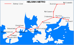 DescriptionHelsinki Metro Map.png Deutsch: Karte der Helsinkier Metro English: Map of the Helsinki metro Suomi: Helsingin metrokartta Date 2005 Source...(658 × 409 (17 KB)) - 18:20, 19 September 2020
 For Airport metro and Pisararata: Metrolinja Pasilasta Helsinki - Vantaan lentoasemalle (2006) ("Metro line from Pasila to Helsinki-Vantaa airport")PDF...(2,197 × 2,037 (1.64 MB)) - 05:22, 21 July 2023
 DescriptionHelsinki metro map 2016.png English: Helsinki metro after the western expansion is completed in August 2016 Date 3 May 2016 Source Own work...(732 × 293 (55 KB)) - 17:46, 19 September 2020
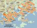 DescriptionHelsinki metro map 2007.png English: Map of the Helsinki Metro network in 2007. White letter 'M' on orange background signifies Metro stations...(1,024 × 768 (401 KB)) - 23:16, 19 November 2022
 BY-SA 4.0 Creative Commons Attribution-Share Alike 4.0 truetrue English Helsinki metro lines (including the Western extension under construction) author name...(3,171 × 489 (163 KB)) - 18:12, 1 January 2023
 Helsinki tram network map The white M on an orange background signifies a Metro station. Original author: Oghmoir Made with Inkscape Line 2 removed by:...(798 × 983 (128 KB)) - 17:34, 3 September 2020
 This is a file created in Inkscape for exporting Image:Helsinki Region commrnw.png. The SVG probably doesn't show up properly outside that program. If...(1,895 × 1,767 (879 KB)) - 11:41, 4 August 2023
 DescriptionHelsinki metro 2016.png English: Helsinki metro after the western expansion is completed in August 2016 Date 3 May 2016 Source Own work Author...(797 × 422 (56 KB)) - 17:47, 19 September 2020
 DescriptionHelsinki-metro.png English: Schematic map of the Helsinki metro train lines Source Created with Inkscape Author Oghmoir...(1,027 × 620 (111 KB)) - 02:19, 7 September 2020
 DescriptionHelsinki metro plan 1971.png English: The Metro Office's 1971 proposal for a rail network in Helsinki. Orange = the first metro line, purple...(3,508 × 2,480 (3.88 MB)) - 00:33, 20 July 2024
 DescriptionHelsinki metro plan 1963.png English: The Metro Commission's 1963 proposal for a metro system in Helsinki. Dark blue = above ground tracks...(4,961 × 3,508 (4.54 MB)) - 17:28, 25 November 2022
 height in Inkscape. Same description: Helsinki rapid transit map, in style of a subway map, including Helsinki Metro, VR commuter rail (lähijunat) and bus...(3,055 × 2,160 (833 KB)) - 15:52, 16 April 2021
 DescriptionHelsingin metro.PNG This Picture Was already at the Commons, but I just put one Station, what wasn't correct anymore... Date 3 January 2007...(1,024 × 700 (130 KB)) - 21:10, 19 September 2020
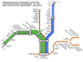 DescriptionYTV-Metro.png Local rail service map for Helsinki/Helsingfors region, including HKL metro line (orange) and VR commuter rail. Date 12 April...(1,024 × 768 (124 KB)) - 05:05, 28 December 2020
 coppy of the map 'File:Commonwealth games 1998 medal winners.PNG' by Commons user [[Roke]].''' It replaces my map 'File:PIGS Mk 2 map.png' which was defective...(3,180 × 1,485 (339 KB)) - 21:14, 17 May 2024
 DescriptionHelsingin metrolinja 2017.png English: HSL:n tuleva metrokartta länsimetron aloittaessa liikenteen. Date 23 February 2017 Source Länsimetro...(5,610 × 1,429 (718 KB)) - 21:10, 19 September 2020


