
Search results
The page "File:CapeBreton.png" does not exist. You can ask for it to be uploaded, but consider checking the search results below to see whether the topic is already covered.
 wikipedia. 2005-10-24 23:17 SimonP 372×490 (11132 bytes) Map of the [[Cape Breton—Canso]] electoral district. Based on [[User:Earl Andrew|]]'s [[User:Earl...(372 × 490 (11 KB)) - 01:33, 1 February 2024
 Canadaolympic989 1064×824× (184399 bytes) {{Information |Description = Map of [[Cape Breton-Canso]] |Source = I (Canadian) created this work entirely by myself....(1,064 × 824 (180 KB)) - 01:28, 1 February 2024
 Cape Breton Island, Nova Scotia, Canada en:User:Geo Swan used this online map creation tool archive copy at the Wayback Machine to generate this map....(514 × 562 (16 KB)) - 04:35, 1 February 2024
 https://creativecommons.org/licenses/by-sa/2.5CC BY-SA 2.5 Creative Commons Attribution-Share Alike 2.5 truetrue English Map of Cape Breton determination method: SHA-1...(1,180 × 825 (291 KB)) - 01:29, 1 February 2024
 Alike 4.0 truetrue English A map of Cape Breton Island in Nova Scotia, Canada. French une carte de l'île du Cap-Breton en Nouvelle-Écosse, Canada. author...(3,073 × 3,255 (1.71 MB)) - 12:42, 26 April 2024
 Pluribus Anthony. Source: en:Image:Map Canada political-geo.png 1052 846 32 36 1280 1128 cape breton isiand English Spanish (formal address) Mapa das provincias...(1,280 × 1,128 (545 KB)) - 23:32, 1 December 2022
 Alike 4.0 truetrue English A map of Cape Breton Island in Nova Scotia, Canada. French une carte de l'île du Cap-Breton en Nouvelle-Écosse, Canada. author...(750 × 625 (2.51 MB)) - 01:30, 1 February 2024
 Bras d'Or Lake, Cape Breton, Canada English determination method: SHA-1...(785 × 565 (145 KB)) - 21:22, 17 December 2023
 21:14 Kuzwa 309×205× (154638 bytes) Picture taken from my trip to the [[Cape Breton Higlands]] on August 29, 2007. ~~~~ English determination method: SHA-1...(618 × 410 (577 KB)) - 08:50, 27 September 2023
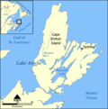 This map shows the location of Lake Ainslie and Margaree River on Cape Breton Island, Nova Scotia, Canada. Created by NormanEinstein, May 12, 2005. I...(1,000 × 1,008 (323 KB)) - 22:48, 22 November 2021
 Canadaolympic989 734×599× (134038 bytes) {{Information |Description = Cape Breton County |Source = I (Canadian) created this work entirely by myself. |Date...(1,200 × 980 (62 KB)) - 04:54, 1 February 2024
 Logo of Cape Breton Development Corporation. Fair use true...(253 × 40 (3 KB)) - 06:35, 16 October 2012
 DescriptionTartan of Cape Breton.png English: The official tartan of Cape Breton Island in Canada, created in 1957. Thread count: 3 gold 6 black 18 grey...(580 × 580 (2 KB)) - 19:03, 7 August 2021
 DescriptionCape Breton Centre.png Based on image by Earl Warren, from 2006 elections Based on image by Earl Warren, from 2006 elections Date 14 December...(357 × 336 (7 KB)) - 01:29, 1 February 2024
 DescriptionCape Breton Nova.png Based on image by Earl Warren, from 2006 elections Based on image by Earl Warren, from 2006 elections Date 14 December...(357 × 336 (7 KB)) - 01:30, 1 February 2024
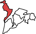 DescriptionCape Breton North.png Map based on image by Earl Warren, from 2006 elections Map based on image by Earl Warren, from 2006 elections Date 14...(357 × 336 (7 KB)) - 01:30, 1 February 2024
 DescriptionCape Breton West.png Map based on image by Earl Warren, from 2006 election Map based on image by Earl Warren, from 2006 election Date 14 December...(735 × 568 (23 KB)) - 01:33, 1 February 2024
 DescriptionCape Breton South.png Map based on image by Earl Warren, from 2006 elections Map based on image by Earl Warren, from 2006 elections Date 14...(357 × 336 (7 KB)) - 01:33, 1 February 2024
 of the following images: File:Lunenburg_Municipal_District_-_Nova_Scotia.PNG licensed with PD-self 2009-10-05T01:36:36Z Gordalmighty 299x250 (10827 Bytes)...(299 × 250 (10 KB)) - 19:35, 22 March 2022
 0 truetrue Unknown authorUnknown author English Pul MacEwan, MLA for Cape Breton Nova, seen here as the Speaker of the Nova Scotia House of Assembly in...(773 × 1,131 (618 KB)) - 17:02, 28 February 2024


