
Search results
There is a page named "File:California 5.svg" on Wikipedia
 DescriptionCalifornia 5.svg Vector image of a 24 in by 25 in (600 mm by 635 mm) California State Route shield. Colors are from [1] (Pantone Green 342)...(385 × 401 (11 KB)) - 01:53, 27 January 2024
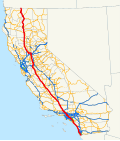 Caltrans Traffic Volumes on CSHS, California State Legislature Definitions of Routes en:Interstate 5 in California English determination method: Olive...(576 × 672 (1.62 MB)) - 05:22, 27 January 2024
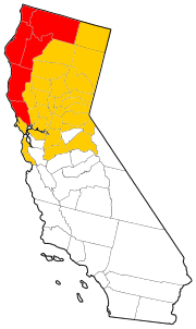 image is a derivative work of the following images: File:California_counties_outline_map.svg licensed with PD-USGov-DOC-Census 2009-09-17T18:30:56Z Babbage...(512 × 857 (741 KB)) - 12:29, 17 August 2024
 File:Riverside County California Incorporated and Unincorporated areas Jurupa Valley Highlighted.svgfollowing images: File:Riverside_County_California_Incorporated_and_Unincorporated_areas_Rubidoux_Highlighted.svg licensed with Cc-by-sa-2.5,2.0,1.0, Cc-by-sa-3...(2,400 × 1,700 (142 KB)) - 14:32, 26 October 2020
 following images: File:San_Diego_County_California_Incorporated_and_Unincorporated_areas_Escondido_Highlighted.svg licensed with Cc-by-sa-2.5,2.0,1.0, Cc-by-sa-3...(1,102 × 857 (650 KB)) - 01:43, 14 September 2020
 following images: File:Riverside_County_California_Incorporated_and_Unincorporated_areas_Jurupa_Valley_Highlighted.svg licensed with Cc-by-sa-2.5,2.0,1.0,...(2,400 × 1,700 (142 KB)) - 14:31, 26 October 2020
 I, the copyright holder of this work, hereby publish it under the following license: English Los Angeles California US street map vector SVG editable...(10,893 × 7,651 (54.16 MB)) - 14:20, 11 August 2024
 English This is a duplicate of [[File:COVID-19 Cases in California by counties (Percent).svg]], I couldn't figure out how to overwrite it. determination...(338 × 400 (74 KB)) - 13:14, 23 January 2024
 English Seal of the California State Assembly...(760 × 760 (197 KB)) - 23:54, 19 September 2023
 English Shield of the city of Beverly Hills, California, United States German (formal address) Wappen der Stadt Beverly Hills, Kalifornien, Vereinigte...(309 × 331 (17 KB)) - 08:07, 5 May 2023
 to any region, the CSS will do it for us. All California telephone Area Code maps are now using the SVG file format due to the regular need for changes...(460 × 630 (79 KB)) - 01:23, 13 September 2023
 to any region, the CSS will do it for us. All California telephone Area Code maps are now using the SVG file format due to the regular need for changes...(460 × 630 (79 KB)) - 01:25, 13 September 2023
 File:Muni Metro.png (category CC-BY-SA-2.5)org/licenses/by-sa/2.5CC BY-SA 2.5 Creative Commons Attribution-Share Alike 2.5 truetrue Map of the Muni Metro System in San Francisco, California. Created 2007, by...(1,787 × 1,156 (157 KB)) - 03:42, 14 September 2020
 English California's Three Strike Initiative. Each shade represents a 10% difference. 59.5% is rounded up to 60%, etc. author name string: Fluffy89502...(167 × 284 (84 KB)) - 13:07, 5 October 2023
 Alike 4.0 International, 3.0 Unported, 2.5 Generic, 2.0 Generic and 1.0 Generic license. Attribution: California State University, Fullerton You are free:...(250 × 250 (70 KB)) - 08:48, 23 May 2024
 Transwiki approved by: w:en:User:Dmcdevit English Seal of California Arabic ختم كاليفورنيا Amharic Печать штата Калифорния...(400 × 399 (380 KB)) - 04:05, 4 February 2024
 choice. This image is a derivative work of the following images: File:California_Topography-MEDIUM.png licensed with Cc-by-sa-3.0-migrated, GFDL 2009-07-31T09:46:35Z...(733 × 830 (215 KB)) - 05:12, 27 January 2024
 (3877 bytes) {{Information |Description=|This is the 1846 Flag of the California Lone Star Flag. It was raised in a revolt against the Mexican Government...(900 × 600 (584 bytes)) - 07:45, 27 January 2024
 Image:World_homosexuality_laws.svg licensed with Cc-by-sa-2.5, GFDL 2008-05-15T18:12:14Z Applysense 840x480 (1352211 Bytes) Update for California (for more information...(840 × 480 (1.3 MB)) - 20:06, 23 October 2021
 Description1894 California gubernatorial election results map by county.svg English: Counties shaded according to winners share of vote. Data from the...(800 × 947 (1.86 MB)) - 20:14, 16 June 2024


.svg)

