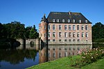
Hauteroche Castle
Appearance
(Redirected from Castle of Hauteroche)
| Hauteroche Castle | |
|---|---|
| Wallonia, Belgium | |
 Castle ruins | |
| Coordinates | 50°05′15″N 4°35′58″E / 50.0875°N 4.5994°E |
| Type | Castle |
| Site information | |
| Condition | Ruined |
Hauteroche Castle (French: Château de Hauteroche) is a ruined 14th-century castle, destroyed after a siege in 1554, in the village of Dourbes in the municipality of Viroinval, province of Namur, Wallonia, Belgium.
The castle site was scientifically excavated between 1976 and 2002.
See also
Sources
External links
References
- De Boe G., 1982. Le sanctuaire gallo-romain dans la plaine de Bieure à Matagne-la-Grande. Archaeologia Belgica, Brussels: Service National des Fouilles, p 25
- Plumier J. and Pleuger J.L., 1986: Le château de Hauteroche à Dourbes. Archaeologia Belgica II, Brussels: Service National des Fouilles, 1, p.109-112
- Pleuger J.L. and Pleuger E., 2001. Viroinval/Dourbes : fouille du château de Hauteroche. Chronique de l’Archéologie Wallonne, Namur, 9, p 227-228
- Pleuger J.L. and Pleuger E., 2002: Viroinval/Dourbes : fouille du château de Hauteroche. Chronique de l’Archéologie Wallonne, Namur, 9, p 255-256


